'Never seen the snow go so quickly'
The Australian snow season continues its remarkably rapid decline, with seasoned snow watchers on industry-leading site ski.com.au saying they've never seen a season with reasonable late-July snow depths decline so dramatically by late August.
Earlier this week, Snowy Hydro took its latest official depth measurements. The depth at Spencers Creek, NSW, at an elevation of 1830m about halfway between the major resorts of Perisher and Thredbo, tells the story.
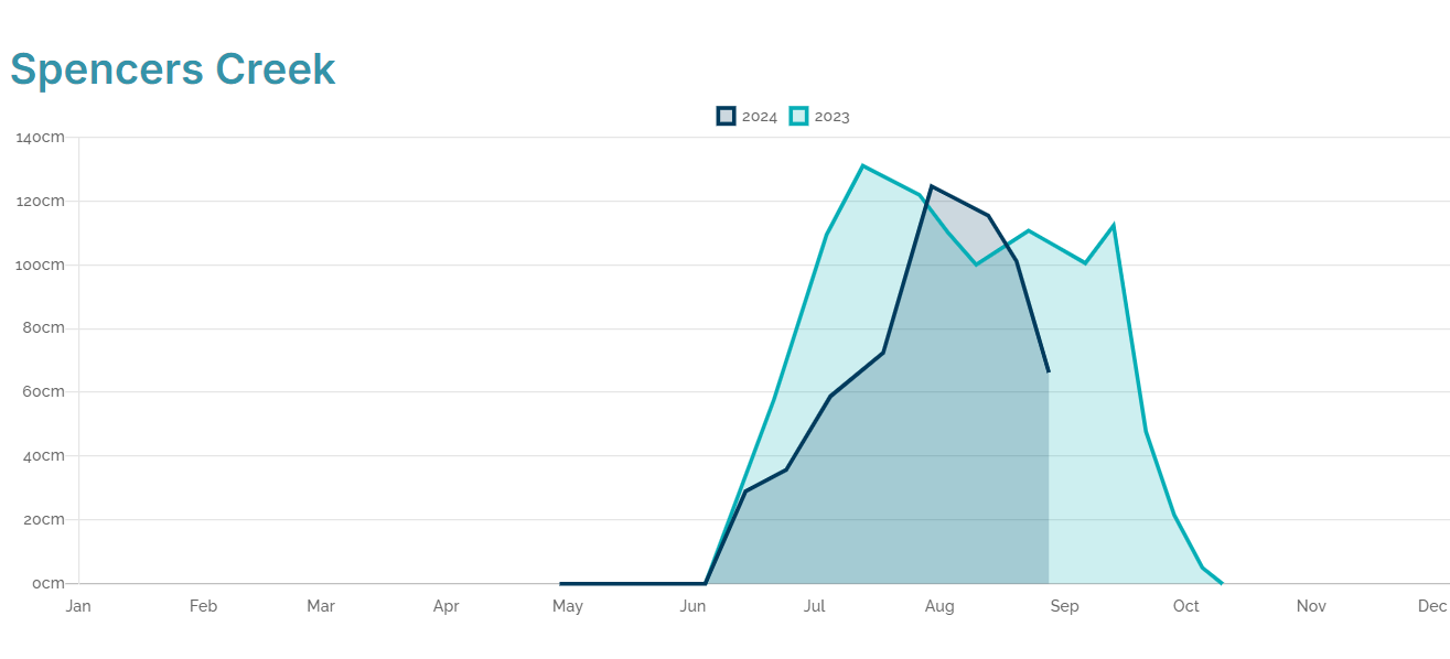
Image: Depth was measured at 66.2 cm on August 28, the second-lowest on record for late August and roughly half the 124.6 cm recorded in the last week of July. Source: Snowy Hydro.
The graphical representation of the season becomes all the more stark when you view the work of Glen Fergus, an engineer who doesn't work for Snowy Hydro, but who for years has analysed the Snowy Hydro data as a hobby, producing graphs like this.
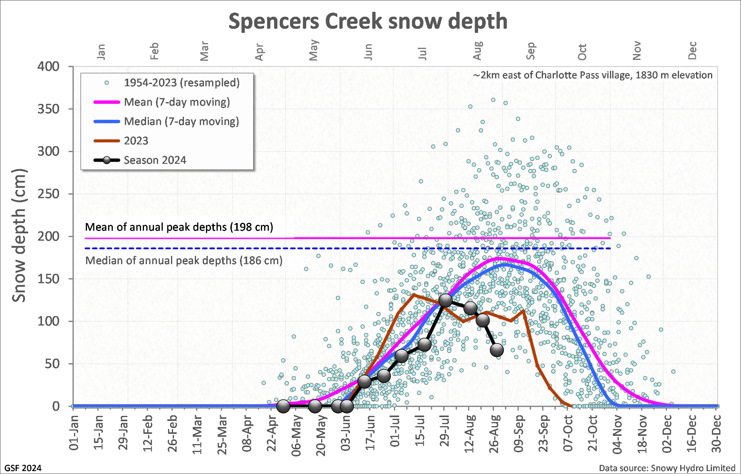
Source: Glen Fergus.
- As you can see, the graph for most seasons has historically made a hump shape, with a peak depth around late August or early September.
- The 2023 season bucked that trend, peaking in July (the earliest peak on record) before slowly falling away in the warm, dry August that followed.
- The 2024 snow season has not so much fallen away as plummeted – as warmth combined with wind and rain have created the dreaded "hair dryer" conditions that eat away at the snow.
While lifts are still running at the higher resorts (albeit intermittently this week due to extremely strong winds), skiing is now almost entirely confined to slopes where the coverage was augmented with snowmaking earlier in the season.
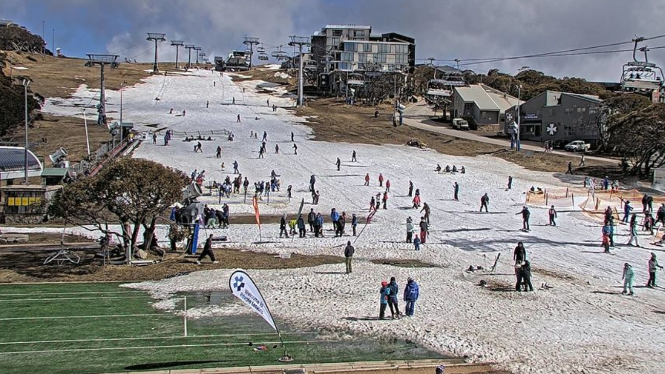
Image: The famous Bourke St run at Mt Buller is usually as busy in August as its Melbourne namesake. But crowds are thin this Friday with all terrain closed away from the main runs. Source: ski.com.au.
Meanwhile in Tasmania, heavy snow has fallen this week and more can be expected to relatively low elevations (as low as 500m) later on Friday and right through the weekend.
kunanyi / Mt Wellington from Knocklofty summit pic.twitter.com/N4slvN0CbE
— Adam Holmes (@AdamHolmes010) August 29, 2024
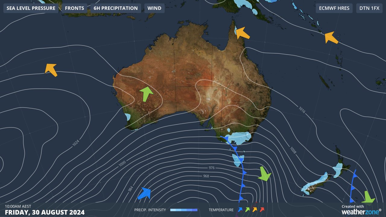
Some snow will also fall on the alpine areas of NSW and Victoria over the weekend, but the coldest air will be south of the mainland, as it has been in recent weeks.
This has been an extremely frustrating month for Aussie snow lovers. The worst possible scenario for mainland ski resorts is cold fronts peaking too far south while dragging warm air and rain ahead of them in a strong northwesterly airstream – but that has been the story of August 2024.