Nation shivers through coldest May morning in decades
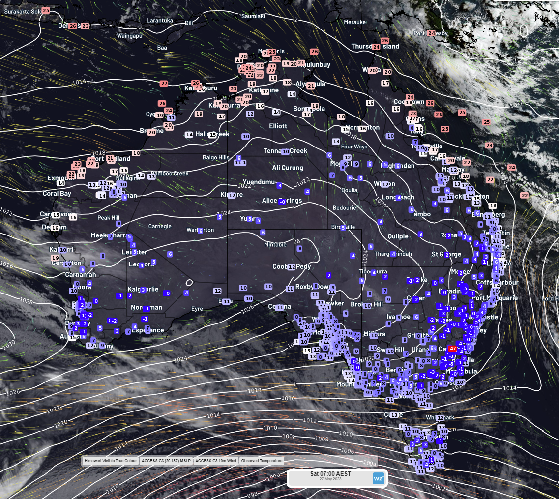
Winter came early to Australia today, as exceptionally clear skies, light winds, high pressure, and a very cold airmass caused temperatures to plummet overnight. As can be seen in the image below, temperatures dropped below 5°C across much of the country this morning.
 Image: Observed temperature at 7:00 AM AEST Saturday 27 May 2023, with Access-G’s forecast mean sea level pressure and 10 metre winds for the same time and date
By 5:30 this morning, the temperature at Perth Airport had dropped to 1.1°C – the coldest May morning the airport has experienced in 59 years. This is only 2.4 degrees warmer than Perth Airport’s record minimum of -1.3°C, which was set on 17 June 2006.
Further inland at Narrogin, the temperature dropped to -1.0°C, making it Narrogin’s coldest May morning in 55 years. It was also Narrogin’s coldest morning (any month) in almost 5 years – the last time it was this cold was back in September 2018. Meanwhile, Wongan Hills shivered through its coldest May morning in 52 years, seeing a minimum of 1.5°C. Busselton gave record-breaking a good crack too, recording a minimum of 0.2°C at 6:50am – its coldest May morning in 17 years.
Cold shivers and horripilation (there’s your word for the day) likely broke out across the country’s southeast this morning as well, with Sydney’s Observatory Hill recording a temperature of 6.9°C at 7:04am – its coldest May morning in 24 years. Bega’s minimum temperature of -1.6°C made for its coldest May morning in 15 years. Not to be outdone, Camden and Tibooburra recorded their coldest May mornings in 12 years today, with minimum recorded temperatures of -1.2°C and 3.8°C respectively.
Additionally, multiple locations across QLD, NSW, WA, and the NT registered their coldest May mornings in 5 to 11 years.
The high-pressure system responsible for bringing such unseasonable cold to the nation today will likely bring further cold temperatures tomorrow (Sunday) morning and possibly Monday morning, as you can see in the images below.
 Images: ECMWF forecast daily minimum temperature for (L) Sunday 28 May 2023 and (R) Monday 29 May 2023
A front approaching WA’s southwest on Monday night should cause that high pressure system to shift east, bringing increased cloud cover which should then result in warmer minimum temperatures over WA’s south on Tuesday, as demonstrated in the images below, although another cold morning may be on the cards for the nation's southeast.
 Images: (L) ECMWF forecast daily minimum temperature for Tuesday 30 May 2023. (R) ECMWF forecast cloud cover and mean sea level pressure at 4:00 AM AEST, Tuesday 30 May 2023