Morning glory cloud and stunning smoke seen over Australia
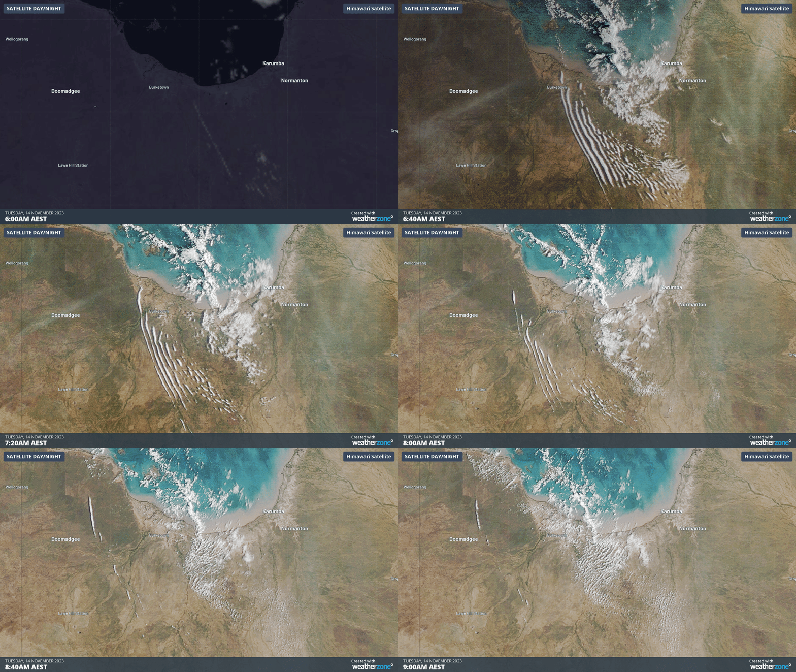
Satellite images captured two captivating phenomena in Australia on Tuesday morning: a series of ‘morning glory clouds’ passing over northwest Qld and smoke over the NT being contorted by vertical wind shear.
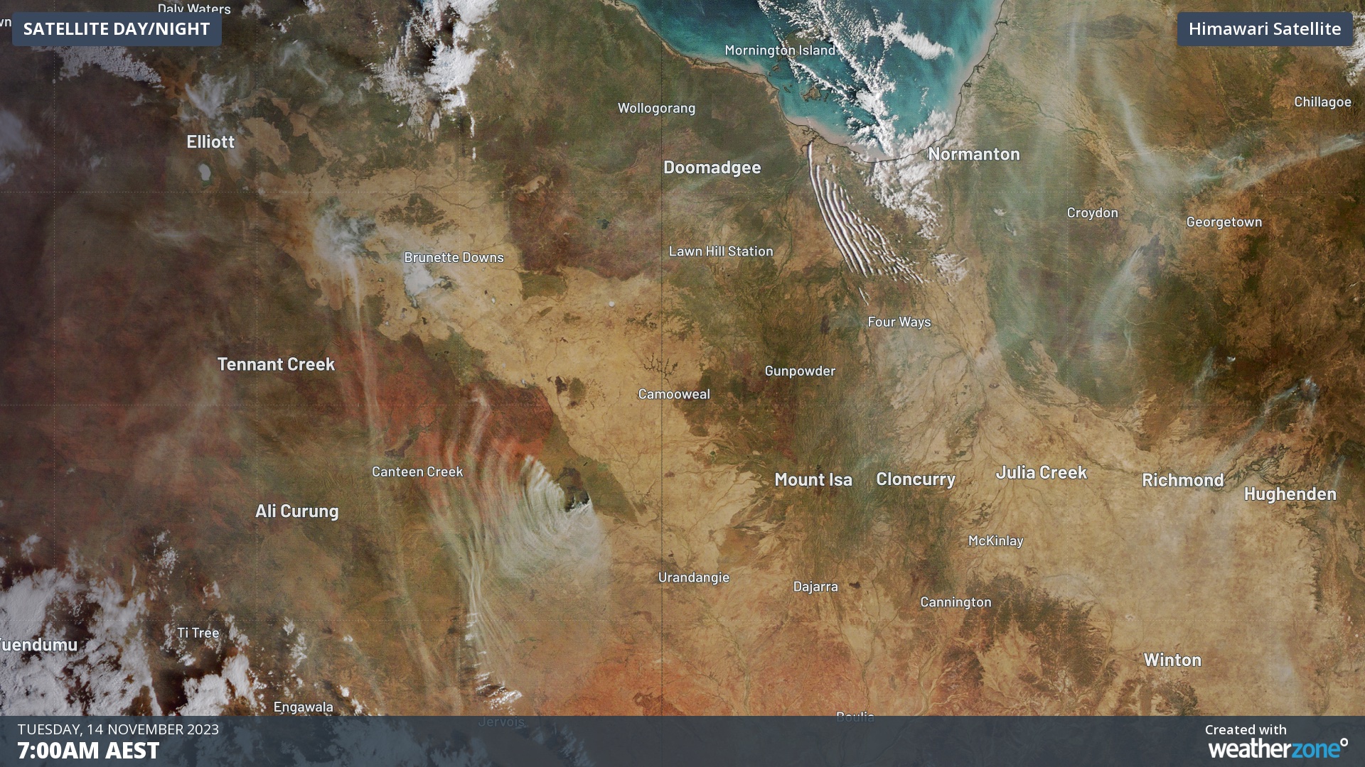
The image below was captured by the Himawar-9 satellite shortly after sunrise on Tuesday morning. There are two things that stand out in this image. One is a series of parallel lines over northwest Qld to the south of the Gulf of Carpentaria. The other is a fan-shaped plume of smoke being blown over the NT’s eastern inland.

The parallel lines of cloud in northwest Qld are a textbook example of roll clouds that regularly form over this part of Australia around this time of year. Known locally as the ‘morning glory’ cloud, these long tube-shaped roll clouds are created by the unique geography of northern Qld.

Tuesday morning’s rising sun also revealed an unusual fan-shaped smoke plume over the NT’s Barkly District.
The smoke in the image below is being caused by a large fire located about 230 km west of Mount Isa. The fan-like shape of this plume was a result of vertical wind shear gradually changing the direction of the smoke’s movement as it rose higher into the sky.
As the sun rose above the fire ground on Tuesday morning, wind near the surface was blowing smoke from north to south. At 1000 m elevation, the wind was blowing the smoke more towards the southwest, and at 1500 m the smoke was being blown towards the west. By 3000 m elevation, the wind was pushing smoke towards the northwest, almost in the opposite direction to the surface.
The presence of smoke over the NT’s eastern inland on Tuesday morning revealed the otherwise invisible effects of vertical wind shear in our atmosphere. This change of wind direction with height occurs all over our planet and it can be a key ingredient for severe weather under the right conditions.
The satellite images shown in this story were all captured by the Japan Meteorological Agency's Himawari-9 satellite, which is a geostationary satellite that sits roughly 36,000 km above the Earth’s surface. Himawari-9 captures multispectral images of Earth every 10 minutes and being positioned above the equator at 140.7 degrees east longitude, it offers a perfect view of the sky above Australia.