More wet weather for central, eastern Australia
Rain and thunderstorms will continue to soak large areas of central and eastern Australia during the coming week, with potential for substantial rain in Qld stating this weekend.
The first half of November featured widespread rain and storms over part of every state and territory in Australia. This wet and stormy weather included ominous shelf clouds, plenty of outback thunder, and more than 8 million lightning strikes in a single week.
Australia’s stormy November now looks set to continue for at least another week, with a series of upper-level troughs expected to trigger rain and thunderstorms over large parts of the country during the next 7 to 10 days.
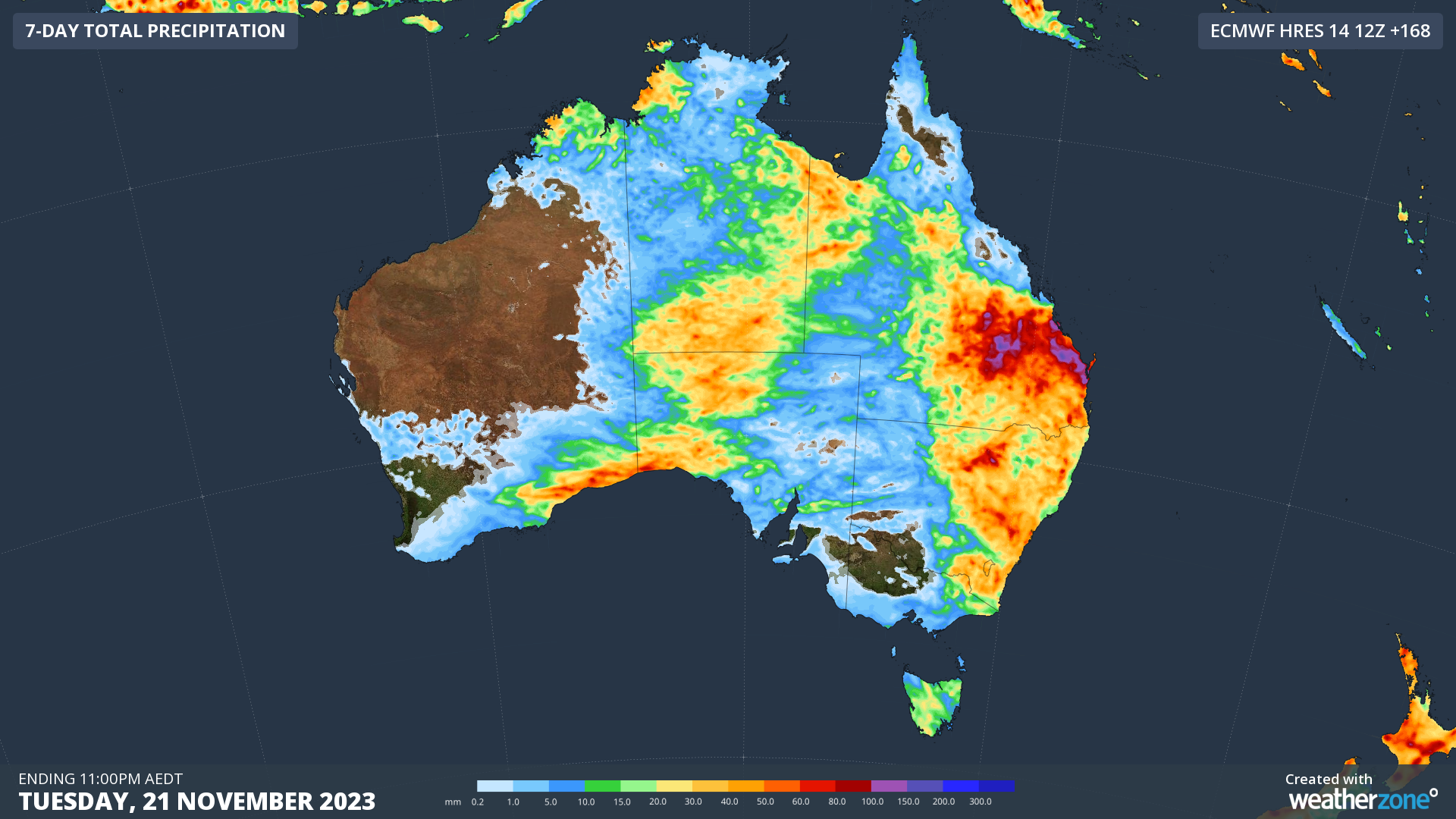
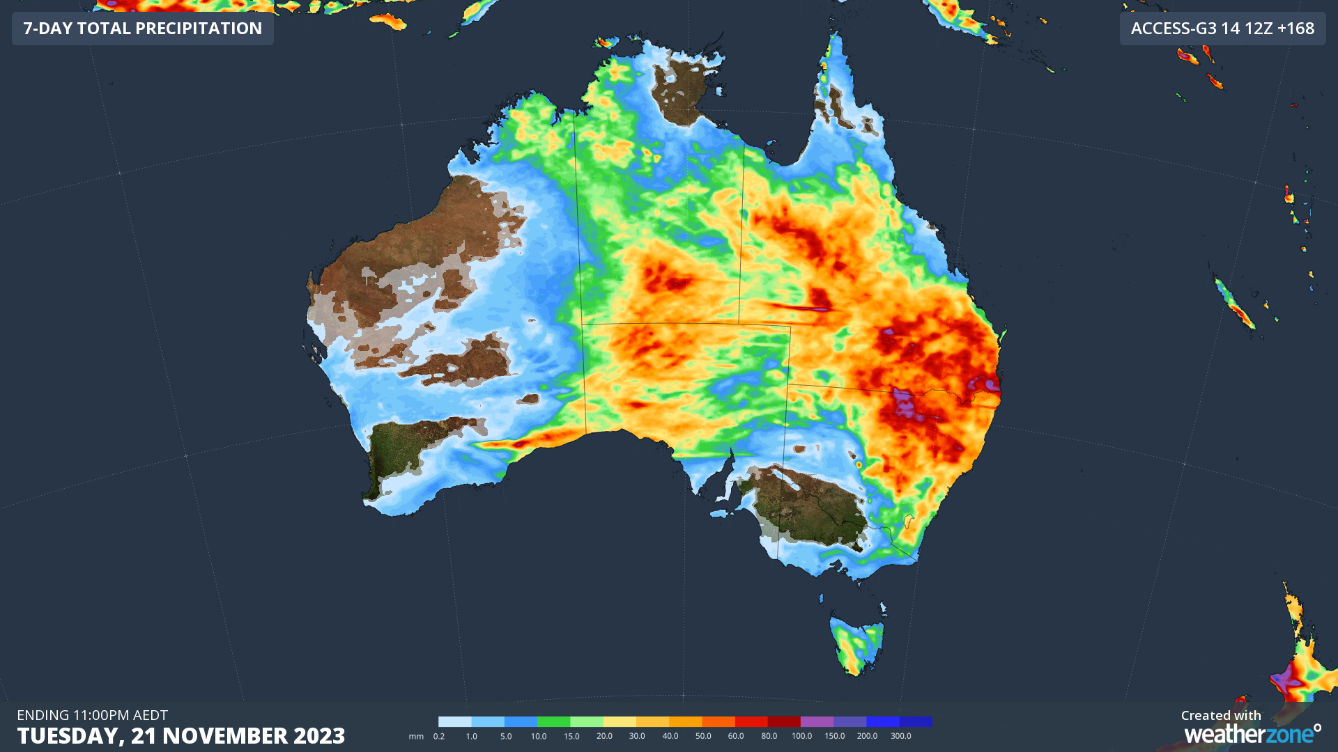
The maps below show how much rain two different forecast models are predicting over the next seven days.


Images: Forecast accumulated rain during the seven days ending at 11pm AEDT on Tuesday, November 21, 2023, according to the ECMWF-HRES model (top) and ACCESS-G model (bottom).
The bulk of the rain and storms will initially focus on central Australia, northern and western SA and southern WA between this Wednesday and Friday, with a bit of wet weather also affecting parts of Tas, Vic, NSW and Qld.
From the weekend, a deepening low pressure trough should allow showers and thunderstorms to become more active over eastern Australia. Most forecast models suggest this wet and stormy weather will continue into the first half of next week across a broad area of the nation’s east and north.
It’s difficult to predict where and how much rain will fall over the next week due to the dynamic nature of the weather pattern, which will involve several upper-level and surface-based troughs. At this stage, rain and storms are likely to affect part of every state and territory during the next seven days, with heavy falls possible over Qld, NSW and central Australia. Some of the coming week’s thunderstorms are likely to become severe and heavy rain could cause flash flooding in some states.
This month’s rain and prolific storms are in some ways defying the dry spring outlook that was predicted under the influence of El Niño and a positive Indian Ocean Dipole. The main reason for this month’s wet weather has been a positive phase of the Southern Annular Mode (SAM), which has increased the flow over moisture over Australia from the east in the last couple of weeks.
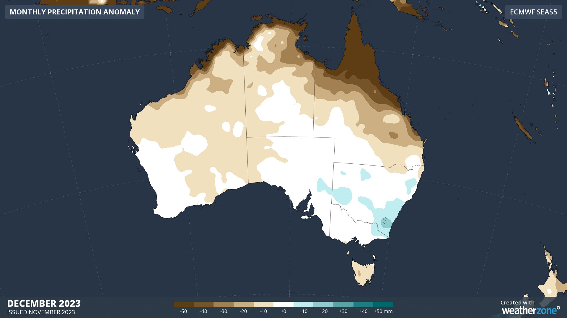
Looking further ahead, seasonal forecast models predict that rain will be near to above average over much of southern and southeastern Australia in December. However, the country’s northern tropics are expected to be drier than usual as El Niño delays the start of the wet season.

Image: Monthly rainfall anomaly forecast for December 2023, according to the ECMWF-SEAS5 model.
