
More rain on the horizon for Australia
Heavy rain, severe thunderstorms and flooding will affect several Australian states and territories over the next seven days, including some still-flooded areas in the Murray-Darling Basin.
Unusually warm sea surface temperatures to the north and east of Australia are currently enhancing evaporation and allowing moisture-laden air to build over the Australian continent.
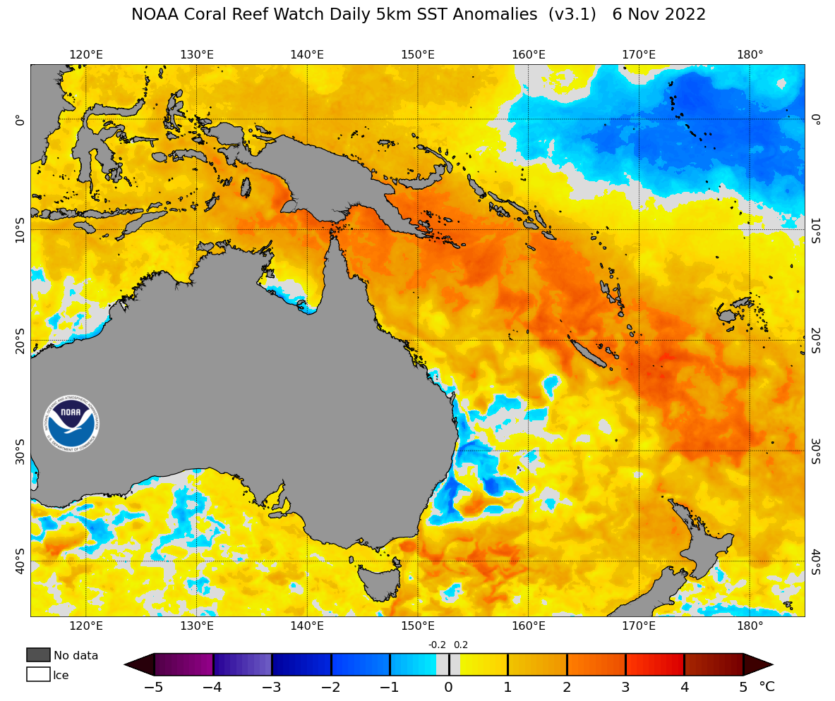
Image: Sea surface temperature anomalies on November 6, showing abnormally warm water surrounding Australia.
This airborne moisture will interact with a series of low pressure troughs and low pressure systems over the coming week, resulting in frequent showers, thunderstorms and widespread rain over several states and territories.
We have already seen some of this wet and stormy weather over the last 24 hours. In NSW, slow-moving severe thunderstorms dumped 35mm in 30 minutes at Oranmeir and 26 mm in one hour at Condobolin on Monday. Meanwhile, in the Central Wheatbelt of WA, Wongan Hill received 61mm during the 24 hours to 9am on Tuesday. This was about five months’ worth of rain for Wongan Hills and its highest November daily total in records dating back to 1907.
Showers and thunderstorms will continue to pepper several Australian states and territories during the rest of this week, before culminating in a large band of heavy rain and severe thunderstorms towards the weekend and into early next week. The maps below show one computer model’s prediction for how the rain and storms will play out over the next seven days.
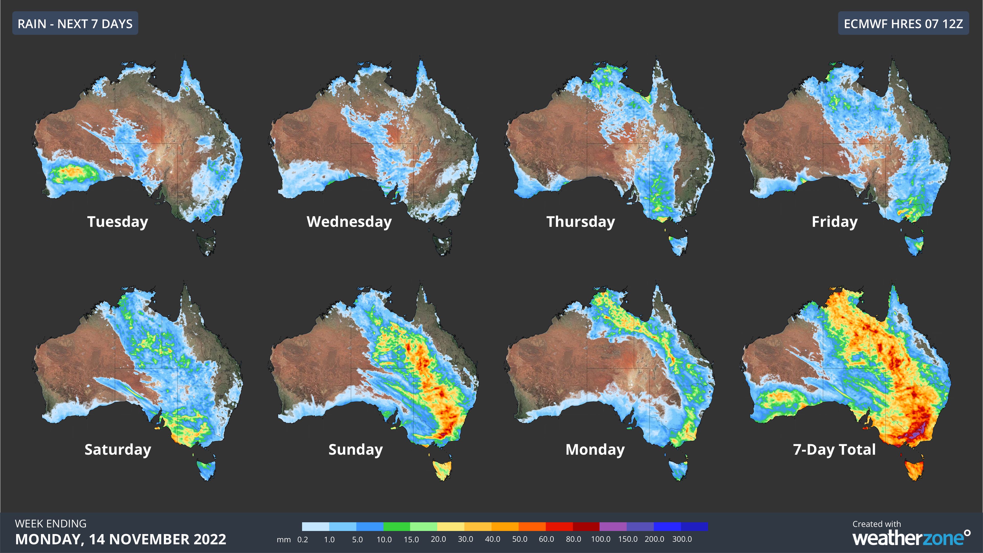
Image: Forecast accumulated daily rainfall during the next 7 days according to the ECMWF-HRES model.
It’s important to point out that there is still some uncertainty around exactly where and how much rain will fall during the coming week. However, all models agree that substantial rain is possible over several states and territories and that some of the heaviest rain could fall in southern NSW and northern Vic.
The maps below show how much rain three different computer models are predicting during the next seven days, between Tuesday November 8 and Monday November 14.
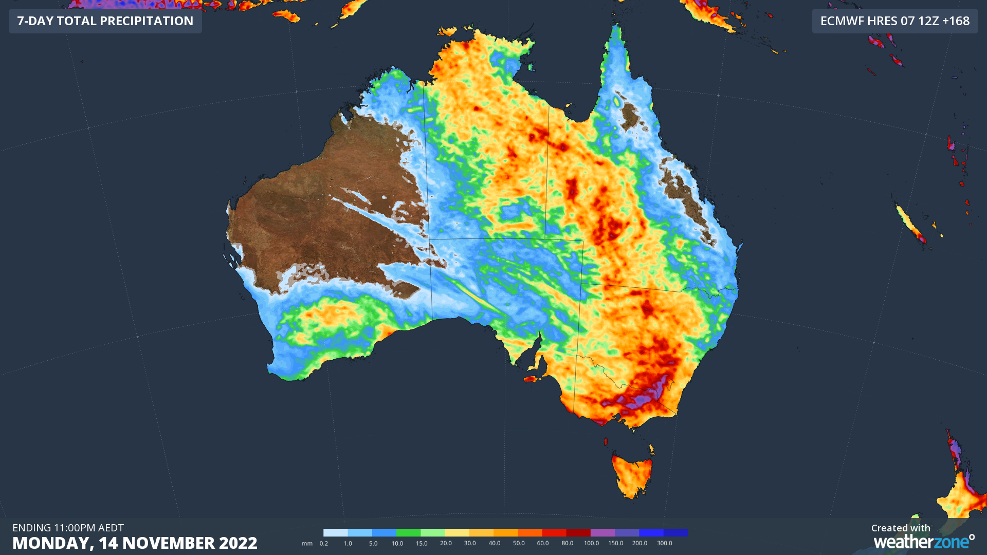
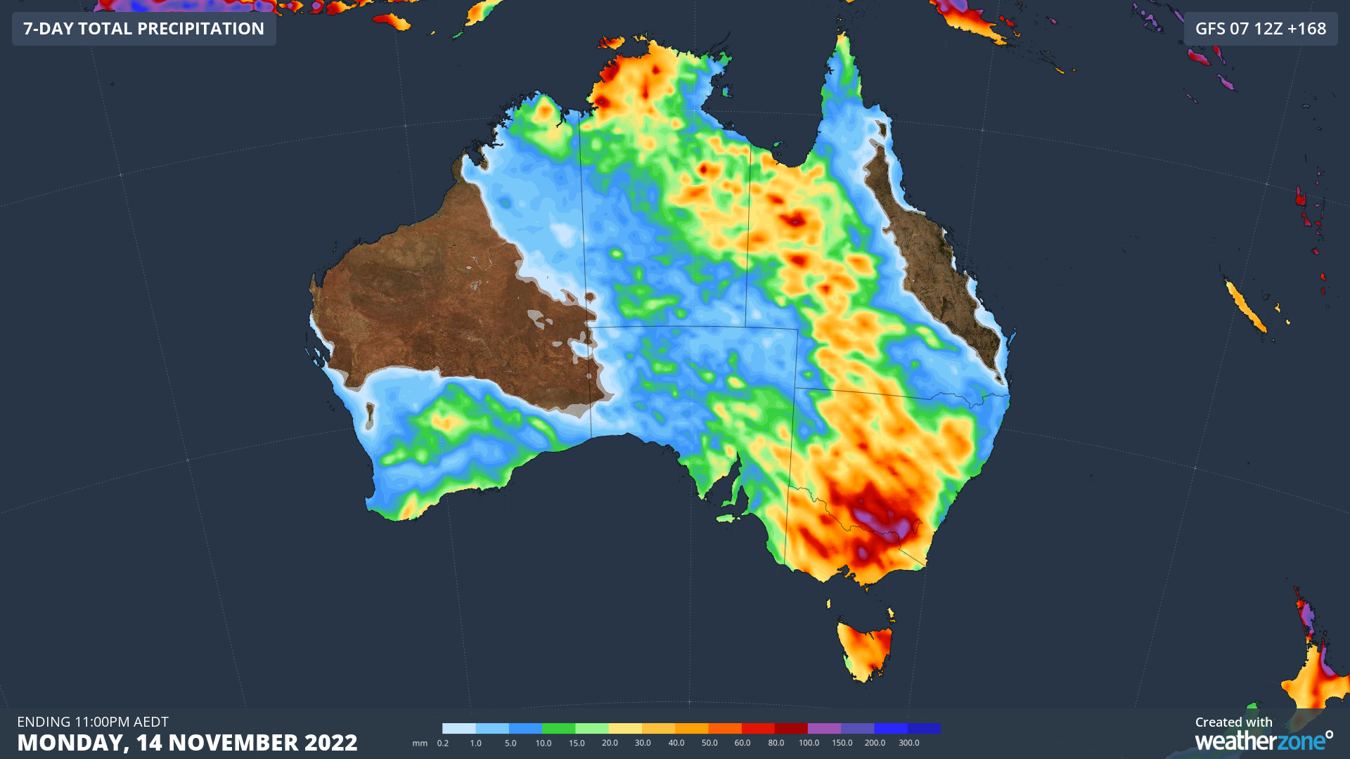
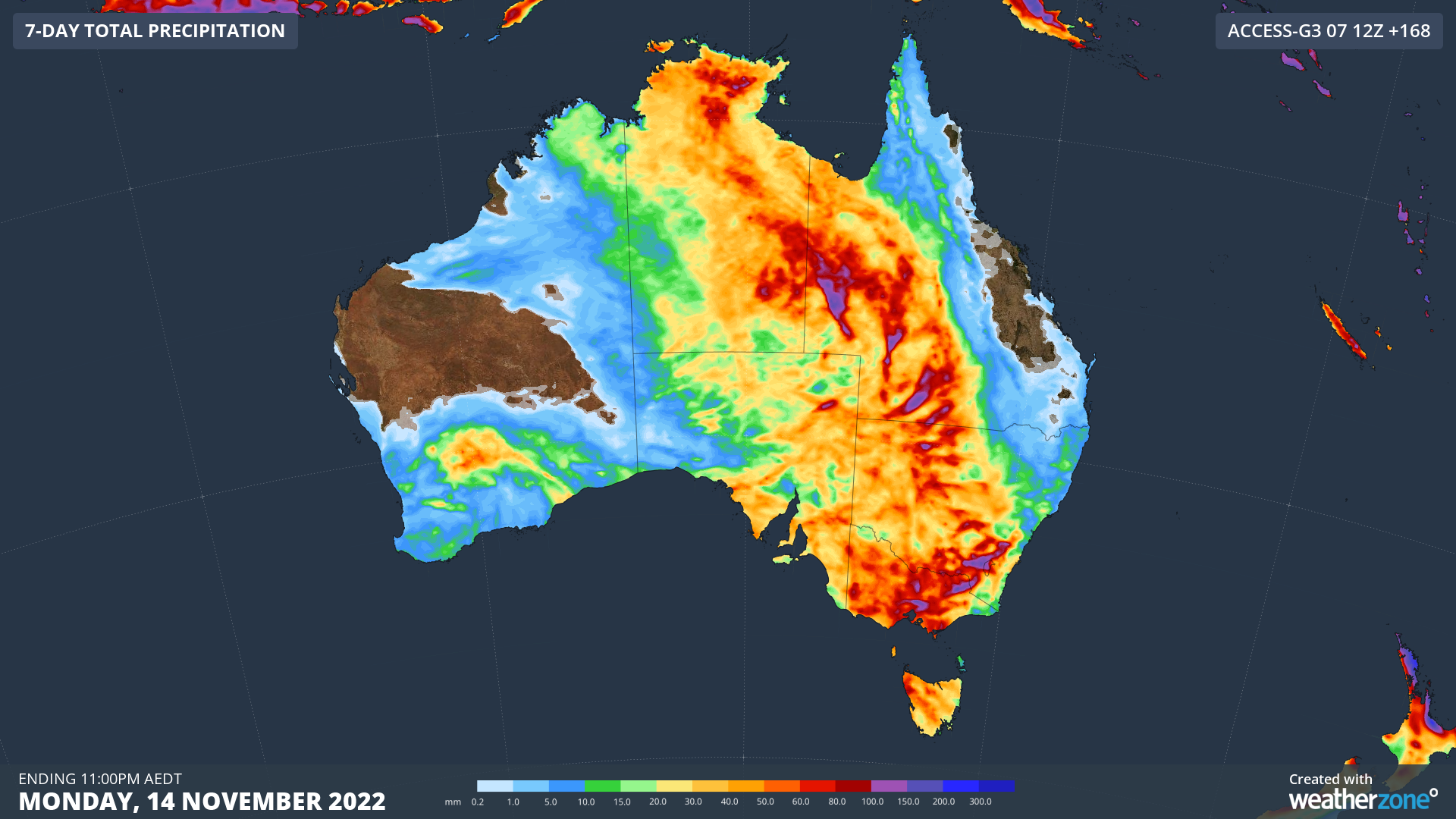
Images: Forecast accumulated rain during the 7 days ending at 11pm AEDT on Monday, November 14, according to the ECMWF-HRES (top), GFS (middle) and ACCESS-G (bottom) models.
This rain comes off the back of the Murray-Darling Basin’s wettest October on record. Unfortunately, this means that heavy rain and thunderstorms over the coming week will fall in catchments that are still experiencing moderate to major flooding from recent rainfall. These areas will be very sensitive to additional rain and are at a heightened risk of further river level rises and flooding.
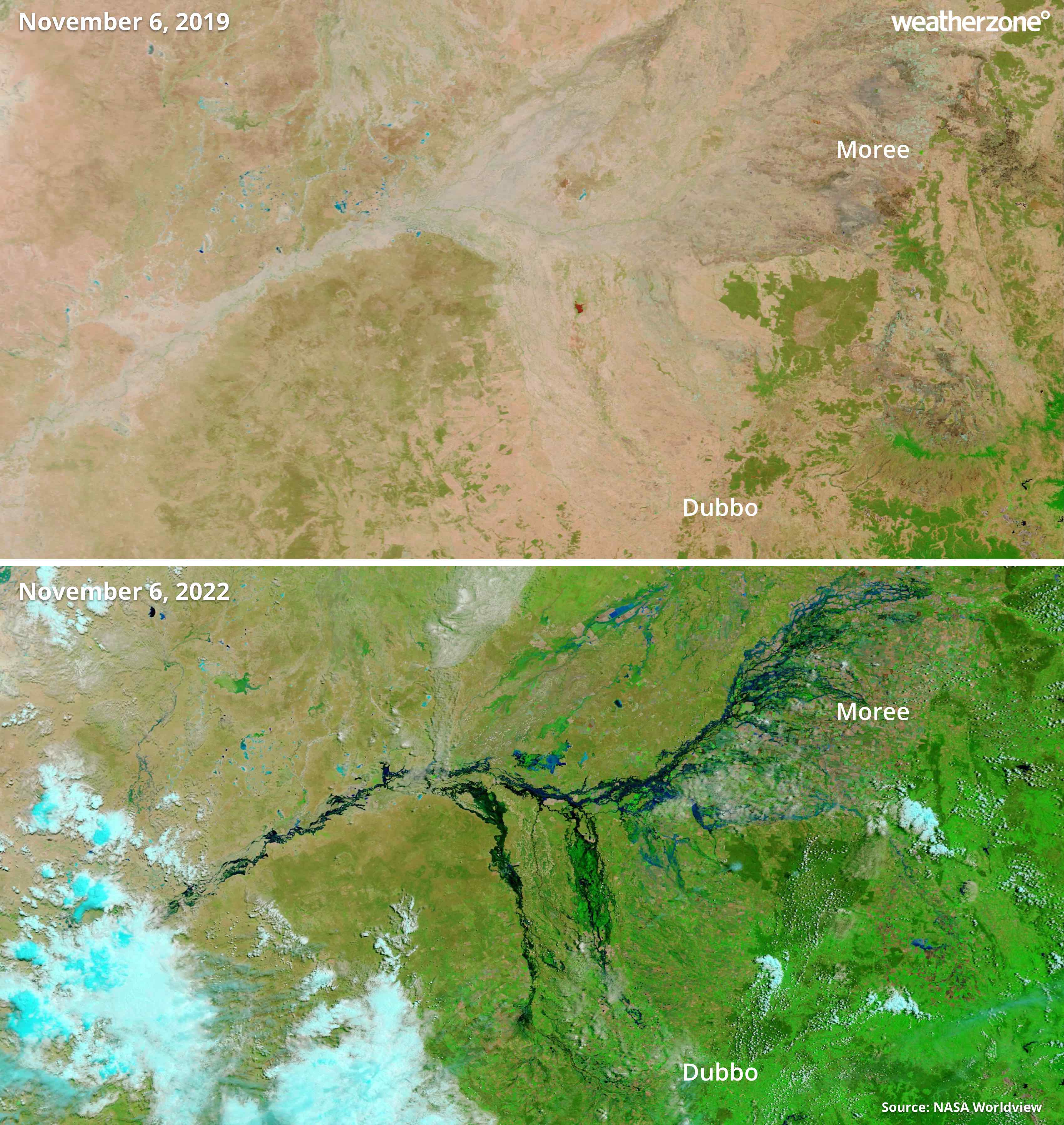
Image: Enhanced visible satellite images showing the transformation of the landscape in northern NSW from drought in 2019 to floods in 2022. Source: NASA Worldview
Check the latest flood warnings for the most up-to-date information river levels and keep an eye on severe weather and thunderstorm warnings throughout the next week.