More heavy rain imminent for central, northern Australia
Large areas of northern and central Australia are about to be hit with this week’s second round of heavy rain, with flood watches already in place for some states and territories.
Earlier this week, a large northwest cloudband delivered widespread and unseasonably heavy rain to outback areas of WA, the NT and SA. Some places collected several months’ rain in one or two days, which caused localised flooding and cut off roads in some areas.

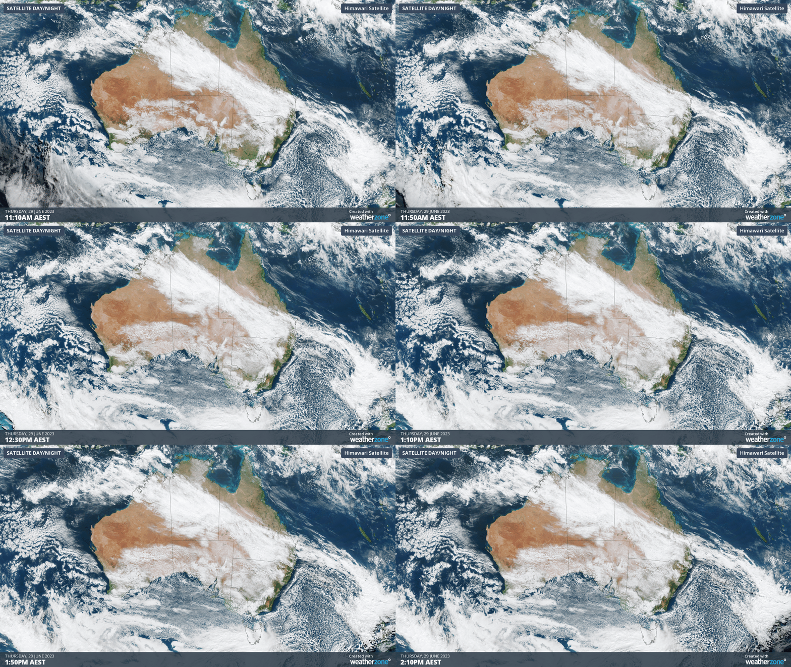
While the satellite image above shows the northwest cloudband still draped over Australia on Thursday, rain has been easing over the last 24 hours in most areas.
Unfortunately, this break from the heavy rain will be short-lived.
Another pulse of heavier rainfall will develop over WA’s Kimberley and the NT Interior on Friday and Saturday, before spreading further east across Qld from Sunday into early next week. Some forecast models also suggest NSW, Vic, the ACT and even Tas could pick up some rain from this system next week.
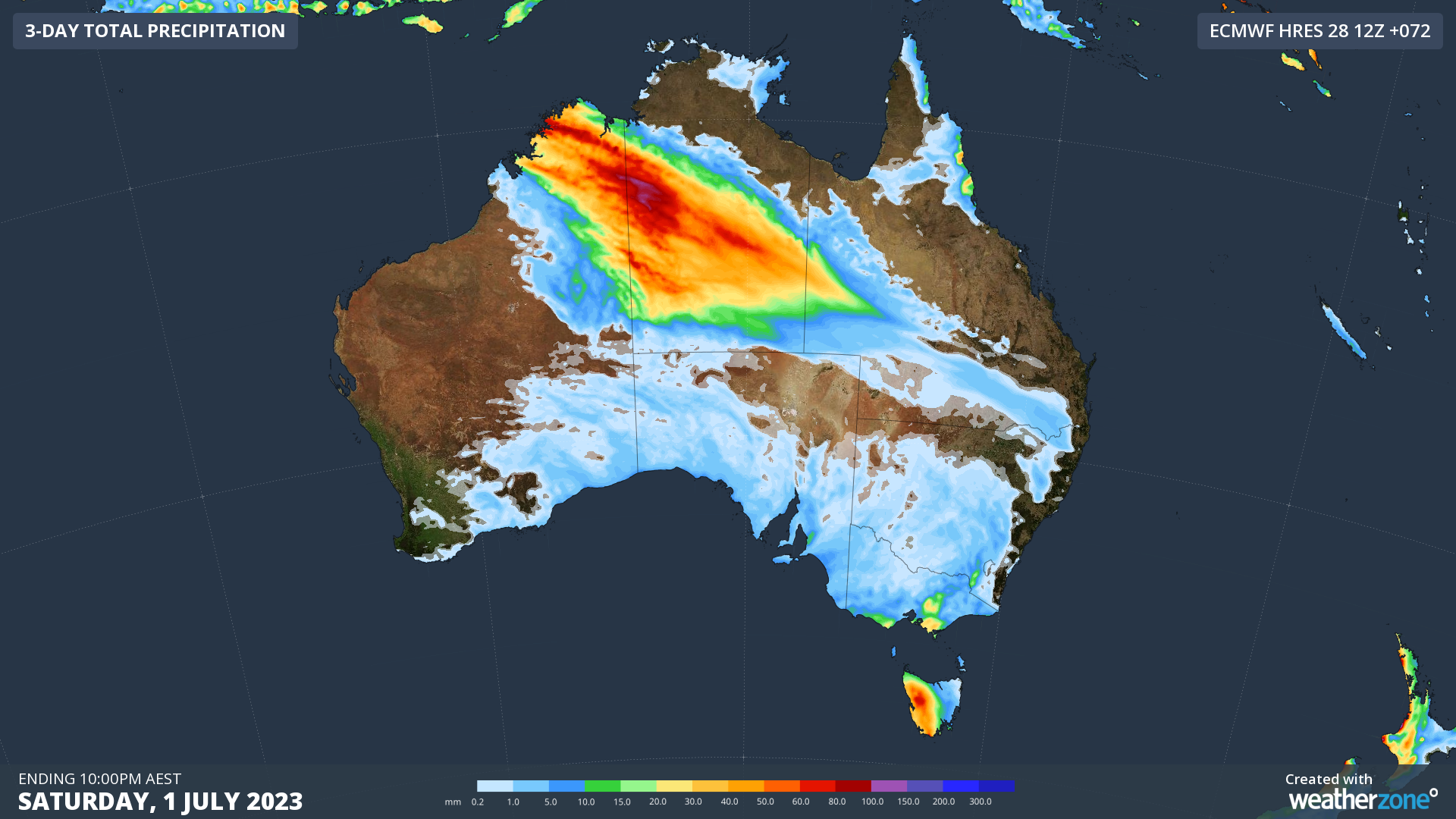
The maps below show how much rain is being predicted by one computer model during the next three and seven days.


Images: Forecast accumulated rain during the next three days (top) and the next seven days (bottom) according to the ECMWF-HRES model.
Broad areas in far northern WA, the NT and Qld could see around 50 to 100 mm of rain in the next 3 to 5 days, on top of what has already fallen earlier this week.
As of 4pm AEST on Thursday, flood watches had already been issued in WA and the NT. More flood watches and possibly flood warnings will be issued in the next few days as this second pulse of rain spreads across northern and central Australia.
With this rain and potential flooding occurring in the winter school holidays, it will be important to check the latest warnings and road conditions before travelling.