
Months of rain in a day in southern WA
Heavy rain has fallen in southern parts of Western Australia, with the heaviest day of rain (in any month) in at least 20 years at some locations.
Lightning was also a feature of the band of rain and storms that lashed southern WA overnight, with almost 700,000 strikes recorded within 650km of the town of Merredin (three hours east of Perth).
Notable rainfall readings in the 24 hours to 9am this Monday, April 14, included:
- The tiny township of Munglinup, about 100km west of Esperance, received 119.4mm, its highest daily rainfall (in any month) in 14 years.
- Erinair, roughly halfway between Esperance and Munglinup, was the other local weather station to record rainfall in triple digits, with exactly 100mm.
- Hyden, the town near iconic rock formation Wave Rock, received 73mm. Its April average is just 23mm and even its wettest month of June sees just 47.8mm on average.
- Esperance received 63.8mm, its highest daily rainfall (in any month) for 16 years. Its April average is 43.5mm.
- Perth largely missed out, recording just 4mm in a brief Sunday evening burst, bringing its running April rainfall tally to 6.2mm. Its long-term April average is 35.9mm.
The loop below shows how the overnight rainfall activity centred on Esperance and areas northwest of the large coastal town of almost 15,000 residents, which is famous for its spectacular white sandy beaches.
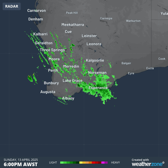
Image: 12-hour radar loop for the southwest corner of WA from 6pm Sunday to 6am Monday, April 14, 2025 (AWST).
Another representation of the overnight rainfall is reflected in the map below – where red, orange and green dots show the locations which received the heaviest rain.
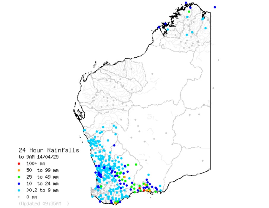
Image: Rain was relatively widespread across the southwest, but heaviest in the Great Southern and South East Coastal forecast districts. Source: BoM.
What caused the heavy rain?
Three factors combined to cause the significant autumn downpour.
The first ingredient was a sharp upper level trough, which triggered the rain event. A pool of cold air in the upper atmosphere provided instability, while a feed of tropical moisture from the northwest provided the fuel.
A dry spell lies ahead for the next week for Perth, while showers can be expected in the South West, South Coastal, and South East Coastal forecast districts from Thursday into the weekend in a cool southerly stream.
Esperance should see a few more millimetres of rainfall, but nothing as heavy as it saw overnight, with showers not expected to penetrate far inland.