
Monsoon squalls and heavy rain hit northern Australia
A burst of monsoonal rain, wind and storms is lashing northern Australia this week, while the threat of multiple tropical cyclones lingers in the east and west.
The satellite image below shows clouds covering a vast area of central and northern Australia on Monday morning.
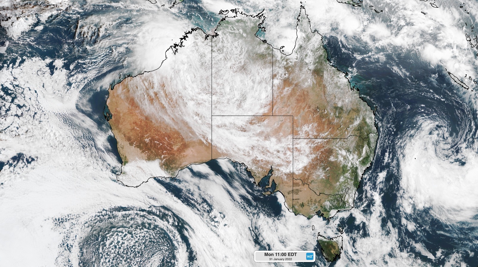
Image: Satellite showing clouds over central and northern Australia at 11am EDT on Monday, January 31.
These clouds are being carried across Australia by monsoonal winds that are feeding into multiple low pressure systems and an active monsoon trough.
What is the monsoon trough?
The term 'monsoon trough' simply refers to the leading edge of moisture-laden west to northwesterly winds that develop over northern Australia during the wet season.
This deep layer of persistent west to northwesterly winds affect northern Australia periodically during the monsoon season, which runs from about December until March. This is typically the wettest part of the north Australian wet season, which occurs between about November and April.
During active periods of the monsoon, air flows from the Indian Ocean and southern Asia towards Australia, where is fuels widespread rain and storms.
The monsoon is currently active over Australia. The synoptic chart below shows the position of the monsoon trough and several low pressure systems embedded within it.
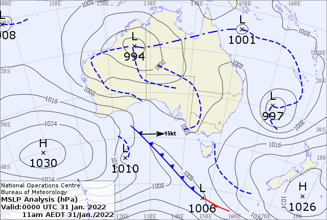
Image: Synoptic chart at 11am EDT on Monday, January 31, showing the monsoon trough and embedded lows over northern Australia.
The monsoon trough and these embedded lows will cause a dynamic mix of weather over and near Australia this week.
The Kimberley and Top End
The low pressure system over northwestern Australia is currently causing squally winds and heavy rain in parts of WA and the NT.
Broome Airport received 66 mm of rain in 30 minutes on Sunday afternoon and amassed 238 mm during the 24 hours to 9am on Monday. Broome Port also clocked a 91 km/h wind gust in Sunday evening.

Image: A thunderstorm towers near Broome earlier this month. Credit: @kane_mclatchie_photography / Instagram
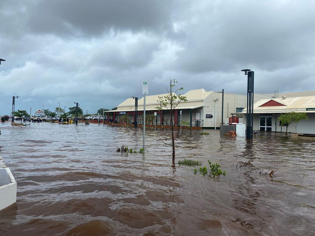
Image: Flooding in Broome after heavy rain on the weekend. Credit: @lauren.hall95 / Instagram
Further north, Darwin Airport had a 67 km/h wind gust early on Sunday afternoon.
Damaging winds will continue to affect parts of the Kimberley and western Top End on Monday into Tuesday. The strongest winds are likely over the western Kimberley, where destructive gusts above 125 km/h are possible.
Heavy rain will also linger near the low, mainly affecting the West Kimberley and North Interior in WA. Daily rainfall totals of 100 to 180 mm are likely on Monday and Tuesday, with isolated daily totals of 200 to 250mm. Two-day accumulated falls of more than 500 mm are possible in the west Kimberley by Tuesday night.
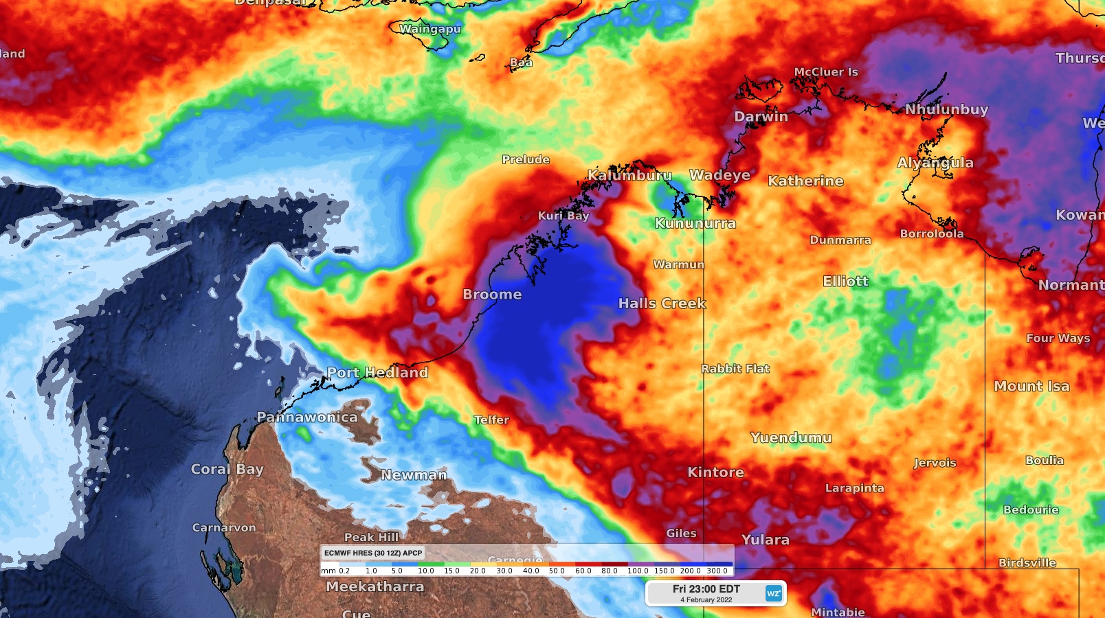
Image: Forecast accumulated rainfall from Monday to Friday, according to the ECMWF-HRES model.
Monsoon rain and thunderstorms will also affect the western Top End and central Australia during the coming days. Severe thunderstorms are possible and warnings will be issued where necessary.
The low pressure system is likely to remain over northern WA on Wednesday into Thursday, causing more rain and thunderstorms in the region.
Some models suggest that the low could move off Australia's northwest coast on Thursday or Friday, which may give the system a chance of developing into a tropical cyclone. However, at this stage, the low is expected to move towards the west and away from the Australian mainland after it moves offshore.
Northern Queensland and the Coral Sea
Rain and thunderstorms are also going to affect tropical Queensland this week. While this rain won’t be as heavy as northwestern Australia, weekly accumulated totals could reach 100 to 250mm in some areas.
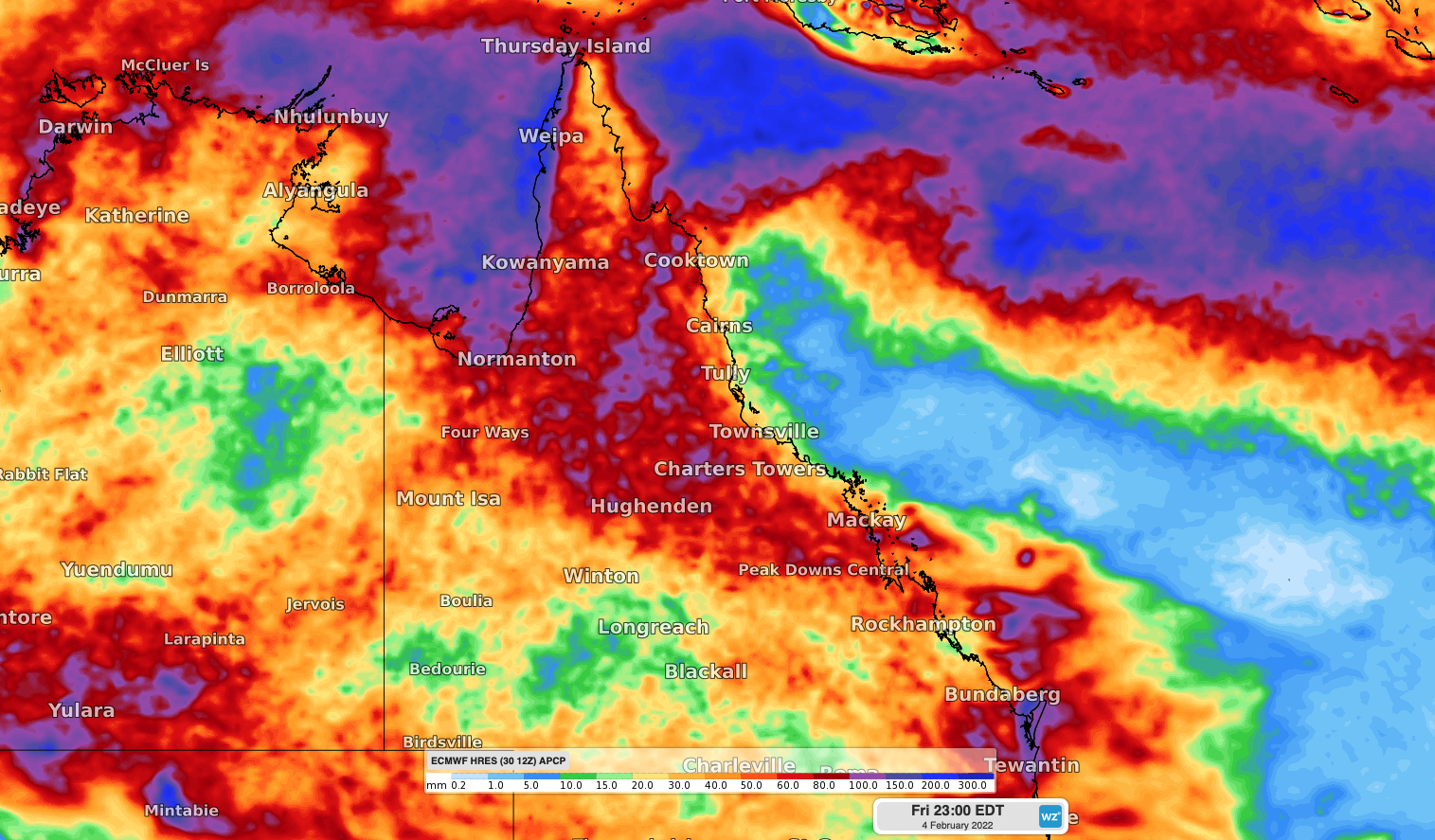
Image: Forecast accumulated rainfall from Monday to Friday, according to the ECMWF-HRES model.
The satellite images below show a tropical low developing over the northwest Coral Sea on Monday morning, about 500 km off the coast from Cooktown.
Video: Satellite images of the northern Coral Sea low pressure system on Monday, January 31.
This low is in a favourable area for development and has a moderate chance of developing into a tropical cyclone over the coming days. However, there is good model agreement that it will move towards the east away from the Queensland coast during the next several days.
Another low pressure located over the southern Coral Sea on Monday morning is moving south into the Tasman Sea. This low won’t have any direct impact on Queensland.
Video: Satellite images of the southern Coral Sea low pressure system on Monday, January 31.
With an acrive mosnoon over northern Australia, severe weather is a good chance in the tropics this week. Be sure to stay up to date with the latest warnings in your area.