"Mister Gandalf, can't you do something about this deluge?"
In the words of one grey-robed wizard, “it is raining, Master Dwarf, and it will continue to rain until the rain is done.”
That is the quote that’s been rolling through the mind of this meteorologist while watching this rain event play out over northern Australia in the past few days, which we first brought to your attention here and reported on a little bit more yesterday (see here).
A surface level trough, fed by an unseasonable abundance of tropical moisture and heavily reinforced by an upper level trough, is responsible for the rainfall totals we’re witnessing in the NT and western Qld today. In the 24 hours to 9am today, the NT’s Tennant Creek received 39.4mm of rain, its highest daily rainfall for the month of July in 45 years. Further south, the Territory Grape farm in Anmatjere, NT, registered its highest July rainfall total in 18 years, with 23.3mm in the rain gauge.
Qld’s now giving the NT a run for its money, of course. Camooweal, near Qld’s western border, received 25.4mm of rain by 9am this morning, making it Camooweal’s highest July rainfall total in 37 years. At the time of writing, Camooweal has since received another 16.8mm, while Julia Creek (about a 3-hour drive east of Mt Isa) has received 11.2mm.
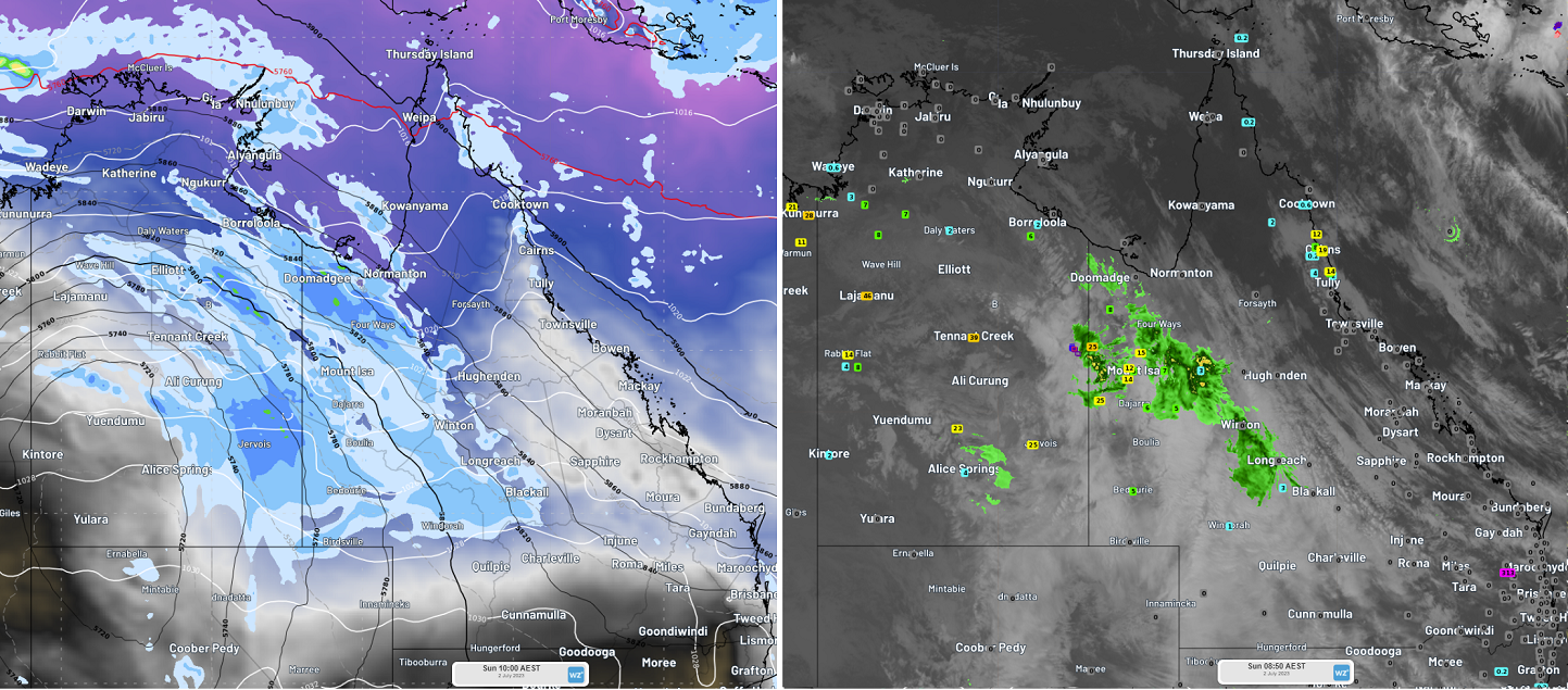
 Left: ECMWF’s modelled 10am AEST time step on Sunday 2 July, showing the upper level trough (indicated by the black 500hPa thickness lines) and the precipitable water field (an indicator of the amount of moisture available for precipitation) extending down from the tropics into the NT and Qld, together with the forecast mean sea level pressure (indicated by white lines) and forecast precipitation accumulated over 3 hours. Right: For comparison, radar and Himawari-8 infrared imagery at 8:50am AEST on Sunday 2 July, together with rainfall gauge data (blue squares indicating light rainfall and orange squares indicating heavier rainfall since 9am the previous morning).
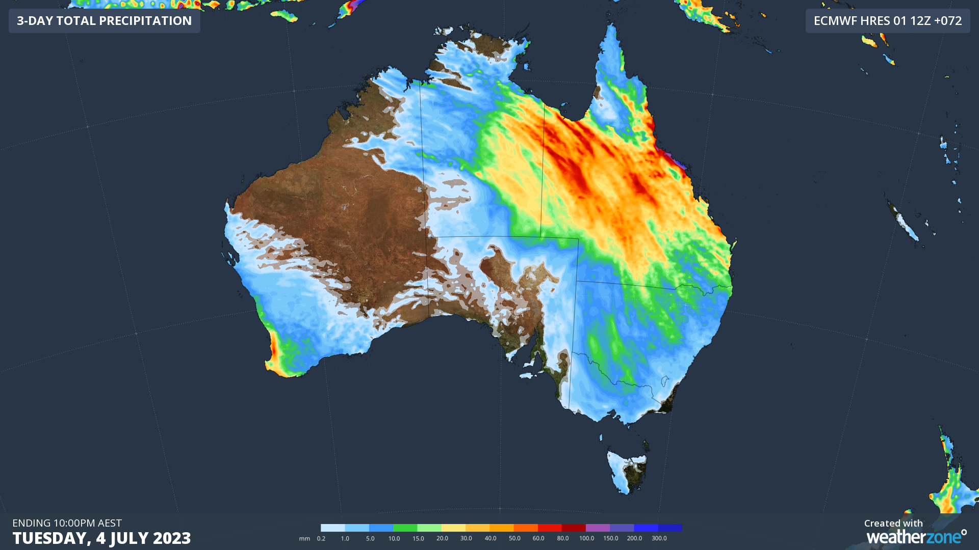
The unseasonably heavy rain will track east and stretch down into southeastern states over the next few days. As you can see in the image below, the heaviest falls will be concentrated over Qld until Wednesday, with most of the state expected to receive 30-80mm in the next 72 hours.
 Image: Accumulating precipitation to 10pm AEST Tuesday 4 July, 2023, using ECMWF
From Wednesday onwards, the weather system responsible should weaken significantly, although showers could persist over Qld’s east coast until late Thursday. By the end of the working week, it may be safe to proclaim that the rain is finally done. If, however, you’d like to change the weather of the world, you may want to find yourself another wiz—uh, meteorologist.