
Midwinter soaking for the Pilbara and the interior
Parts of the Pilbara have experienced an unseasonably soggy few days, as a low pressure trough gathered moisture over the Indian Ocean and is now dragging it across the region and into the interior. The mass of cloud associated with the trough, which we talked about earlier in the week, now dominates the current satellite images of Australia.
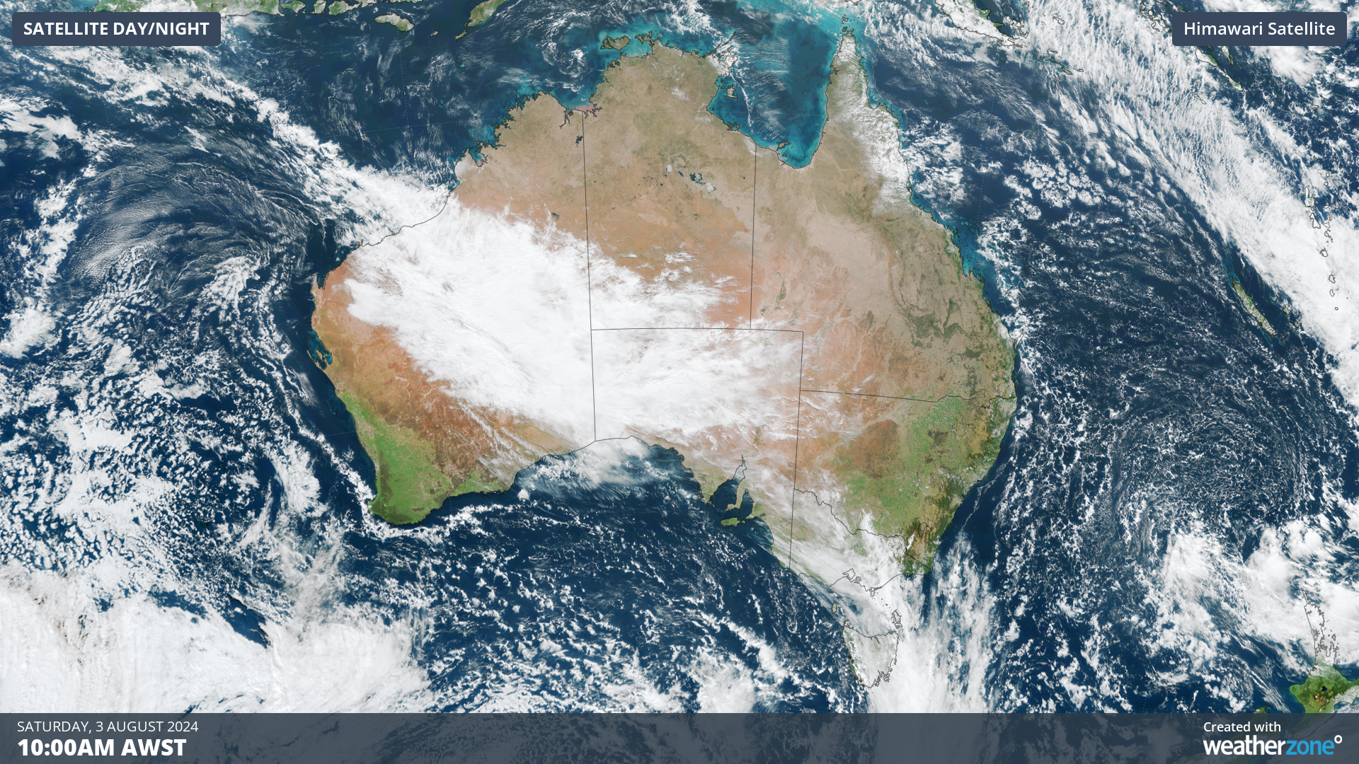
Image: Himawari enhanced visible true colour satellite image of Australia
Carnegie station, almost smack bang in the centre of WA, picked up 35.0mm of rain in the 24 hours to 9am this morning, representing its highest August total in records dating back to 1943. Some other significant statistics from the last few days include:
- Karratha (26.8mm in 24 hours to 9am Friday) had their highest August total since 1974
- Warambie (11.5mm in 24 hours to 9am Friday) had their highest August total since 1965
- Port Hedland (28.2mm in 24 hours to 9am Saturday) had their highest August total since 1983 and highest overall since January 2023
- Paraburdoo (11.8mm in 24 hours to 9am Saturday) had their highest August total since 1988
Other significant totals in the last 24 hours include 25.6mm at Ironbridge Ap, 20.8mm at Varanus Island and 15.6mm at Roebourne Ap. Most of these locations typically average less than 10mm of rainfall in August.
The trough will continue to drive rain over the Pilbara, as well as spreading into western parts of the Kimberley as the day wears on. Overall, another 20-30mm of rain is possible in some of these areas by the end of the day. Rain is also falling over the interior of WA, and spreading into neighboring NT and SA, with eastern WA towns such as Warburton and Giles registering a few drops in the rain gauges this morning. Indeed, Warburton’s 24 hour total of 4.4mm is more than half of its August average (8.3mm).
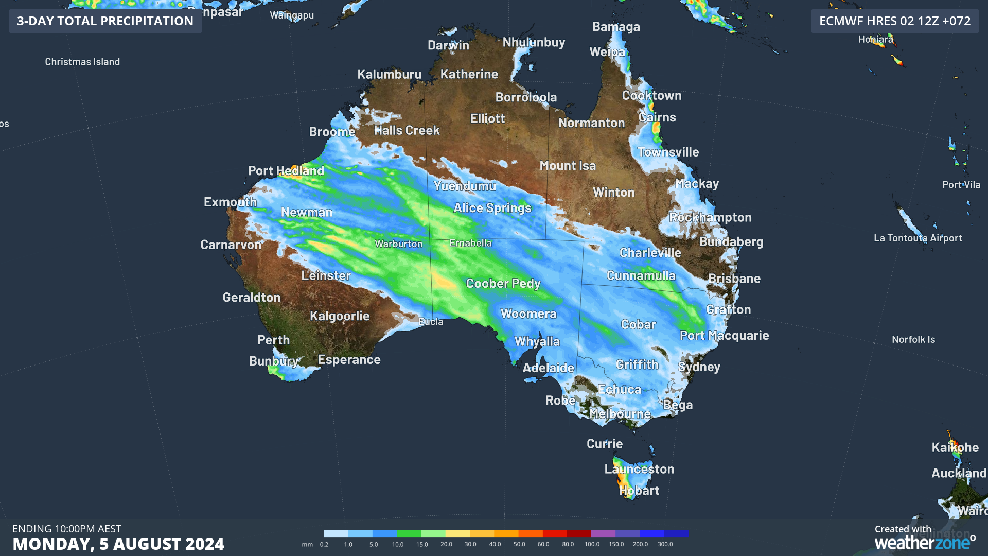 Image: ECMWF forecast accumulated rainfall to 10pm EST Mon 5th of August
Showers will begin to clear from most of WA tomorrow while spreading further into SA and the southern NT, as an upper-level trough sweeps across the country steering the rain east. While the trough will spread showers across large portions of the country in the coming days, most of the rain from this system will fall over the western half of the country.