
Mid-autumn hot spell for Melbourne, Adelaide
Significant mid-autumn heat is heading the way of southeastern Australia this weekend, with Melbourne and Adelaide the main capital cities set to be affected.
Adelaide can expect maximums around 34°C on both Saturday and Sunday, with maximum temperatures staying in the low-to-mid 30s until Wednesday.
Melbourne should reach 30°C on Saturday and as high as 32°C on Sunday, with maximums in the mid-to-high 20s persisting through to Wednesday.
The heat is being caused by two main factors.
The first influence is the strong high pressure system which will be the dominant feature of the Australian weather pattern this weekend, as it funnels warm, dry air from Australia’s interior towards the southeast.
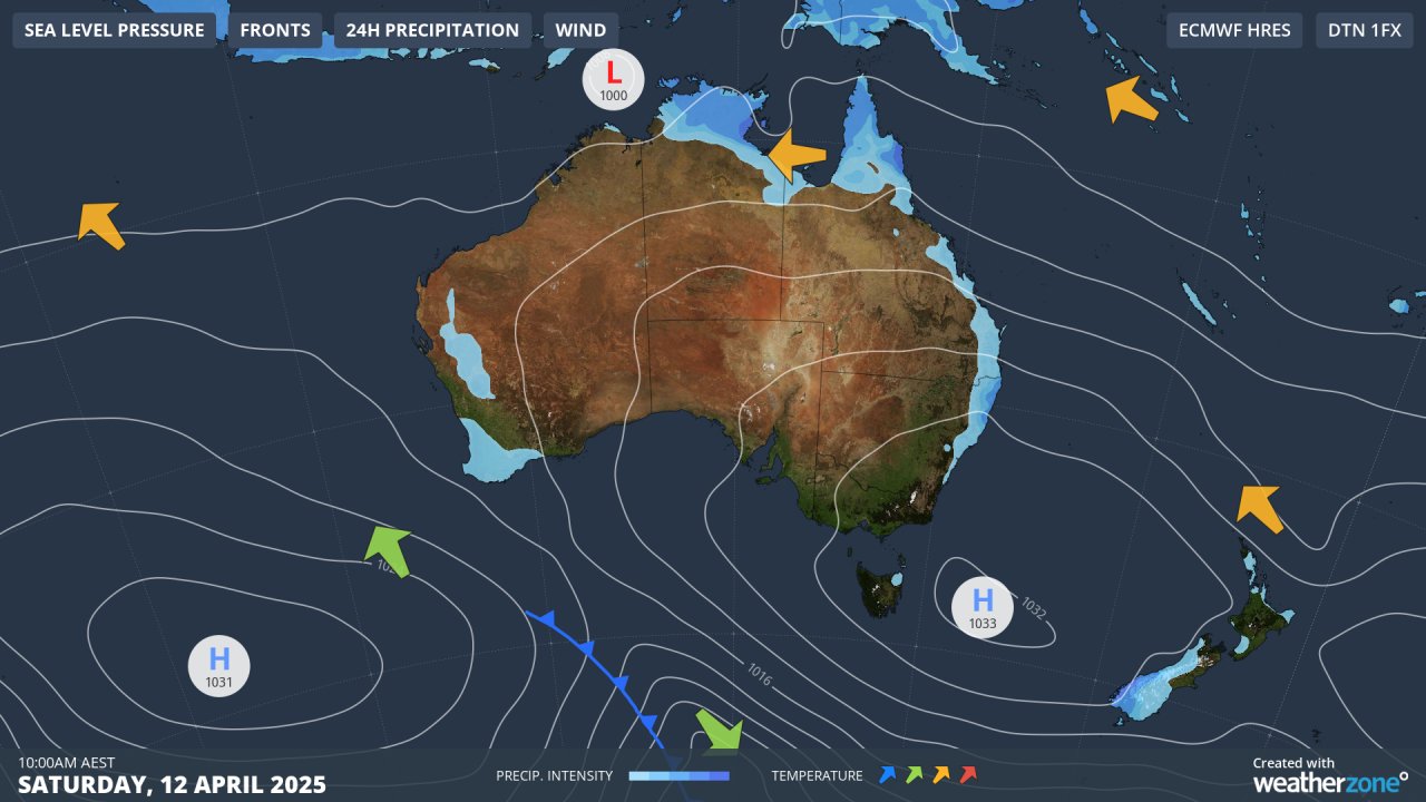
Image: Forecast synoptic chart for Australia on Saturday, April 12, 2025.
As the high moves further out into the Tasman Sea, the high currently centred over the ocean southwest of WA will move eastwards into a similar position, maintaining the unseasonably warm airflow.
The second factor is the low pressure system visible on the chart above in the Arafura Sea, northwest of Darwin. That low is expected to become a Category 1 tropical cyclone on Saturday evening, strengthening to Category 2 by Sunday evening as it tracks in a southwesterly direction, close to the Kimberley coastline.
It might seem strange to suggest that tropical cyclones – or even the strong lows that precede them – can generate heat that travels literally all the way across the country, but that’s exactly what can happen.
As Weatherzone meteorologist Joel Pippard explains, tropical cyclones cause hot tropical air to rise high into the atmosphere. This rising air must be dispersed – what goes in must come out – so as the cyclone’s outflow strengthens, it pushes hot air away from the system.
This process leads to subsidence, where the accumulated warm air in the upper ridge begins to descend. As it sinks, it compresses and reheats, returning to its original temperature and injecting additional heat and energy into the surrounding atmosphere.
READ MORE: How tropical cyclones can create heatwaves in Australia
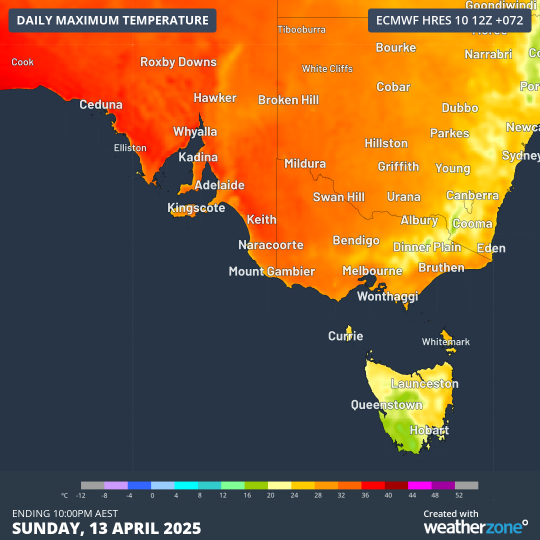
Image: Maximum temperature predictions for Sunday, April 13, across SE Australia.
While no heat records are likely to be broken in southeastern Australia in coming days, we are facing a prolonged spell of significantly above-average temperatures across a wide area.
For example, Melbourne’s average April maximum is 20.3°C while Adelaide’s is 22.2°C – so maximums will be around 10 degrees warmer than average in both cities for at least four days.
Minimum temperatures should also be around 6 to 8 degrees above the April average in both cities for several nights.