Melbourne top temps in teens for much of the week
Melbourne is headed for a cool mid-November working week, after last Friday saw a top of 33.1°C, the highest temperature in the city since March 18.
Maximum temps will likely stay in the teens until Friday, when a top of just 20°C is expected. That means that every day this week should be well below the long-term November average high of 22.0°C.
Things will be kept cool by persistent south to southwesterly winds, and if you take a look at the two synoptic charts below, the picture is really interesting.
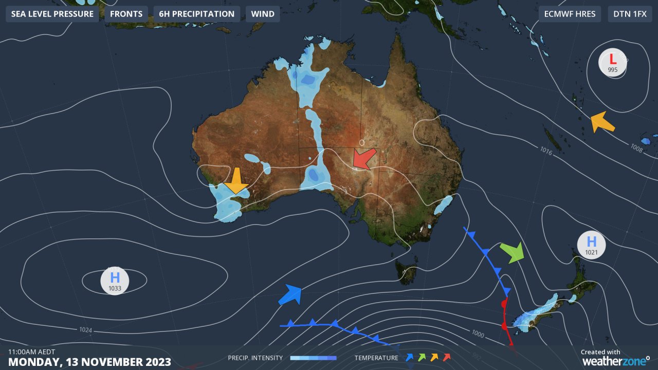
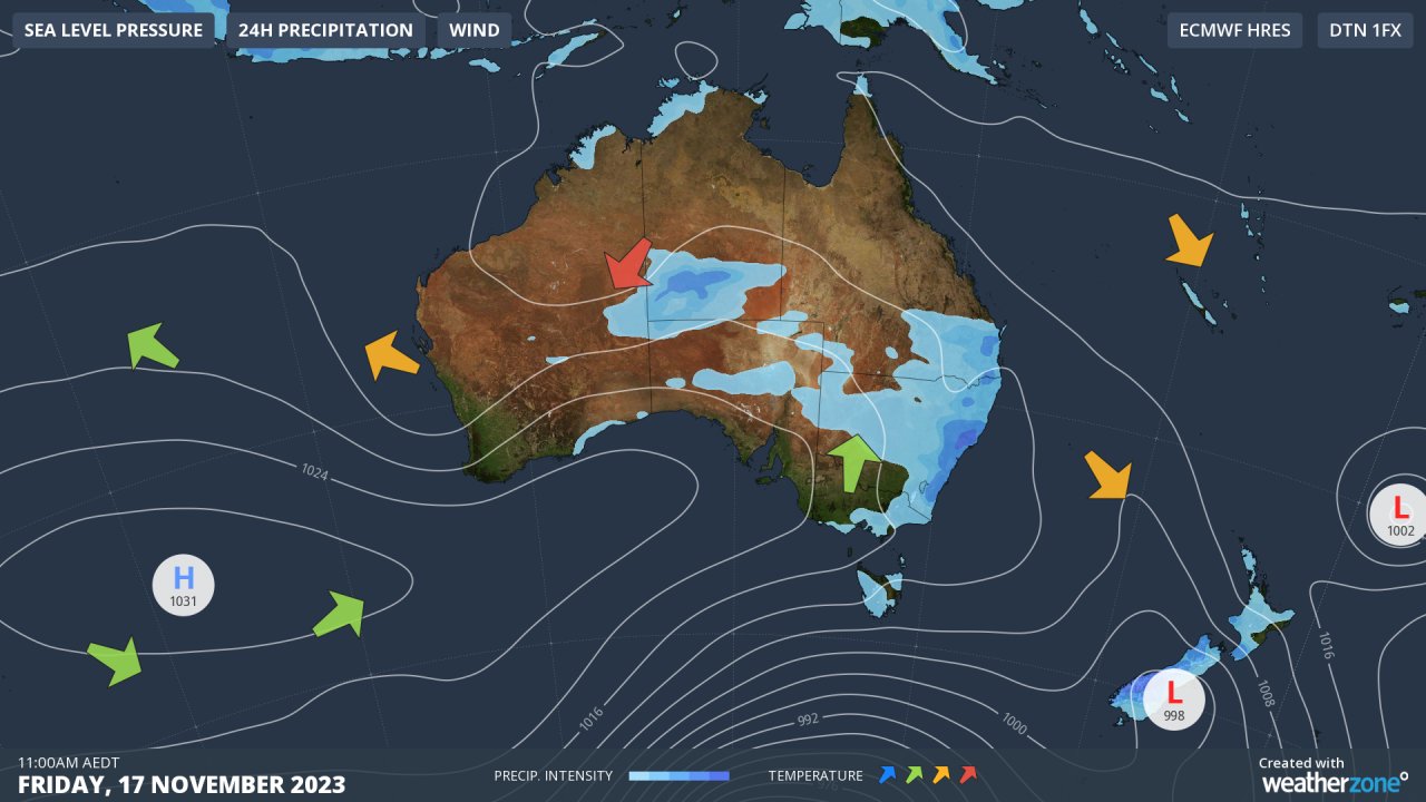
As you can see, the two charts look almost identical. It's almost as if the weather gods have run out of ideas and just let things be, with the high centred southwest of Perth almost stationary for the next for four or five days.
According to Weatherzone meteorologist Joel Pippard, "blocking" highs like this occur when the jet stream wraps around a high and "locks" it in place, usually for a week or more. This particular blocking high is likely caused by the current strong Indian Ocean Dipole (IOD).
With that high locked in place, a series of cold fronts will bring showers to parts of Tasmania, with snow showers possible on the highlands on Thursday. However southern Victoria should see only occasional light showers midweek, although those cool winds will have a bite.
So forget about the classic four-seasons-in-a-day weather for Melbourne for the next few days.
This working week will be all about a consistent cool spring spell which feels just a touch more like winter than summer, with sunny warmer weather with top temps in the mid-twenties finally kicking in by the weekend.