Massive U.S. heavy rain event could mean historic flooding this week
Days of heavy rain and thunderstorms will hit parts of the Mid-South and Ohio Valley this week, with rainfall amounts exceeding six inches possibly resulting in historic flooding.
Two big storm systems are going to move across the U.S. this week and produce all kinds of weather hazards. Some heavy snow across the north, strong winds in the Plains, and areas of severe weather east of the Rockies are all on the docket.
But this week’s wild weather might be most remembered for the incredibly heavy rain that is forecast to fall.
A big system already moved into the Plains on Tuesday, April 1 before crossing the Midwest on Wednesday, April 2. Showers and thunderstorms formed along this system’s cold front on both days, causing areas of heavy rain and severe weather.
This front is going to get stuck from northeast Texas through the Ohio Valley from Thursday, initially causing showers and thunderstorms along that area for both Thursday, April 3 and Friday, April 4. Warm, moist air coming up from the Gulf should aid in producing widespread areas of heavy rainfall in this area as well.
On Saturday, April 5, the next big storm system will reinvigorate the front, producing more widespread heavy rain and severe thunderstorms along the same areas stretching from Texas to the Ohio Valley. Rain from this stubborn front may not clear the region until Sunday, April 6.
Huge rainfall totals to cause flooding
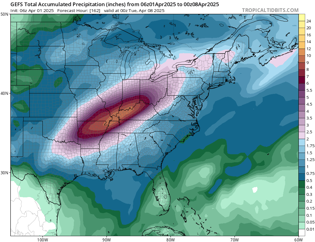
With essentially 4-5 days of nearly continuous rainfall, amounts will stack up very quickly. Model simulations are pointing toward widespread areas of 4-8 inches of rainfall from far northeast Texas and southeast Oklahoma through Arkansas and southern Missouri up through Ohio, which includes much of Kentucky and western Tennessee.

Image: Heavy rain is forecast to occur from the extreme southeastern Plains up through the Ohio Valley. Some areas may see more than eight inches of rain. Source: TropicalTiibits.com
Where thunderstorms train - or move over the same areas continuously - those amounts are likely to be higher. The risk of training thunderstorms is much higher along the stalled frontal area, roughly between Texas and Oklahoma. It is hard to put a ceiling on how much rain may fall, but it appears possible that some areas may eclipse a foot of total rainfall over the extended event.
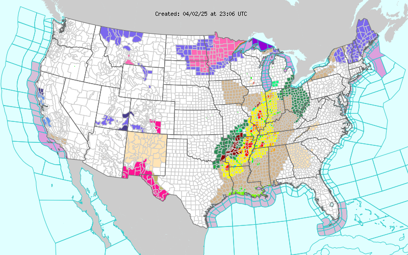
The National Weather Service currently has flood watches posted for much of these areas and may expand them as the front starts to set up on Thursday. All of these areas feed the Mississippi River and flooding along it south of St. Louis appears likely, not to mention the Ohio, Cumberland, Tennessee, and Arkansas Rivers and the local tributaries as well. With that much rain, the flooding could be historic.

Image: In addition to other extreme hazards across the U.S., areas shaded in green are forecast to see heavy rain and potential flooding. Source: NOAA/NWS
There was another period where this same area had tremendous flooding, back in April 2011. That April was most remembered for its severe weather, in which multiple tornado outbreaks occurred, including the Super Outbreak that produced four maximum-rated EF-5 tornadoes late in the month. You can find a NOAA recap here.
However, that active weather pattern also produced heavy rainfall in much of the same areas from Arkansas up through the Ohio Valley. Some areas saw more than 300% of their normal April rainfall, or more than ten inches of rain, though that fell over the entire month, not just a five-day period. Major flooding occurred along those rivers and many areas were deemed federal disaster areas. The same may occur with this series of rainfall as well.