Massive swell arriving this weekend
A Tasman Low pressure system will whip up large and powerful swell for several days from Saturday, with the potential to impact port operations along the eastern seaboard.
The images below show that a stubborn high-pressure system will cradle the low and keep it over the Tasman Sea between Saturday and Wednesday. 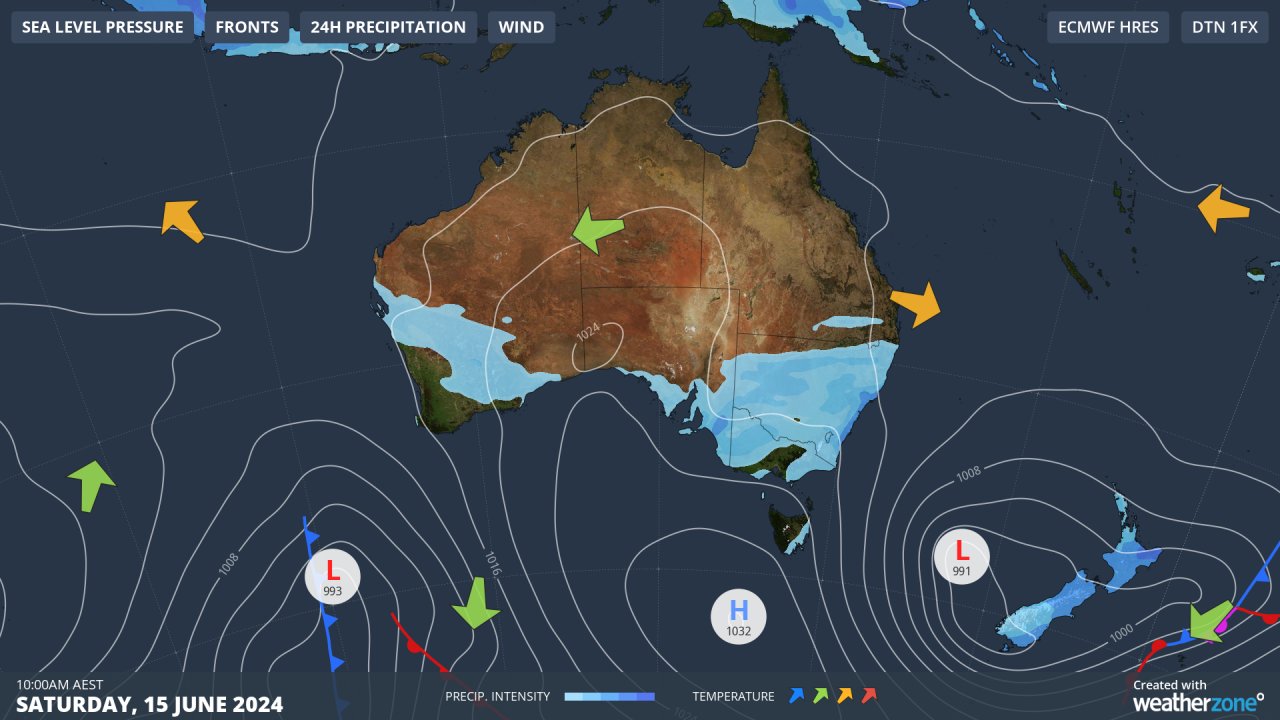
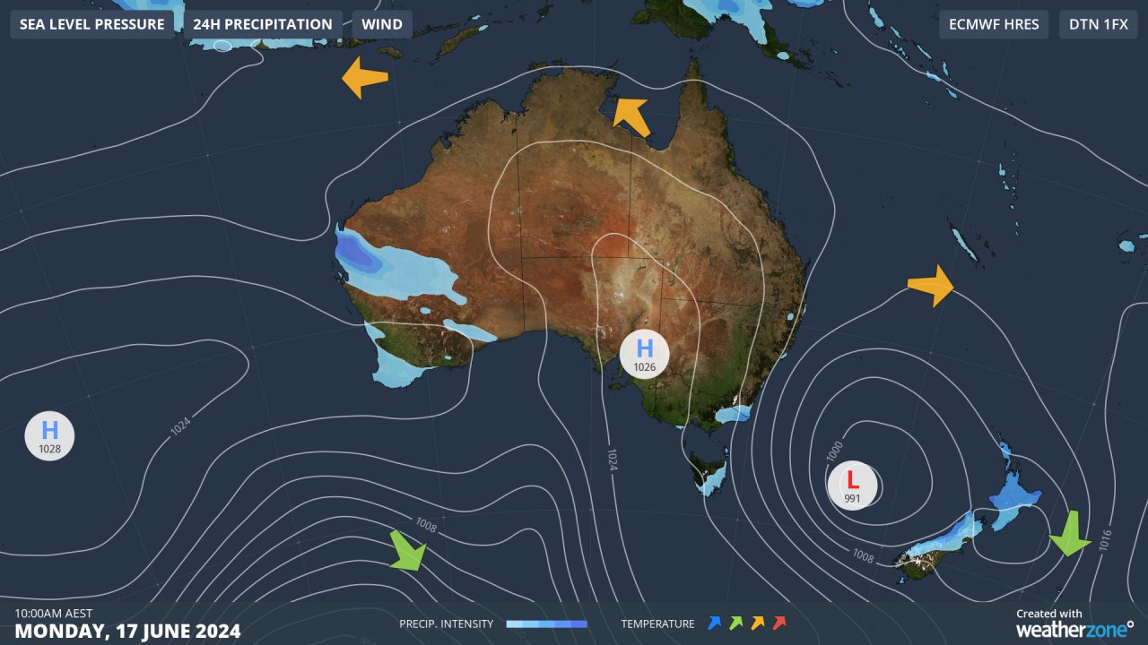
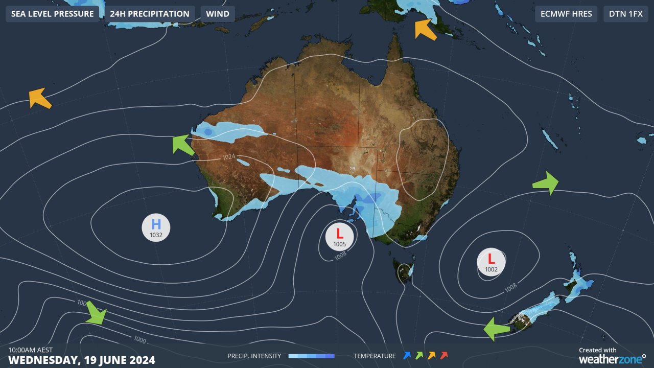
Images (top to bottom): Mean Sea Level Pressure (showing the low in the Tasman Sea marked with an 'L') together with 24-hour precipitation on Saturday, June 15, Monday, June 16, and Wednesday June 17.
The low will generate fierce winds along coastal areas of NSW, Vic and Tas between Saturday, June 15 and Wednesday, June 19. The image below shows that the low will strengthen further on Sunday, with the potential for gale force winds to impact the waters off the NSW, Vic and Tas coasts. 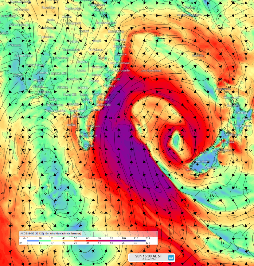
Image: 10-metre instantaneous wind gusts at 4pm AEST on Sunday, June 16, according to Access-G.
While the winds should ease below gales on Monday, they will continue to be strong through till Wednesday.
The stubborn Tasman low will generate a long fetch, meaning these tireless southerly winds will move over a large swath of open water causing large waves to impact the coast for several days.
The swell will build over the weekend, before easing in the middle of next week. However, there is potential for the low to linger over the Tasman until Friday, June 21, continuously pumping massive swell towards the east coast.
The images below show significant wave heights reaching 4 to 6 metres during this period, with the potential for 6-8 metres off the Vic, Tas and southern NSW coastline on Sunday. 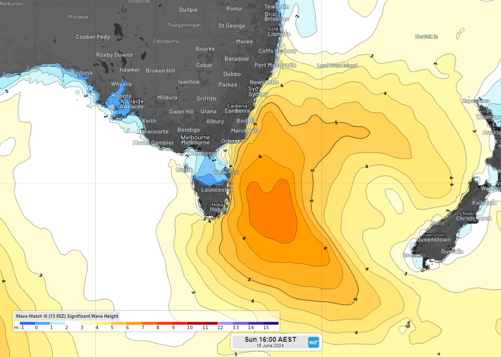
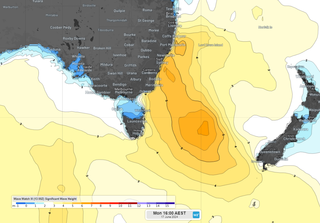
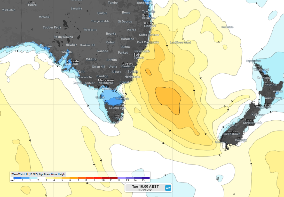
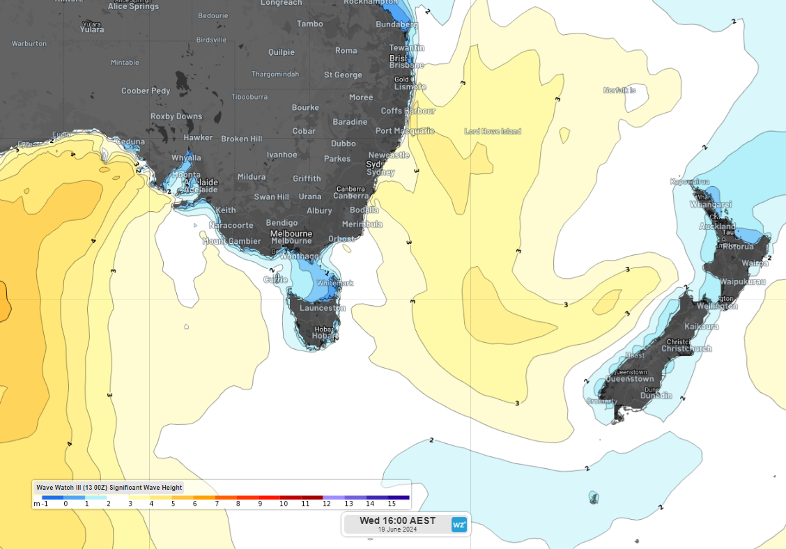
Images (top to bottom): Significant wave heights at 4pm AEST between Sunday and Wednesday, June 19, according to Wave Watch III.
These large waves will also be powerful with the wave period potentially reaching 13 to 16 seconds.
The wave period is the time between successive wave crests or troughs. The longer the time, the greater the energy is within the wave. Wave periods over 11 seconds are associated with stronger waves.
The wave height and period expected over the coming days has the potential to impact port operations along eastern Australia. These large and powerful waves should cause coastal erosion along southern facing beaches in NSW, Vic and Tas. Dangerous surf warnings will likely be issued, so keep an eye out for the latest warnings.