
Massive blob of outback October heat
Extreme October heat is building up over the centre of the continent with October heat records for both maximum and minimum temperatures likely to be threatened at some locations.
Central Australia started to warm up under northerly winds on Tuesday, with multiple weather stations in the southern NT and northern SA nudging 40°C.
Wednesday and Thursday are forecast to be even hotter. Two of the hottest locations on Thursday are expected to be:
- Birdsville (Qld): Thursday’s forecast max 43°C (Oct record 45.1°C)
- Oodnadatta (SA): Thursday’s forecast max 43°C (Oct record 45.4°C)
While those forecast maximums are a degree or two short of the record (and the same is true for the forecast minimums for both towns), these are still extreme temperatures for this time of year.
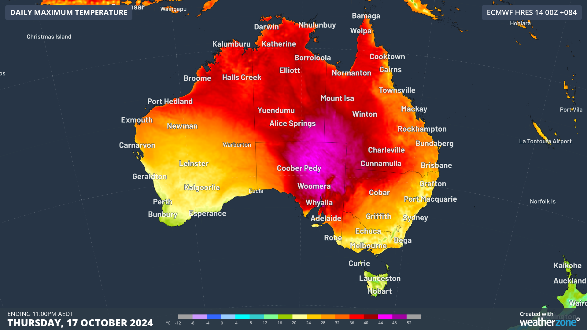
Image: Thursday in particular will be a scorcher in the centre of the country.
It's also worth mentioning that the hottest air will park itself over areas where weather stations are few and far between, so it's likely that some exceptionally hot October temperatures could go unrecorded.
This outback heat is being funnelled southwards from northern Australia, which has been significantly hotter than average for virtually all of spring 2024 to date.
While Australia as a whole was almost two degrees warmer than average in the nation's fourth-warmest September on record, parts of northern Australia exceeded the average by a lot more than two degrees.
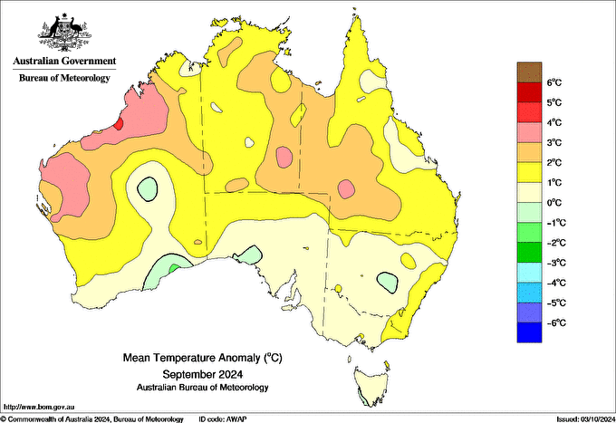
Image: Temperature anomalies (difference above or below normal) in September 2024. Source: BoM.
See the small red patch in the northwest corner of the country?
That's more or less where the town of Port Hedland is located, and the average September minimum in the town of 15,000 residents was almost six degrees above average, while Port Hedland's average Setpember maximum was two degrees above average.
October has also been much warmer than usual in Port Hedland, as it has been at numerous other locations in northern Australia – with the region serving as a heat engine for areas further south.
The full force of this heat event will not affect the southern capitals, although temps will definitely be on the warm side this Thursday.
Adelaide is likely to reach 30°C, which has only happened once so far this spring (31.4°C on Tuesday), and Canberra is also in line for its warmest day of spring 2024 to date, with a top of 26°C.