
Major Antarctic outbreak from this weekend
There are increasing signs that a prolonged cold snap is on its way to southeastern Australia from Antarctica later this week into next.
The frigid air will be dragged from Antarctica by a cold front sweeping across the continent this weekend. A high-pressure system will quickly follow in the fronts path and remain over southern Australia until at least mid-next week, prolonging this cold outbreak.
The image below shows the frigid airmass over southeastern Australia early next week, with the southerly winds transporting it north into Qld.
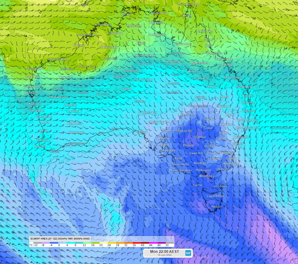
Image: 850 hPa (around 1.5km above the surface) temperature and wind forecast at 10pm AEST on Monday, July 15
The combination of this high pressure system and a low in the Tasman Sea, will direct southerly winds across southeastern Australia. This will keep temperatures 2 to 4°C below average across several states and territories for several days from late this week into next week.
These southerly winds will lead to wind chill, with temperatures feeling much colder than the actual temperature.
The image below shows southerly wind gusts across southeastern Australia on Tuesday next week.
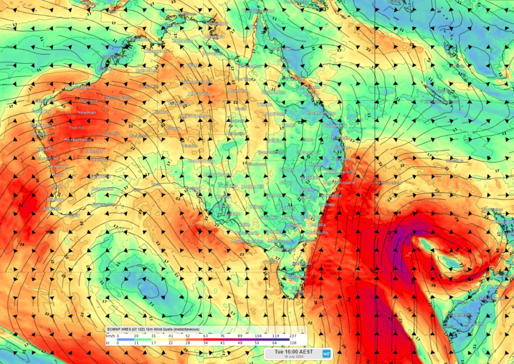
Image: Instantaneous wind gust forecast at 4pm AEST on Tuesday, July 16, according to ECMWF
As the week unfolds, we will update you with more details on the temperatures expected across southeastern Australia later this week into next.