
Low level snow imminent in southeastern Australia
A strong cold front crossing southeastern Australia during the next two days will bring damaging winds, heavy rain and some of the lowest snow so far this year.
The satellite image below shows a cold front passing over SA, VIC and TAS late on Monday morning, with a large cold air mass in its wake.

Image: Day/night satellite image captured on Monday morning. The band of cloud stretching from Tasmania to SA shows the location of the cold front, while the large area of speckled clouds to the south of Australia is forming in a large pool of cold air.
The front will continue to move towards the northeast over the next 24 to 48 hours, crossing TAS, VIC, SA and southern NSW on Monday and then the rest of NSW, the ACT and southern QLD on Tuesday.
The passage of this strong cold front will produce a wintry mix of blustery winds, rain, thunderstorms, hail and snow.
The strongest winds are likely to occur ahead of and with the cold front, with damaging gusts likely over mountainous areas in northeast VIC and southern NSW on Monday into early Tuesday morning. Gusty southerly winds will also spread up the coast and ranges in NSW on Tuesday and Wednesday, in the wake of the front.
Rain will spread over a broad area of southeastern Australia during the next two-to-three days, with widespread falls of 10 to 30 mm and isolated totals above 50 mm, most likely in western TAS.
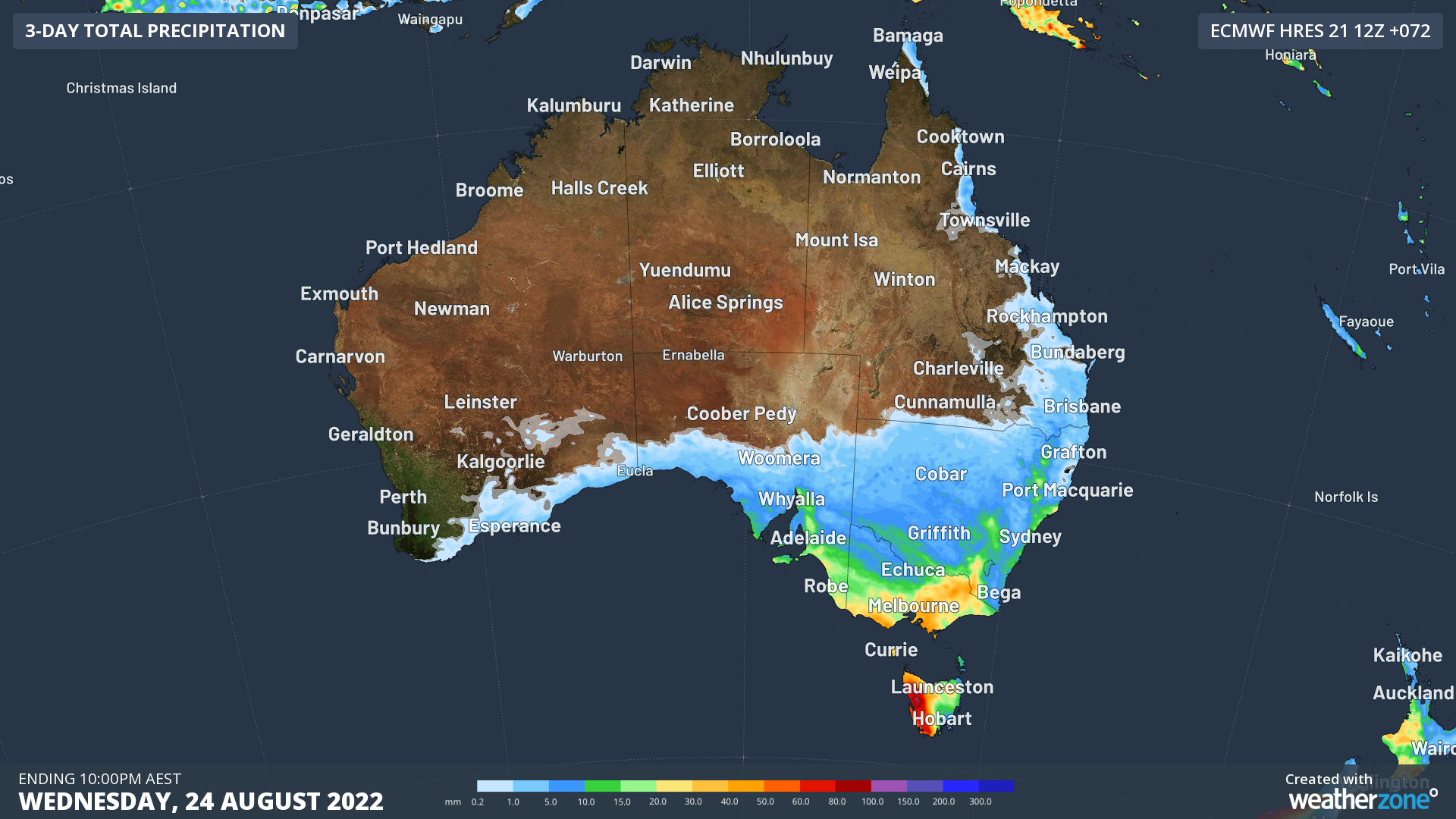
Image: Forecast three-day accumulated rainfall for the 72 hours ending at 10pm AEST on Wednesday, August 24.
Some of this precipitation will be falling as snow thanks to a mass of very cold air in the wake of the front. Snow is expected to reach as low as:
- Around 300 metres above sea level in Tasmania on Monday night into Tuesday morning
- Around 500 metres in Victoria on Tuesday morning
- Around 700 metres in southern NSW and the ACT late on Tuesday
- 900 to 1000 metres in central and northern NSW late on Tuesday
This system could deliver the first snow so far this year in parts of central and northern NSW, and in some lower-lying areas of TAS and VIC. There is even potential for a few snowflakes on higher terrain in SA’s Mount Lofty Ranges on Monday night.
Maximum temperatures will be several degrees below average from Tuesday across much of southeastern Australia:
- Adelaide is forecast to reach 14 and 15ºC on Tuesday and Wednesday, which is around 3 to 4ºC below average.
- Melbourne’s maximum temperature is predicted to only hit 12ºC on Tuesday, around 4ºC below average.
- Hobart should only warm to 10 to 11ºC on Tuesday, which is 3 to 4ºC below average.
- Canberra’s maximum should reach 11ºC on Tuesday.
- Sydney’s daily maximums will range from 17 to 19ºC between Tuesday and Saturday.

Image: Maximum temperature forecast for Tuesday, August 23, according to the ECMWF-HRES model.
Severe weather warnings and flood watches have been issued for this system, so be sure to keep up-to-date with the latest warnings in your area.