
'Leave immediately': Tasmanians urged to flee fires
The bushfire situation continues to intensify in northwest Tasmania this Tuesday, with multiple warnings in place as more than 20 bushfires rage in the state.
Just after 2pm (AEDT), the Tasmania Fire Service issued a Bushfire Emergency Warning for Corinna and surrounds, urging people to leave immediately due to "fire conditions expected to be uncontrollable, unpredictable and fast moving".
"There is expected to be thick smoke, and showers of embers which may cause fires all around you. Fires will move quickly and may come from many directions."
Authorities have warned that they are unable to attend the fire, and that conditions are expected to worsen.
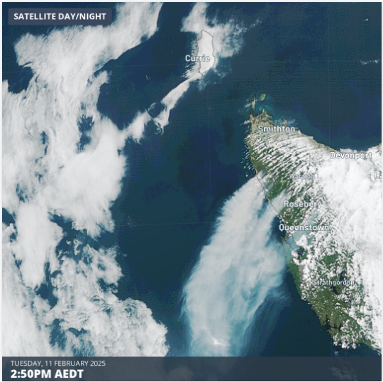
Image: Smoke from fires on Tasmania’s west coast can be clearly seen on the satellite image, with smoke pouring offshore under northeasterly winds.
Corinna is a tiny rural locality in Tasmania's remote, heavily vegetated northwest. The former gold mining settlement is no longer an actual town, but a wilderness retreat which bills itself as the "Gateway to takayna/Tarkine & Tasmania's West Coast."
The eco-retreat is situated on the northern shore of the Pieman River, a broad waterway which could likely serve as refuge in a fire emergency for those who have been unable to flee.
What is the Tasmanian fire weather like right now?
It’s relatively windy in the Tasmanian fire zones this Tuesday with the strongest gusts topping 70 km/h on the northwest coast and on some of the state's higher peaks.
It’s also quite warm by local standards. For example, the coastal town of Strahan – about 90 minutes south of Corinna – topped 28°C at 2:30pm. Its average February maximum is 21.2°C.
Indeed, temperatures are expected to rise past 30°C in numerous west coast locations in the next two days, with the whole of Tasmania currently in a heawtave which is classed as severe for most of the west coast.
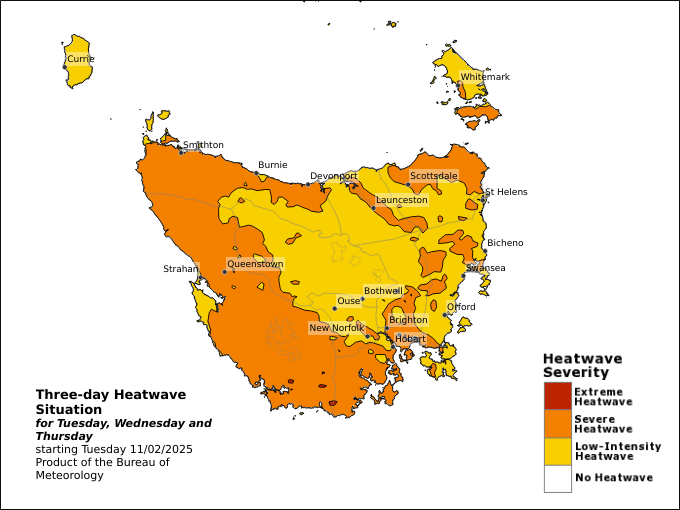
Image: Three-day heatwave map for Tasmania starting Feb 11, 2025. Source: BoM.
These two factors (wind and heat) are obviously making life tough for firefighters.
A third factor underpinning the current dangerous fire weather is the dry start to 2025. To use Strahan again as an example:
- Strahan saw just 16.8mm of rainfall in January. Its monthly average is 81.4mm.
- Strahan has received just 0.4mm so far in February. Its monthly average is 68.9mm.
It’s worth noting that western Tasmania is the wettest part of Australia south of the tropics with consistent year-round rainfall. Even during the region’s drier months from November to March, the average rainfall is still very healthy, with 50 to 100mm falling at most locations.
But in 2025 so far, rainfall deficiencies have been experienced right across Tasmania. Indeed as the chart below shows, parts of the west coast endured their driest January on record.
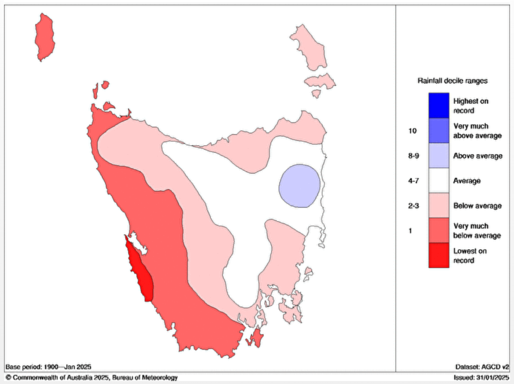
Image: The dry pattern illustrated for January 2025 in the chart above has continued into February. Source: BoM.
Looking ahead, two more days of dangerous fire weather loom for western Tasmania on Wednesday and Thursday, before rain and significantly cooler weather arrive later on Thursday, persisting into the weekend.
Summer snow is even possible on Tasmania/s highest peaks by Saturday.
READ MORE: Cold outbreak brewing with possible summer snow
But for now, the situation remains life-threatening in some areas, so please check the latest Tasmanian fire warnings at alert.tas.gov.au.