Lake Argyle fire seen from above and below
A fire on the bank of Lake Argyle in Western Australia has created an opportunity for captivating images this week.
Lake Argyle, located roughly 50 km to the south of Kununurra, is Australia’s second largest man-made freshwater reservoir.
Following the region’s wettest wet season in nine years, the lake is currently holding around 9775 gigalitres of water behind the Ord River Dam. This is just over 90 percent of the dam’s capacity and a 34 percent increase on the same time last year.
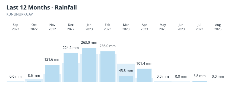
But while the water sitting in Lake Argyle is a legacy of the healthy wet season just passed, the fire currently burning on its bank is a clear sign of the dry season.

Image: Rainfall observations over the past 12 months at Kununurra Airport, showing a wetter-than-normal wet season and a typically-dry dry season.
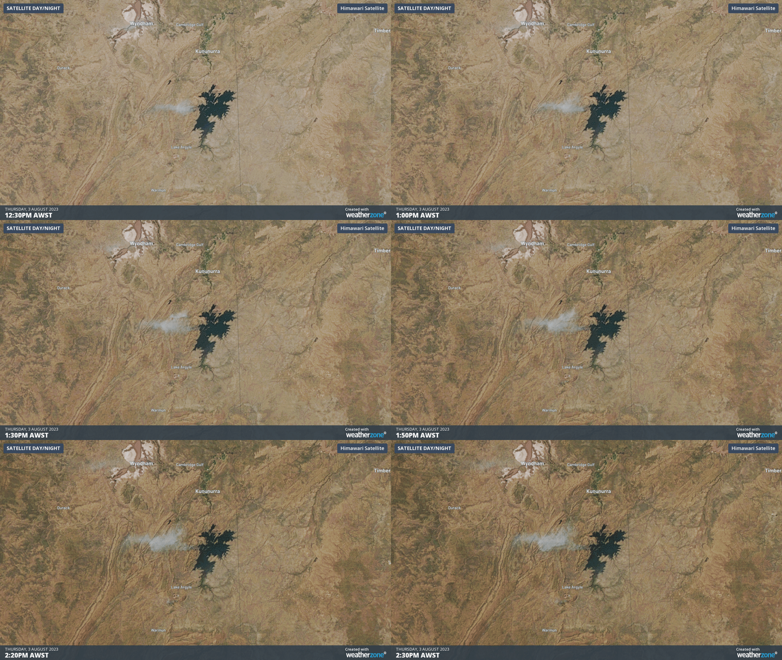
The sequence of satellite images below was captured by the Himawari-9 satellite on Thursday, showing a large plume of smoke blowing to the west of Lake Argyle.

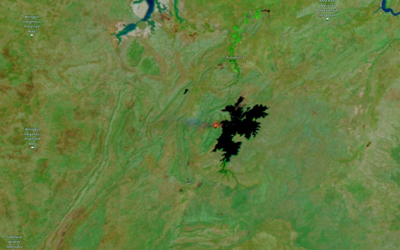
The smoke in the images above was caused by a fire burning on the western bank of Lake Argyle. The image below shows the location of the fire using an enhanced (false-colour) satellite image captured by the NOAA-20 satellite on Thursday.

Image: Enhanced false-colour satellite image of the fire near Lake Argyle, captured on Thursday, August 3, 2023. Source: NASA Worldview
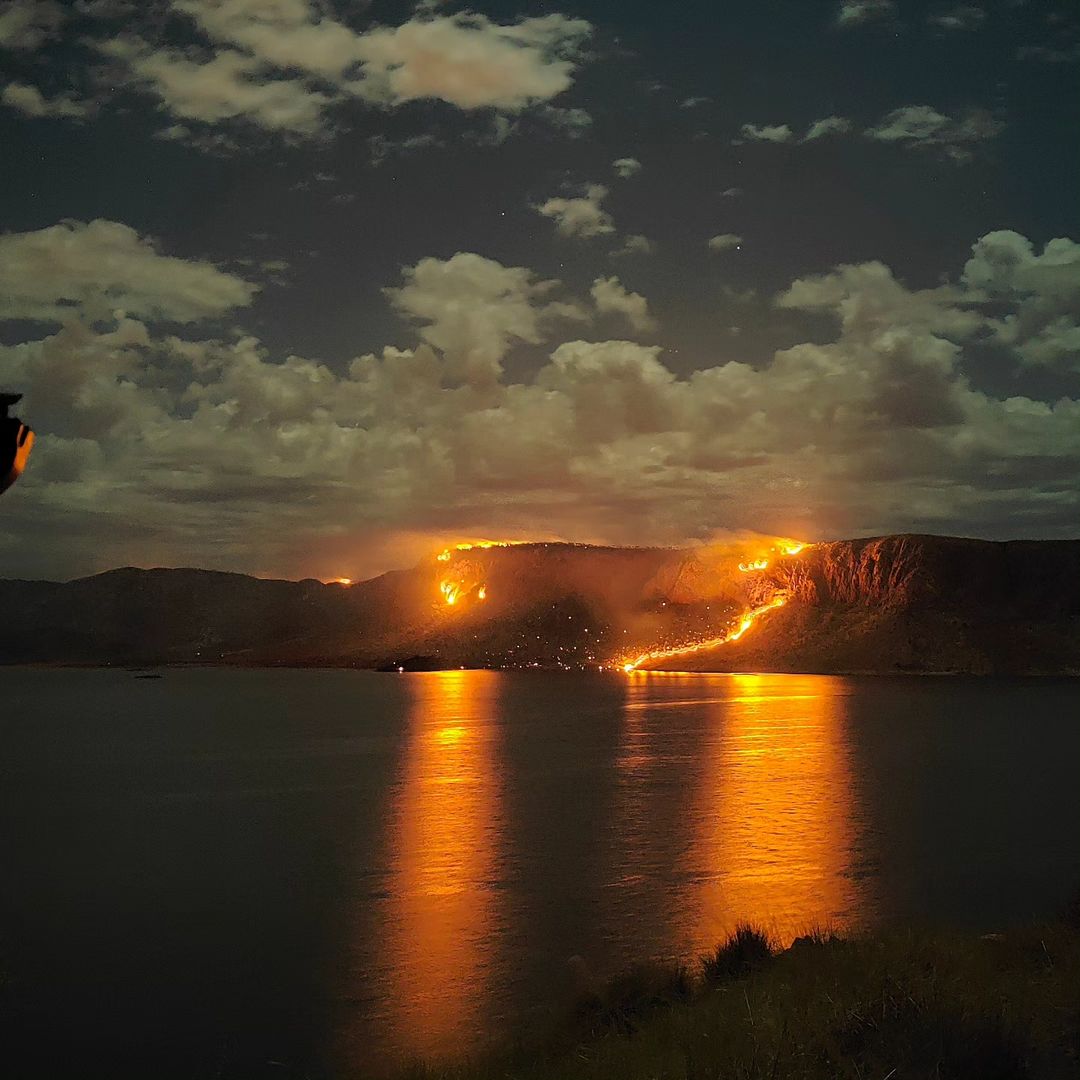
The Lake Argyle fire has also been impressive to watch from the ground, especially at night. The image below shows the fire reflecting across the surface of the lake earlier this week.

Image: Fire at Lake Argyle, WA. Source: @dimitri_georges / Instagram
The fire at Lake Argyle is one of several active fires that are burning across the Kimberley this week, which is normal activity for this time of year. Check the DFES website for more information on fires currently burning in WA.