
Kimberley on flood alert as potential tropical cyclone looms
Heavy rain is likely to cause flash flooding over parts of the Kimberley district in the far north of WA this weekend as a potential tropical cyclone crosses the coast and drags tropical moisture inland.
At 8am AWST on Friday, a tropical low was located about 370 km to the north of Derby. The system could be clearly seen on satellite imagery, identified by large areas of convective cloud bubbling away to the north of the Kimberley.
Image: Visible satellite images showing cloud near a developing tropical low on Friday, March 28, 2025.
The tropical low is expected to move towards the south or southeast on Friday, causing it to approach the Kimberley coast and most likely make landfall somewhere between Kuri Bay and Cape Leveque on Friday night or early Saturday morning. The low is expected to gain strength before landfall, with the Bureau of Meteorology predicting it to cross the coast as a category one tropical cyclone.
Regardless of whether this system makes landfall as a tropical low or tropical cyclone, it’s going to cause heavy rain and flash flooding over parts of the Kimberley from Friday night into the weekend. A severe weather warning is in place for this heavy rainfall.
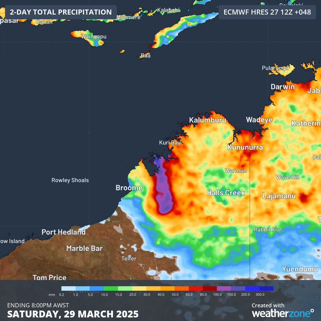
Image: Forecast accumulated rain on Friday and Saturday combined.
Gale force winds with damaging gusts are also a good chance as the system approaches and crosses the coast, more likely if it makes landfall as a tropical cyclone. If the system does become a tropical cyclone, it will be named Dianne.
Anyone in the Kimberley should keep a close eye on the latest tropical cyclone advisories and severe weather warnings in the coming days.