Khanun can cause catastrophe
Tropical Storm Khanun is over the East China Sea, currently about 600 nautical miles in diameter, and it is continuing to devastate with speeds of up to 55 knots as it continues its eastward trajectory directly over Okinawa, south of Japan.
At 1pm Saturday local time, Naha, the capital city of Okinawa with a population of over 319,000, recorded wind gusts of 127km/h.
Khanun, translating to “jackfruit” in Thai, adjusted its path and is heading directly east as of early Friday morning local time.
Whilst initially looking to weaken significantly, Khanun is now expected to maintain 55-knot wind speeds along its eastward path (85-knot wind gusts) at maximum, then reintensify again to potentially destructive 65-knot wind speeds (100-knot wind gusts) as it steers northward during Monday morning in its transition to an extratropical typhoon.

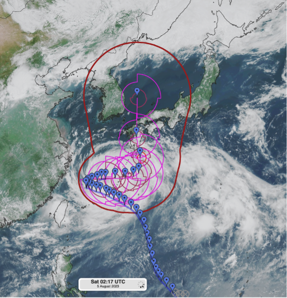
Figure: The path that Khanun is expected to follow, from the Joint Typhoon Warning Centre (JTWC).
Khanun is expected to make landfall at typoon status over the Amami Islands, north of Okinawa, during about Saturday 20:00 UTC. Moving north, it will briefly remain typhoon status until landfall on Japan’s southern-most island, Kyushu during Tuesday evening. From here, it will significantly weaken but still produces speeds of up to 50 knots, even as it re-emerges into the Sea of Japan.
The storm has already produced fatalities in Japan and left thousands of homes without power and cancelled flights in Okinawa and Taiwan. Cancellations and delays are likely to continue as it continues its plight towards southern Japan.

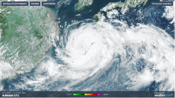
Figure: Typhoon Khanun from satellite imagery as at 4:00 UTC (13:00 local time).
The southern part of Korean Peninsula could cop some of these damaging 50-knot winds during Thursday morning, though by this stage the typhoon status will be long gone.

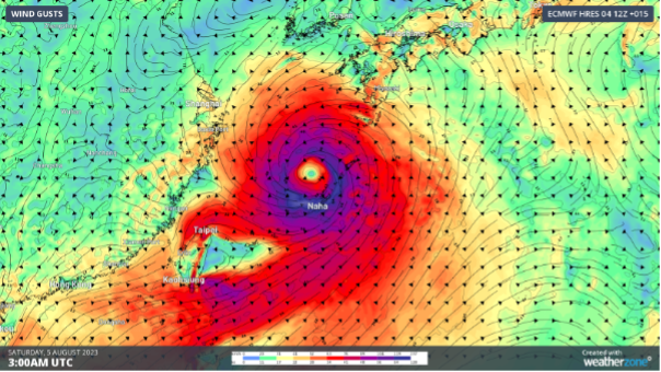
Figure: Wind gusts of Khanun as at 3:00 UTC (12:00 local time). Sustained winds up to 100 nautical miles from the eye are currently reaching 55 knots, with gusts around 85 knots.
For updates on tropical system activity, visit https://www.metoc.navy.mil/jtwc/jtwc.html.