Just when you thought Sydney weather couldn't get worse...
We all know it has been relentlessly wet in Sydney this year, but now it's turned surprisingly cold too.
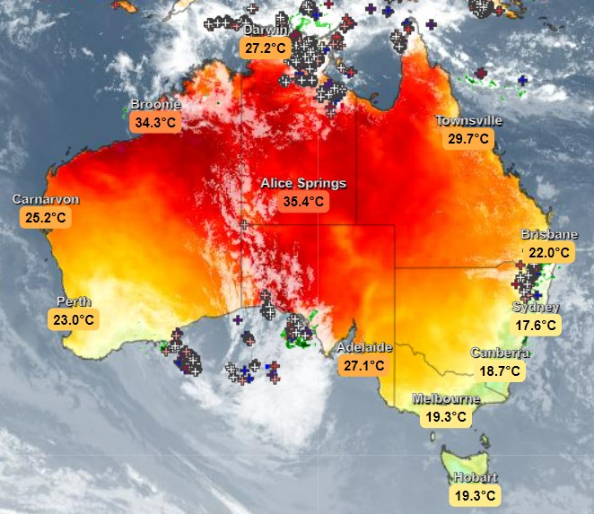
In fact, just after 4 pm as we started writing this story, the temp dropped to 17.6°C which made Sydney quite clearly the chilliest capital city in the country, as you can see on our live temp map below.

It's not too often that Sydney is Australia's coldest city at any given moment in time (the "coolest" city is another matter entirely, and we'll let you all argue about that one!)
But Sydney is currently under the influence of cool southerly and southeasterly winds, and while lunchtime temps climbed to 21.8°C after a mostly dry start to Wednesday, the mercury plummeted by around four degrees in mid-afternoon as a band of heavy showers moved in from offshore.
"When showers come though on a dry day, they also evaporate quite quickly," Weatherzone meteorologist Joel Pippard explains.
"Evaporation on a large scale needs a lot of energy (heat) so the surrounding environment can cool quite rapidly. This is called evaporative cooling."
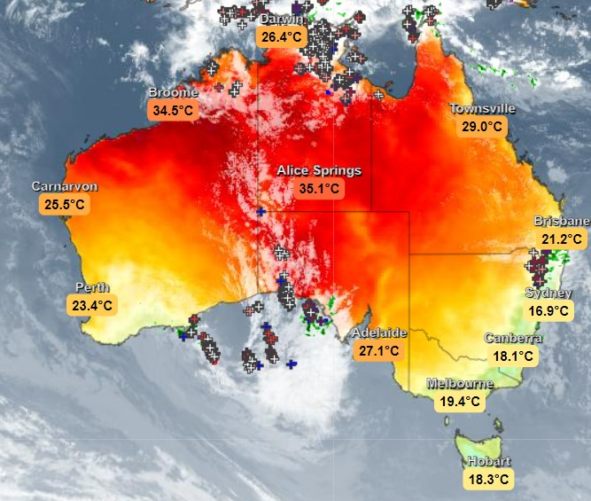
It cooled rapidly, all right. Indeed Sydney has lost nearly another degree in the 40 minutes it has taken to publish this story. Here are national temperatures just before 5 pm.

The good news for Sydney people who are sick of the sight of rain (with the city having already exceeded its annual average rainfall) is that the four days of the Easter break should be fine, as we told you earlier this week in our national Easter weather forecast.