Is El Nino on the horizon?
Some computer models suggest that El Niño could return next year, bringing an abrupt shift in one of our planet’s major climate drivers following three consecutive years of La Niña.
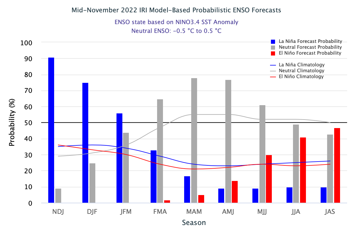
The graph below shows the most recent computer-based El Niño-Southern Oscillation (ENSO) outlook from the U.S. Climate Prediction Center (CPC) and Columbia University’s International Research Institute for Climate and Society (IRI).

Image: Model-based ENSO outlook for the next nine months. Source: CPC/IRI
The bars on the graph above represent the probability of La Niña (blue), El Niño (red) and neutral conditions (grey) occurring in the tropical Pacific Ocean during each of the next nine overlapping three-month periods.
The graph shows that La Niña has a 90 percent likelihood of remaining in place over the next three months. Neutral conditions then become more likely than La Niña from late in the Southern Hemisphere’s summer through until the middle of 2023.
Further into the future, this outlook suggests that El Niño becomes the most likely state for the Pacific Ocean late in the Southern Hemisphere’s winter in 2023. This is the first time in around three years that the monthly CPC/IRI outlook has favoured El Niño as the most likely category in the Pacific Ocean.
It is important to point out that the U.S. CPC and IRI use slightly more relaxed threshold than Australia’s Bureau of Meteorology for identifying La Niña and El Niño.
Also worth highlighting is that this outlook becomes less reliable the further it looks into the future, so predictions for the middle of next year should be treated with some caution. More reliable ENSO outlooks will become available early to mid-next year.