
Introducing "Hector the Convector"
Named weather systems are generally reserved for large, one-off systems that have the potential to bring significant impacts to a large area, such as cyclones or winter storms over northeast America. There are some exceptions to this though. One of which resides in Australia. Introducing a thunderstorm named Hector, also known as "Hector the Convector".
So why does Hector have a name if it is "just" a thunderstorm? In short it is due to his consistency. Hector frequents the Tiwi Islands, roughly 100km north of Darwin, at around 3pm each day between September and December, also known the build-up season. Hector also makes an appearance during the wet season (January to April), but only when the monsoon is inactive.
It is now that time of the year were Hector makes his daily visits to the Tiwi Islands as seen in the satellite imagery below from Saturday.
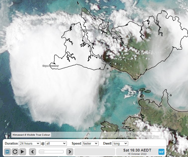
Image: Right on cue. Hector springs to life. Source: Himawari-8 satellite
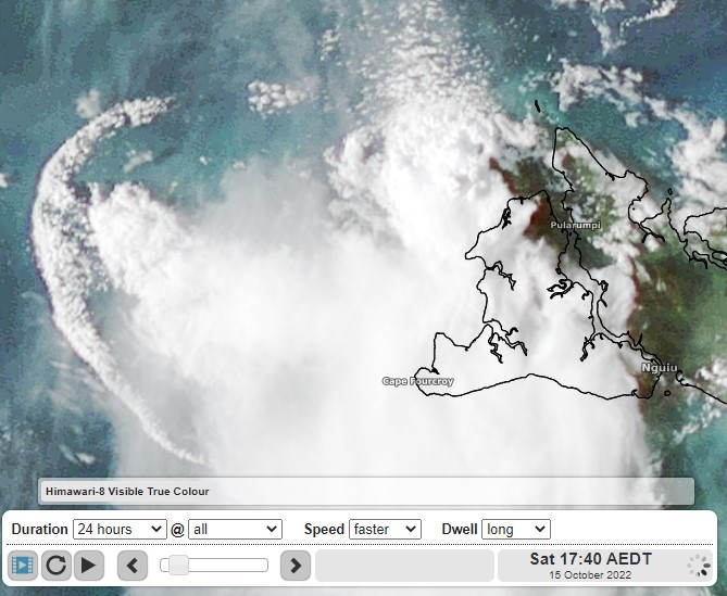
Image: Outflow cloud formation (left of image) from Hector. Source: Himawari-8 satellite
Hector's consistency is due to the several factors. The topography on the two main Tiwi Islands – Bathurst Island and Melville Island – plays a significant role. As these moisture laden sea breezes converge, they are forced upwards, through the atmosphere, where they cool and condense, forming clouds. This convection can be so vigorous that clouds reach up to 20km above sea level, making it visible from Darwin.