Intense thunderstorms in NSW heading north for the weekend
The area of most intense thunderstorms in New South Wales is travelling north with the movement of an active low-pressure trough.
On Saturday afternoon, storms were responsible for flash flooding, strong winds and hail.
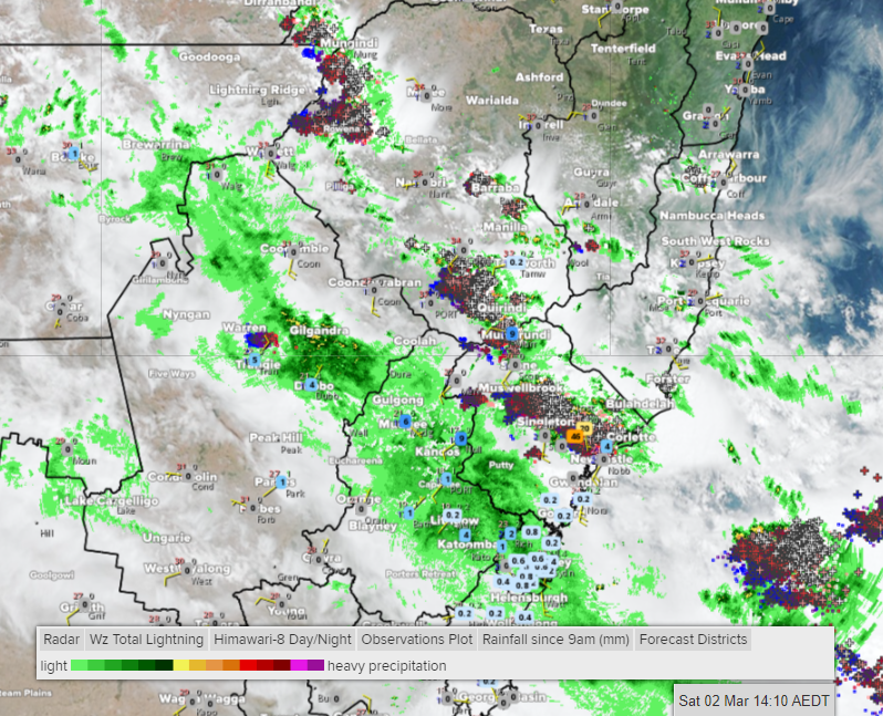
Early in the afternoon, storms had focussed on the Hunter area, producing downpours of 45 millimetres in Maitland, 30mm in Elderslie and 23mm in Tocal, all in just 30 minutes.
Maitland gained 49mm up until 4pm, its biggest daily rainfall in 12 months and a 3-year high for March.

Image: Lightning strikes, radar, satellite and rainfall observations up until 2:10pm EDT Saturday.
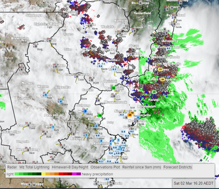
Later in the afternoon, the area of the biggest storms had moved to the Mid North Coast and Northern Rivers where Lowanna (inland of Coffs Harbour) copped 47mm of rain in about 45 minutes.
By about 4:30pm, some of the more populated centres nearer the coast had also gained more than 20mm in quick time, leading to flash flooding. Rainfall had amounted to 28mm at Port Macquarie and 26mm at Kempsey.

Image: Lightning strikes, radar, satellite and rainfall observations up until 4:20pm EDT Saturday.
The offending trough will continue to benefit from higher-than-normal humidity as it causes fresh storms further north, most intense about the slopes, ranges and coast.
On Sunday, storms in NSW are expected to be focussed on Mid North Coast, Northern Rivers, Northern Tablelands and the nearby western slopes.
Keep an eye on related warnings at https://www.weatherzone.com.au/warnings
Meanwhile, central and southern NSW are drying out as cooler southerly winds flow through the region in the wake of the trough.