Intense rain, serious flooding in Wollongong
Wollongong, just south of Sydney, is at the epicentre of dangerous NSW weather on Thursday, with extremely heavy rain leading to flash-flooding and treacherous road conditions across the city.
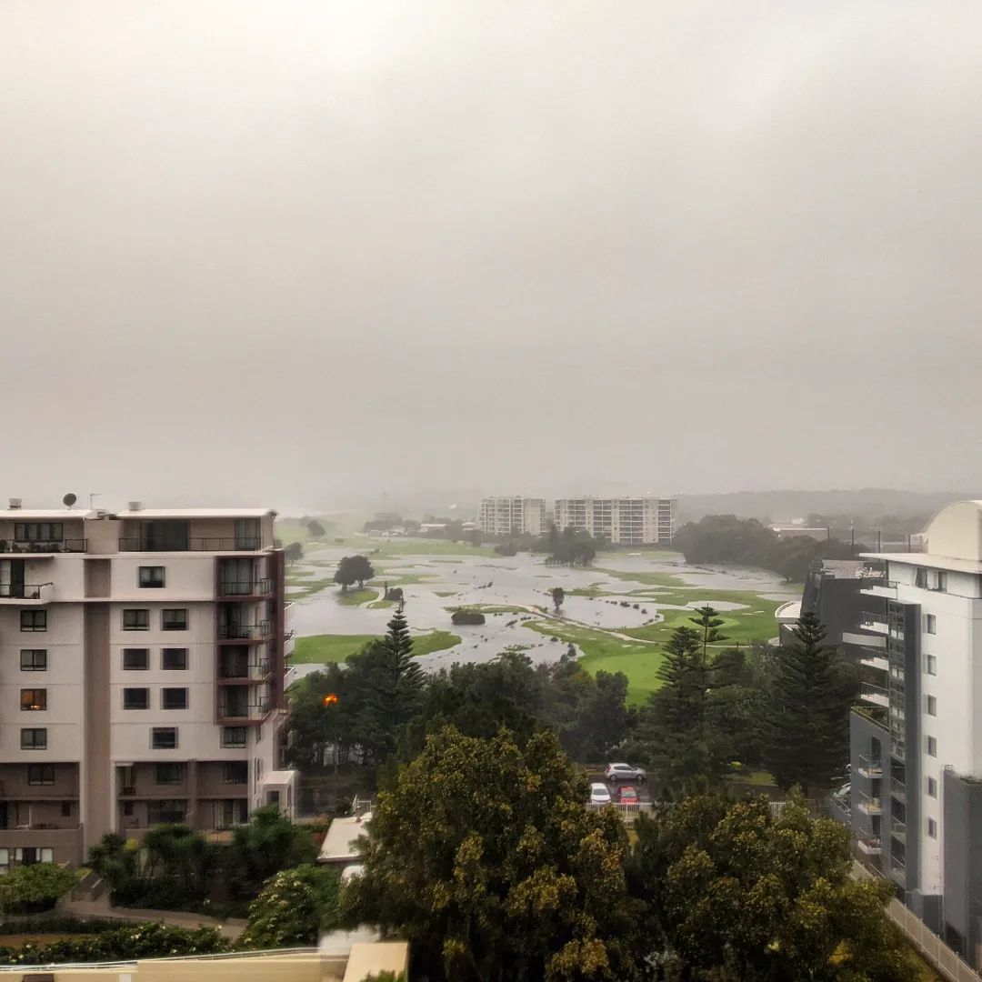
The city sits on a narrow strip of land wedged between a cliff-lined coastal escarpment and the ocean, and heavy overnight and morning rain has inundated low-lying parts of the city.
Don’t drive through flood waters. A couple of Dapto locals had to push their car out and another wasn’t as lucky. pic.twitter.com/AiNUsJVjWQ
— Ainslie DrewittSmith (@AinslieClaire) April 6, 2022
Some of the rainfall totals in the local area include:
- Darkes Forest (a location just NW of Wollongong) with 207 mm, which was the heaviest in NSW.
- Mt Pleasant (an elevated suburb familiar to motorists coming via Sydney): 128.5 mm in the 6 hours to 10:30 am.
- Rixons Pass (a weather station near Woonona in Wollongong's northern suburbs: 113 mm in 6 hours to 10:30 am
The situation is being fuelled by a stream of moisture-laden air feeding into a coastal trough, helped along by a strong upper level trough and embedded low sitting inland.
As we told you yesterday, this weather pattern is near stationary and is being enhanced by a slow-moving upper-level pool of cold air sitting about five to six kilometres above the ground.

Image: Great weather for ducks but not for birdies. Source: @doctorgiann via Instagram.
This is day two of what will likely be three-to-four days of persistent heavy rain with the chance of thunderstorms.
Just before 11 am Thursday, the Bureau of Meteorology issued a Severe Weather Warning for heavy rainfall for the Sydney Metropolitan area, Illawarra, South Coast and parts of Hunter, Central Tablelands and Southern Tablelands Forecast Districts.
Homes in Fairy Meadow at Carter’s lane inundated .. won’t find me at uni today #nswrain #wollongong pic.twitter.com/0kKxz5tmU3
— Noah Murphy (@noahmurrphy) April 7, 2022
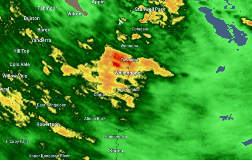
The warning makes specifies mention of "intense rainfall rates possible around the Illawarra coastal areas associated with thunderstorm activity" and as we write this story, Wollongong is indeed copping extremely heavy rain as you can see on the radar image below taken just before midday.

Road closures are currently in place across the city, and the best place to keep up to date with the latest is here at the Wollongong City Council website.
Areas slightly further afield are also in line for flooding and heavy rain this afternoon, as the heavy showers move inland to the Southern Tablelands and Central Tablelands.
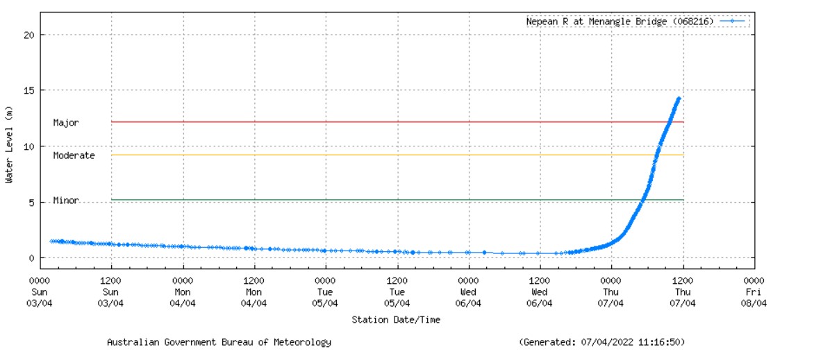
Meanwhile the Nepean River – which begins its life just west of the Wollongong escarpment before flowing northwards around Sydney’s western fringe – is already experiencing major flooding.

Source: BoM.
Please keep checking our warnings page here for updated information, and check the NSW SES site for the latest evacuation orders.