
Intense low set to barrel down the east coast
An intense low pressure system has developed off the Southeast Queensland coast and will traverse southwards over the coming days.
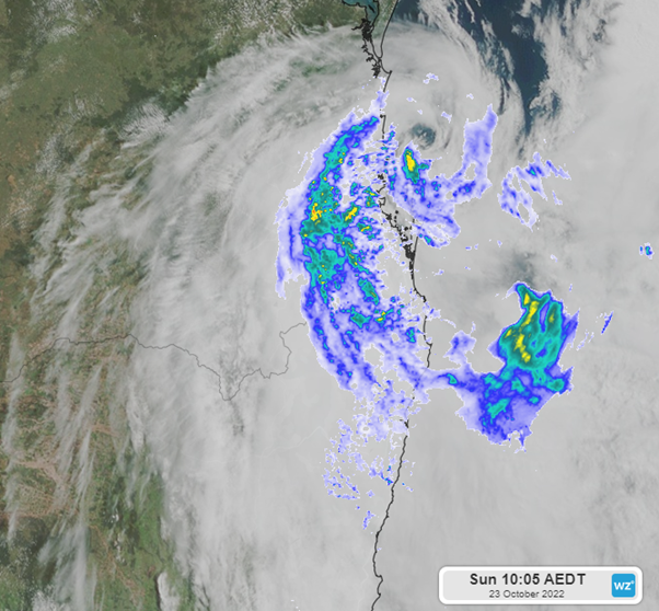
Figure 1: A satellite (Himawari-8) and radar image of a low pressure system off the SE QLD Coast.
As the system moves along the coast of New South Wales it will continue to bring widespread rainfall and thunderstorms to much of eastern Australia, before finally reaching the southern reaches of Tasmania on Friday.
Rainfall totals around the northern parts of New South Wales over the next few days could reach between 140-200mm.
As the system reaches the southeast coast of New South Wales rainfalls will continue to be significant with a possibility of accumulated falls of 40mm to 160 mm over a 3-day period, with the heaviest falls likely to be along the coast. Victoria will not escape the heavy falls with potential rainfall totals between 50mm and 150 mm later in the week.
Continuing down to Tasmania we will also see some significant rain where totals may reach between 40mm and 150 mm.
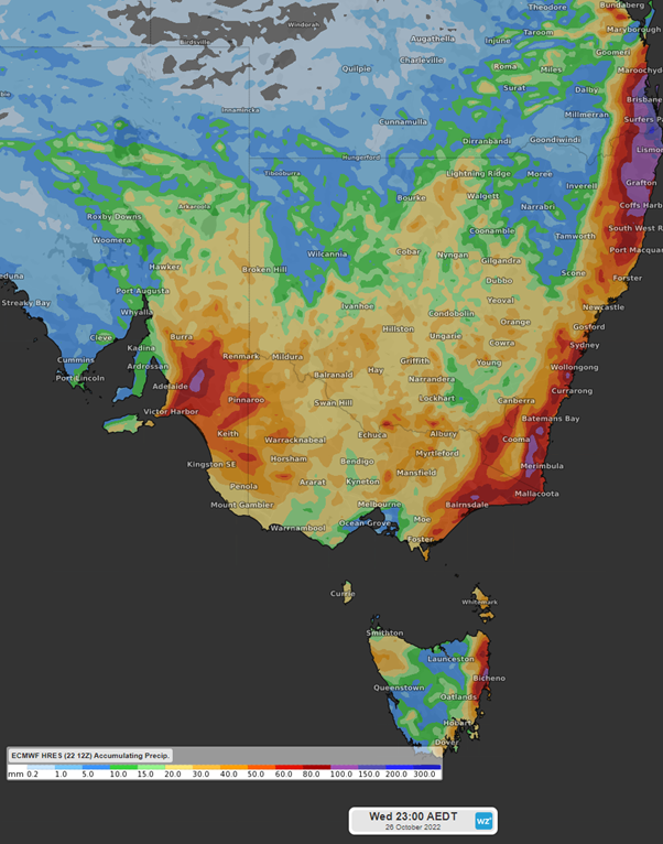
Figure 2: Accumulated rainfall totals to 11pm AEST Wednesday 26th October 2022, ECMWF
Rainfall is expected to exacerbate currently flooded areas.
Rain is not the only severe weather expected to travel with the low pressure system. Significant wave heights in excess of 4-5m are possible, and exposed coastal areas may see wind gusts in excess of 80 km/h.
A high pressure system is expected to establish late Friday and early Saturday over New South Wales, bringing some respite before another low pressure system moves across southeast Australia early next week.