Ida's march: U.S. Gulf Coast bracing for potential major hurricane landfall
Residents in several Gulf Coast states are being told to closely monitor the development of Tropical Storm Ida, which could make landfall as a life-threatening major hurricane on Sunday or Monday.
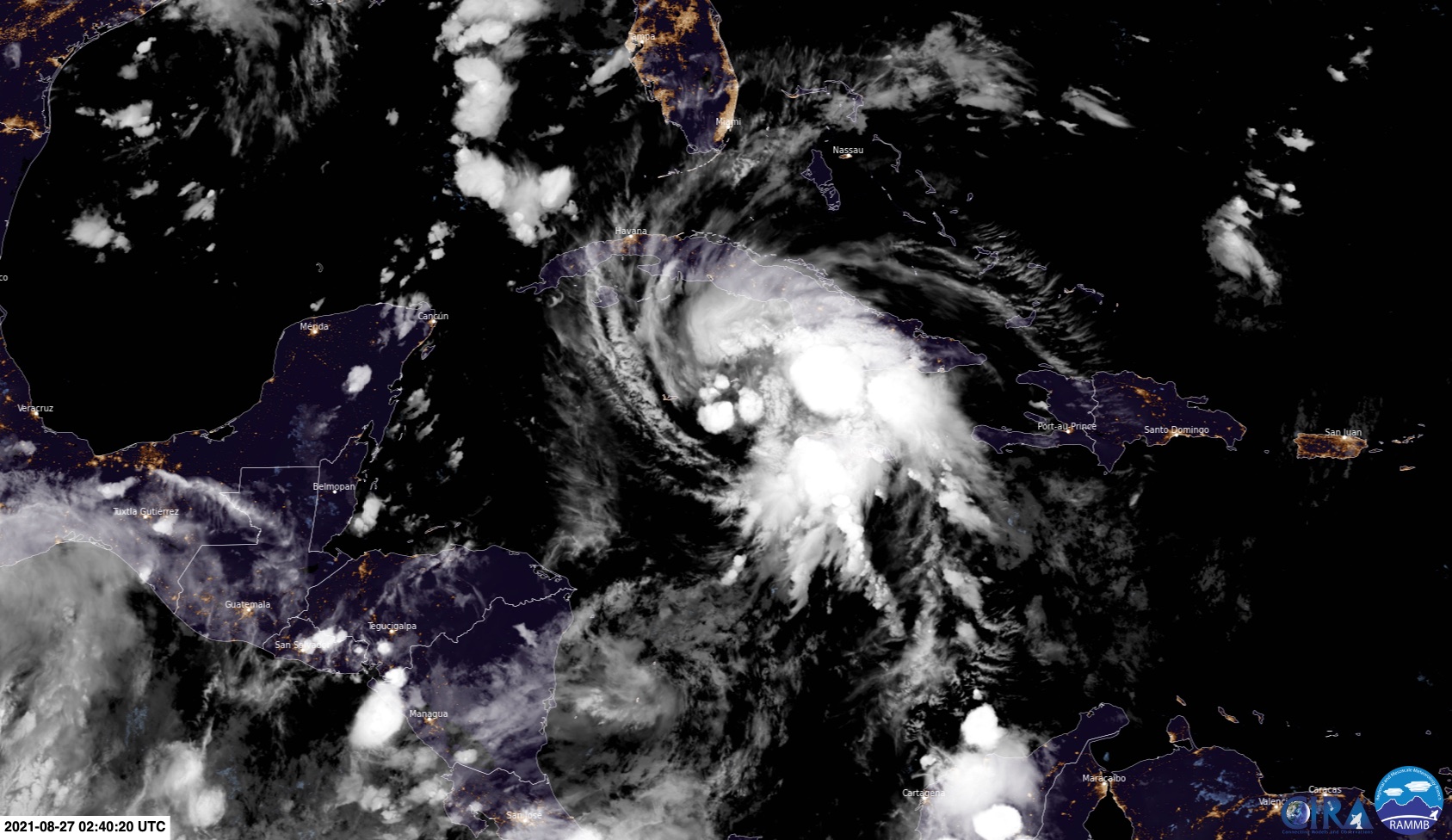
Ida became a tropical storm late on Thursday afternoon when it was passing to the west of Jamaica. The system is now moving towards the northwest and is expected to steadily gain strength during the next 24 hours.

Image: Satellite image of Tropical Storm Ida near Jamaica on Thursday night. Source: RAMMB/CIRA
On this track, Ida should pass near or over the Cayman Islands during Thursday night and western Cuba on Friday, before entering the Gulf of Mexico on Friday night or Saturday morning.
Heavy rain, mudslides, damaging winds and a storm surge are all likely impacts for parts of Jamaica, the Cayman Islands and western Cuba during the next 24-36 hours.

Image: Official NHC forecast track map for Tropical Storm Ida, issued at 8 pm U.S. Eastern Daylight Time on Thursday. Latest track map available here.
Once Ida reaches the warm waters in the Gulf of Mexico, it is likely to rapidly gain strength during the weekend.
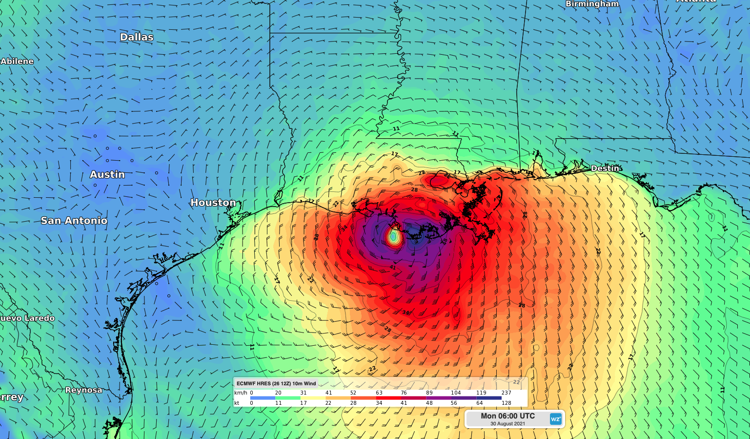
There is growing consensus between forecast models that Ida could build into a major hurricane as it traverses the Gulf of Mexico before slamming into the U.S. Gulf Coast at some point on Sunday or Monday.

Image: Forecast wind speed and direction from one computer model (ECMWF-HRES model) showing Ida hitting the coast of Louisiana on Sunday night.
While there is still a lot of uncertainty around the future development and movement of Ida, coastal areas between the Florida Panhandle and Texas have the potential to see major hurricane impacts in a few days' time.
Meanwhile, another tropical storm named Nora is expected to strengthen into a hurricane near the southwest coast of Mexico this weekend.
You can find the latest information about Tropical Storms Ida and Nora on the U.S. National Hurricane Centre’s website.