
Hurricane Helene to intensify rapidly before Florida landfall
Soon-to-be Hurricane Helene is expected to rapidly intensify over the Gulf of Mexico on Thursday before slamming into Florida’s Gulf Coast, where it will cause a dangerous mix of heavy rain, destructive winds and a life-threatening storm surge.
At 10:00 pm CDT on Tuesday, September 24, Helene was a tropical storm (below hurricane strength) located over the Caribbean Sea roughly 230 km to the south-southwest of the western tip of Cuba.
Video: Visible satellite images showing Tropical Storm Helene over the Caribbean Sea on Tuesday, September b24, 2024. Source: CSU/CIRA & NOAA
The system is expected to move towards the northwest on Tuesday night before passing near the northeast coast of the Yucatán Peninsula on Wednesday.
Helene should then head north and track over the Gulf of Mexico on Wednesday and Thursday before reaching the Big Bend region of Florida, where it is expected to make landfall late on Thursday.
While Helene was only a Tropical Storm on Tuesday evening, it is likely to strengthen significantly before making landfall on Thursday night.
Helene will pass through an environment that is very favourable for hurricane intensification as it traverses the Gulf of Mexico on Wednesday and Thursday. A combination of very warm sea surface temperatures, weak vertical wind shear and ample outflow in its upper levels should allow Helene to become a major hurricane before landfall.
Sea surface temperatures above 26.5°C are warm enough to support hurricane development, while temperatures above 30°C can cause rapid intensification. The average sea surface temperature in the Gulf of Mexico is currently 30.5°C, which is the warmest on record for this time of year.
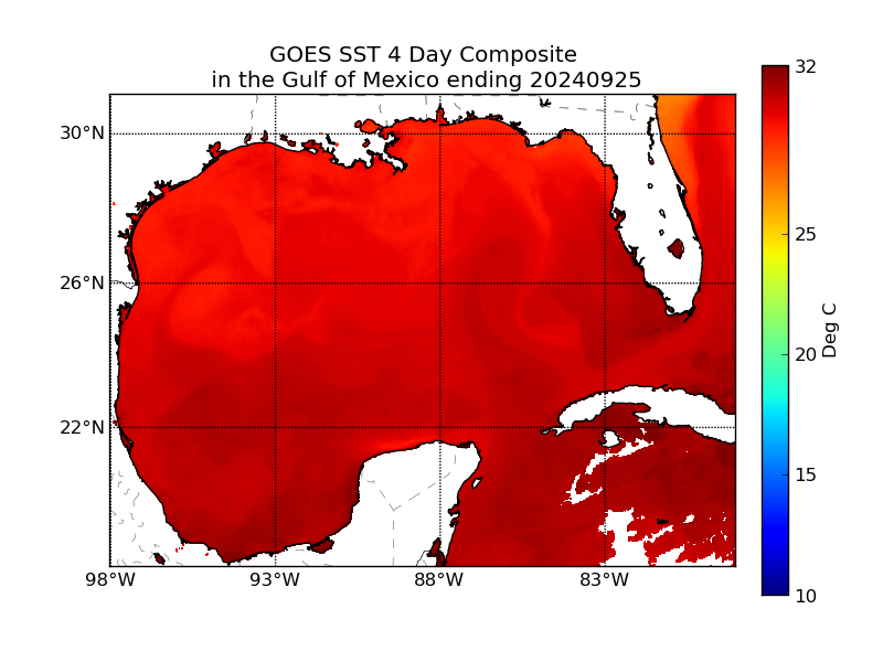
Image: 4-day average sea surface temperatures in the Gulf of Mexico, showing widespread temperatures over 30°C. Source: NOAA
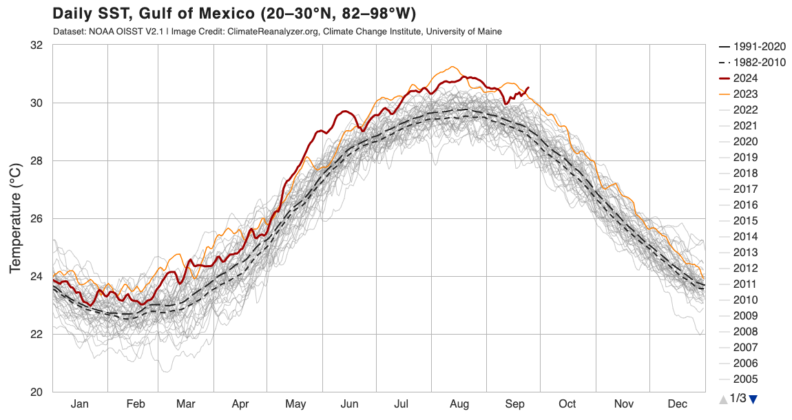
Image: daily sea surface temperature in the Gulf of Mexico, showing that the current value of 30.5°C is a record for this time of year. Source: ClimateReanlayzer.org
Another notable aspect of Helene is its anticipated size. According to NOAA, “Helene's forecast radii are at the 90th percentile of major hurricane size at similar latitudes, and therefore storm surge, wind, and rainfall impacts will likely extend well away from the center and outside the forecast cone, particularly on the east side.”
The image below shows the most likely future path and strength of Helene over the next three days.
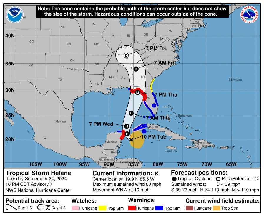
Image: Forecast cone and coastal watches/warnings for Tropical Storm Helene, issued at 10pm CDT on Tuesday, September 24, 2024. Source: NOAA/NHC
Visit the National Hurricane Center website for the latest forecasts, watches and warnings relating to Helene over the next few days.