
Huge temperature drop in southeast Aus
Snow has fallen in Tasmania with some brief very light falls on the alpine areas of the mainland as a strong October cold front swept through southeast Australia on Monday night into Tuesday morning.
Spring is a season notable for its dramatic day-to-day temperature contrasts and that has definitely been the case in the last 24 hours, with Monday’s summery conditions transitioning to wintry weather on Tuesday morning across much of southeastern Australia.
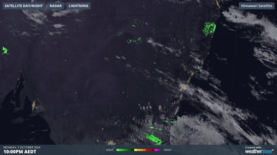
Image: The two-hour loop to midnight shows small amounts of moisture associated with the cold front in eastern Victoria while cloud sneaks up the NSW coast towards Sydney.
- Sydney reached 29.6°C on Monday with a maximum of 31°C recorded at Sydney Airport. Both locations can expect tops a degree or two below 20°C this Tuesday.
- Canberra got up to 22.5°C on Monday for the public holiday but is only expected to reach 16°C this Tuesday, and there is the chance of frosts in coming mornings as overnight temps dip near zero in the dry cool airmass.
- Melbourne is in for a chilly one this Tuesday, with a high of just 14°C expected. That comes after a maximum of 18°C on Monday which was preceded by a run of four days with tops exceeding 20°C – including a spring 2024 season high (to date) of 26.1°C last Thursday.
- The cooler air won't work its way up to Brisbane until Wednesday, and the interaction between the current warm airmass (which has caused a four-day run of top temps near or above 30°C) will likely cause thunderstorms, on Tuesday evening into Wednesday. Those storms could potentially be severe.
Meanwhile in the highest parts of Tasmania and the mainland, some seriously chilly overnight temps were recorded to 9am Tuesday, including –6.1°C at Mt Hotham and –4°C at kunanyi/Mt Wellington above Hobart, where a light dusting of snow was visible on Tuesday morning as conditions cleared.
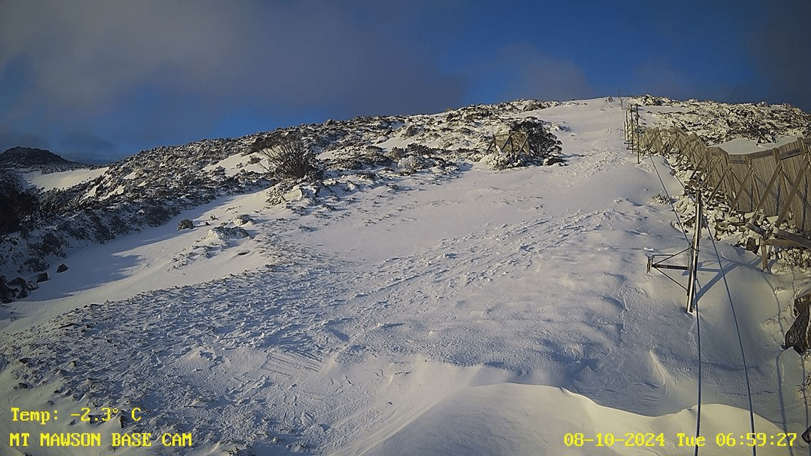
Image: The snow report for the volunteer-run ski club at Mt Mawson, about 90 minutes NW of Hobart, says that the snow depth on higher parts is still 65 cm after several substantial spring snowfalls. Source: Mt Mawson.