
Huge hail, one million lightning strikes on wild stormy night
There were dramatic scenes across southeast Queensland and northeast New South Wales on Tuesday afternoon and evening, as massive storms ripped through the area, unleashing more than a million lightning strikes.
Heavy rain fell over a short time-frame, with large hailstones also reported in many places. Some of the noteworthy observations included:
WIND
- A 90 km/h wind gust was recorded during a storm at Thangool Airport at 5:04pm
RAIN
- The wettest place anywhere in Australia in the 24 hours to 9 am Wednesday was Tuckombil (just east of Lismore) with 173mm
- 113.4 mm fell at Brisbane Airport, which was one of several places to top 100 mm in SE Qld
- 73mm in 1 hour at Rosalie
- 63mm in 1 hour at Brisbane City
- 58mm in 30 minutes at Mt Rawdon Alert
- 54mm in 1 hour at Mount Tamborine
- 46mm in 30 minutes (62 mm in 1 hour) at Mt Coot-tha
The above places and many other spots in Queensland's southeast corner saw their heaviest single-day rainfall since this time last year, when many regions were drenched by as much as 1000 mm in the month.
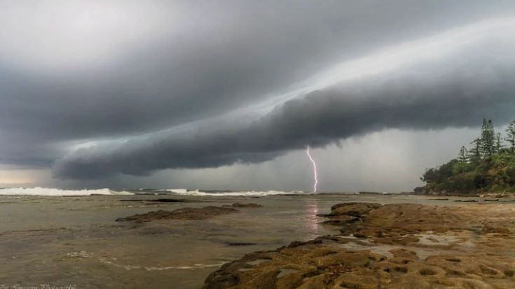
Image: Shelf cloud. Source: @wontuloveit via Instagram.
HAIL
- 4-5 cm hailstones were observed at Kingsthorpe
- Even larger stones were recorded at Stanthorpe and the Granite Belt, with one long-time local describing them as the biggest he had seen

Image: Hail always seems to be measured in terms of round objects, and this Stanthorpe hailstone is definitely more in the tennis ball range than your typical pea or marble. Source: @momake_models via Instagram.
LIGHTNING
- As mentioned, there were more than a million strikes, with 1.01 million strikes recorded within a 500km radius of Dalby, a couple of hours west of Brisbane
- Over 100,000 of those lightning strikes reached the ground
Here are the maps showing the areas where the heaviest rain fell to 9 am Wednesday. On both maps, red dots equal 100 mm or more.
SE Qld
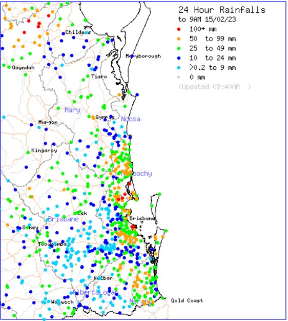
Source: BoM.
NE NSW
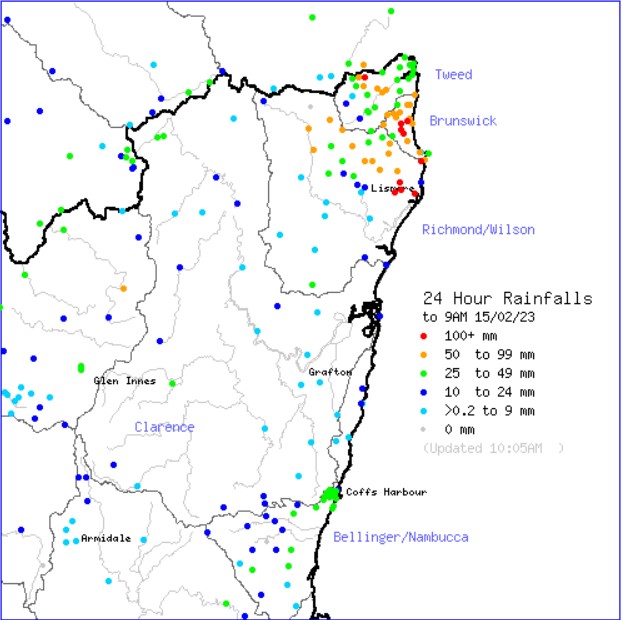
Source: BoM.
Tuesday's spectacular storms were caused by a cool southerly change colliding with the hot and humid airmass which was responsible for the southeast Qld heatwave over the last few days.
An upper trough also brought cool and dry air aloft over the region, which provided the perfect ingredients for giant hail to form.
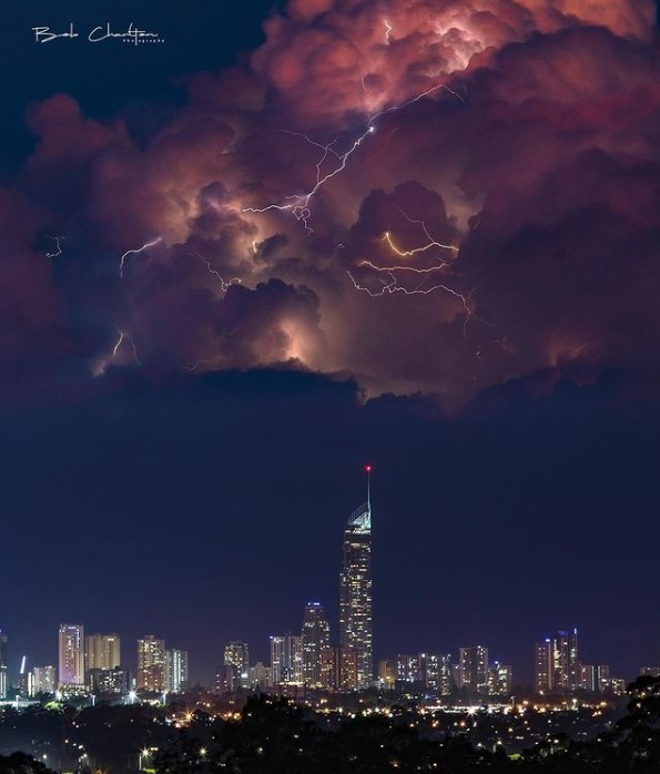
Meanwhile this incredible image of the Gold Coast skyline was taken around 9 pm on the Gold Coast by local photographer Bob Charlton.
Bob and other weather photographers won't have much to get excited about in the next week in southeast Qld and northeast NSW, with a week-long spell of warm, mostly fine weather on its way.