
How Storm Boris became 'the perfect storm'
At least six countries have seen devastating flooding, with 22 people dead at latest count, after Storm Boris delivered exceptionally heavy rain to the central and eastern European nations of Poland, Austria, Hungary, Romania, Slovakia and the Czech Republic.
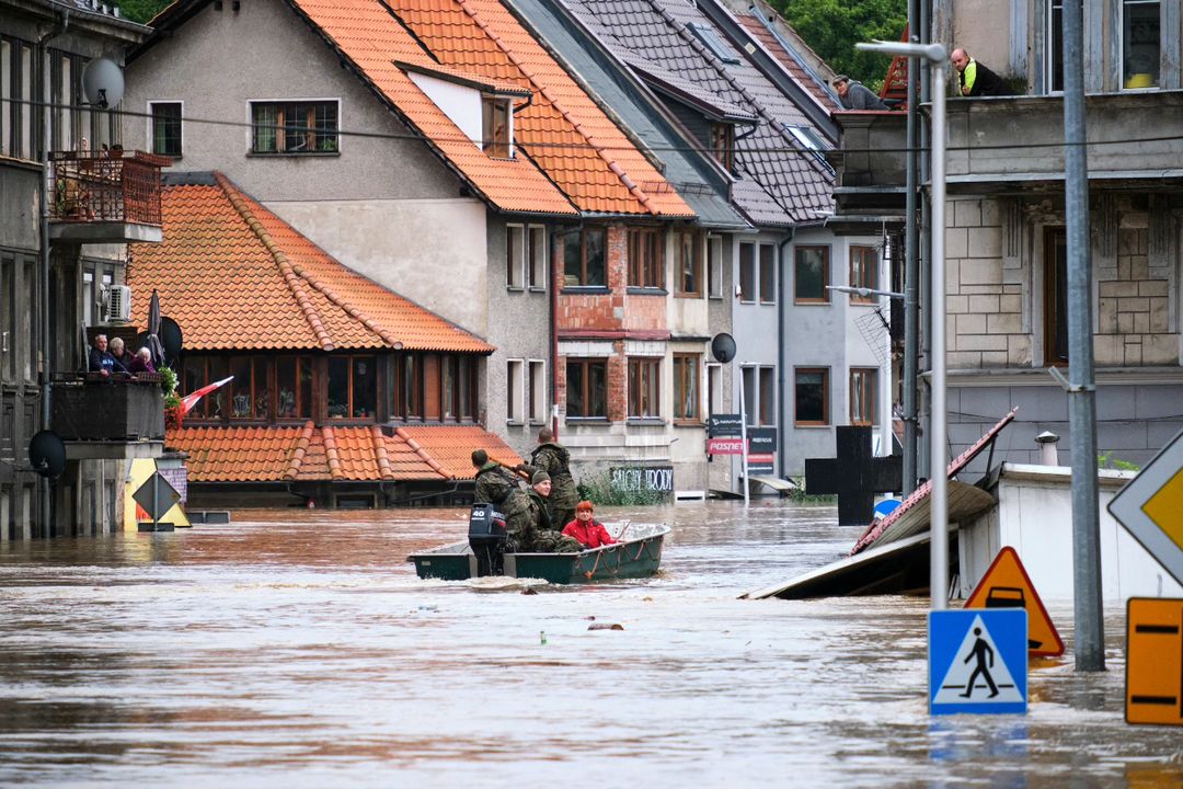
Image: Flooding in Klodzo, a large town with a population of 27,000 in SW Poland. Source: Monika Kwiecien on Instagram: @kwiecien_monikaa.
European meteorological bodies name all severe extratropical cyclones (unlike here in Australia where only tropical cyclones are named) and Boris delivered over 300 mm of rain across a wide region.
That equated to more than three months of rainfall within about three days in most of the areas affected, and the damage was both extreme and extensive.
K?odzko, Poland.
— Met4Cast. (@Met4CastUK) September 16, 2024
Street view image before yesterday’s flood and a photo taken today of the aftermath. Devastating. pic.twitter.com/AgG1GJhm3E
But why was Boris so severe?
Let's break this system down into five key components that turned this intense low pressure system into what you might call the perfect storm:
- A strong cold front extending as far south as the Mediterranean formed a cut-off low, cradled between two high pressure systems over western Russia and the Sahara in northern Africa.
- Fuelled by the extremely warm Mediterranean and Black Seas (where surface temps at the end of the European summer were in the mid-to-high 20s celsius), moist air circulated towards central and eastern Europe.
- Around Austria and the Czech Republic, the warm moist air met up with very cold air and the natural barrier of the Alps, causing the heavy, prolonged rainfall.
- Storm Boris has also been a very slow-moving low pressure system generating powerful winds in addition to heavy rain.
- Experts say that human-caused climate change is likely a factor underpinning the storm's intensity, as a warmer atmosphere can carry more moisture. For every 1°C rise in the global average temperature, the atmosphere can hold about 7% more moisture.
All of these factors made Storm Boris one of the most extreme European weather events in decades.
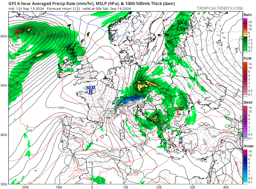
Image: European weather map showing heavy precipitation over central Europe last weekend. Source: Tropical Tidbits.
And the danger is far from over. Storm Boris has delivered the two main types of flooding to a wide area: flash floods and riverine flooding.
We all saw the incredibly frightening footage of flash floods ripping through European towns and cities.
Vienna in Austria this morning ????pic.twitter.com/DIOOsCdhCH
— Volcaholic ???? (@volcaholic1) September 15, 2024
Now those swollen rivers are sending their water downstream. Poland in particular is bracing for further flooding as rivers slowly spill their banks, inundating low-lying areas.
Poland takes its name from "pole" – the Polish word for "plain" or "field", which tells you all you need to know about the flood-prone nature of large parts of that country.
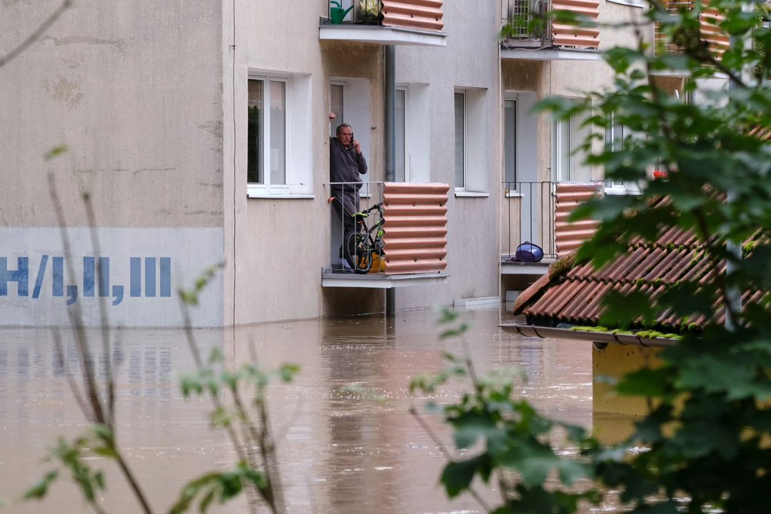
Image: Second-floor balconies were only just safe in the Polish town of Klodzo. Source: Monika Kwiecien on Instagram: @kwiecien_monikaa.
Northern Italy is also likely to see flooding due to a combination of rivers flowing from badly affected areas, as well as further rainfall in coming days.
EUROPE FLOODS
— BBC Weather (@bbcweather) September 17, 2024
Attention now turns to Italy for the risk of flooding from storms.
Parts of the Emilio-Romagna and Marche regions could see up to two months worth of rain fall in just three days. RED warnings have been issued for Wednesday.
Floods latest: https://t.co/fDdXR0v4u3 pic.twitter.com/RmtTYVoz1r