
Hot and stormy Brisbane
November 2022 has been a generally drier and cooler than average month in Brisbane. So far this month, the city has only seen 11.8mm rain (far from the monthly average of 95.7mm), and only two days with maximum temperatures above 30ºC.
The next two days in Brisbane are about to disturb the relatively calm weather that the city has had during most of November. From tomorrow, Sunday 20th, a trough may bring a burst of heavy showers, storms and hot weather to the city. As the trough makes its way to eastern Qld, humid northwesterly winds ahead of it will drag in a significant amount of tropical moisture that will fuel storms in the afternoon and evening, some potentially severe. Temperatures will soar to about 33ºC, making Sunday a muggy end to the weekend.
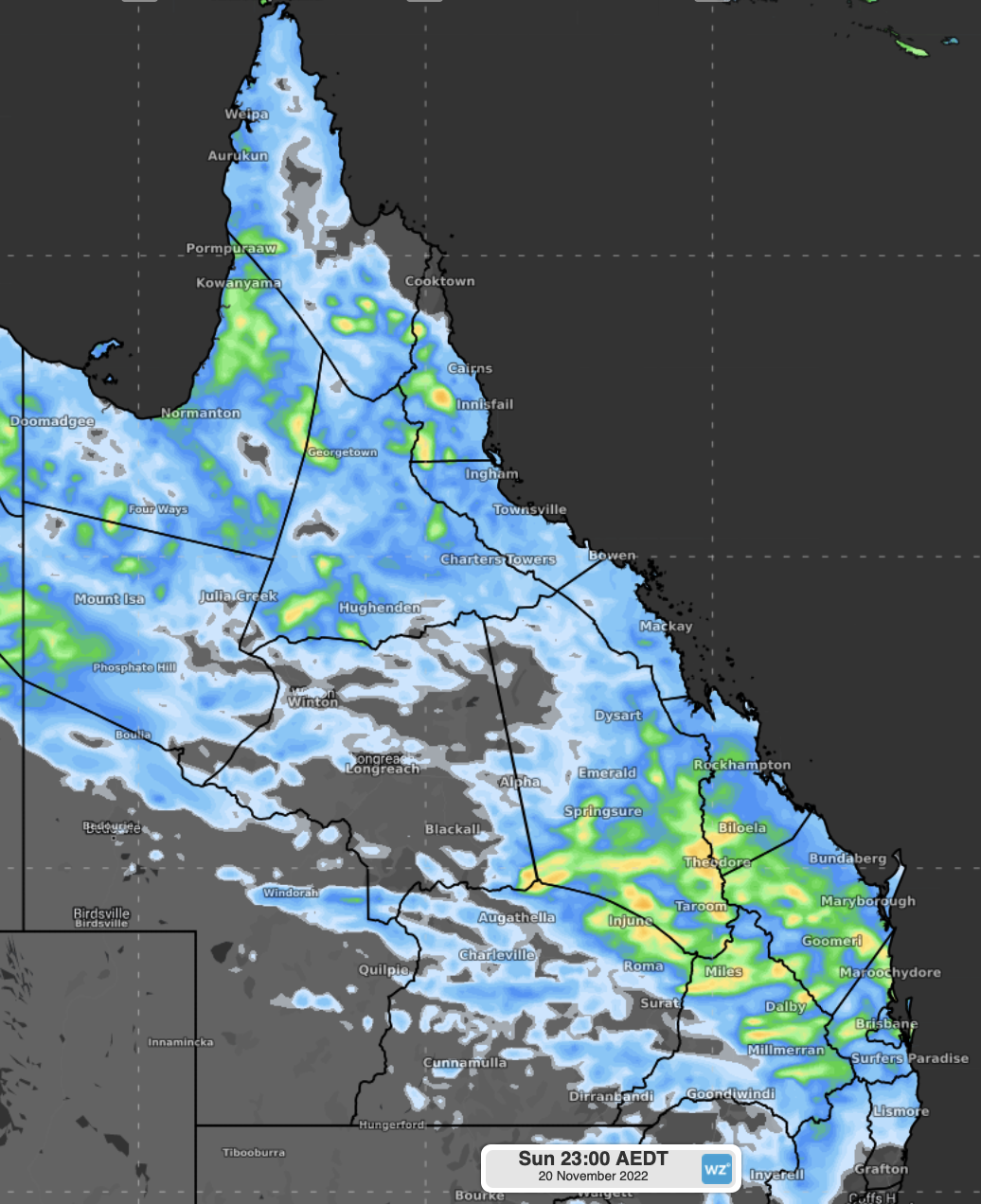
Fig. 1. 24h Accumulated rainfall to Sunday 20th 11p.m. AEST.
Although showers and storms will ease later on Sunday in Brisbane, a hot airmass with a trough to the north will linger over the area. While a wet and stormy Monday is a significant chance for locations to the north of about Bundaberg, mostly clear skies and hot westerly winds in Brisbane are set to elevate the thermometer to near the mid-thirties, possibly making Monday the hottest day of November 2022.
We wrote a few days ago here about the contrasting mix of late-spring weather that took place this week in Australia, with a 50ºC temperature difference between the southeast (VIC) and the Kimberley. This week ahead (although not as significant as the temperature range registered a few days ago) the hot days in Brisbane will definitely contrast with the wintry weather (low teens) the south and southeast of the country will experience in the coming days due to wintry troughs and cold fronts moving across the region.
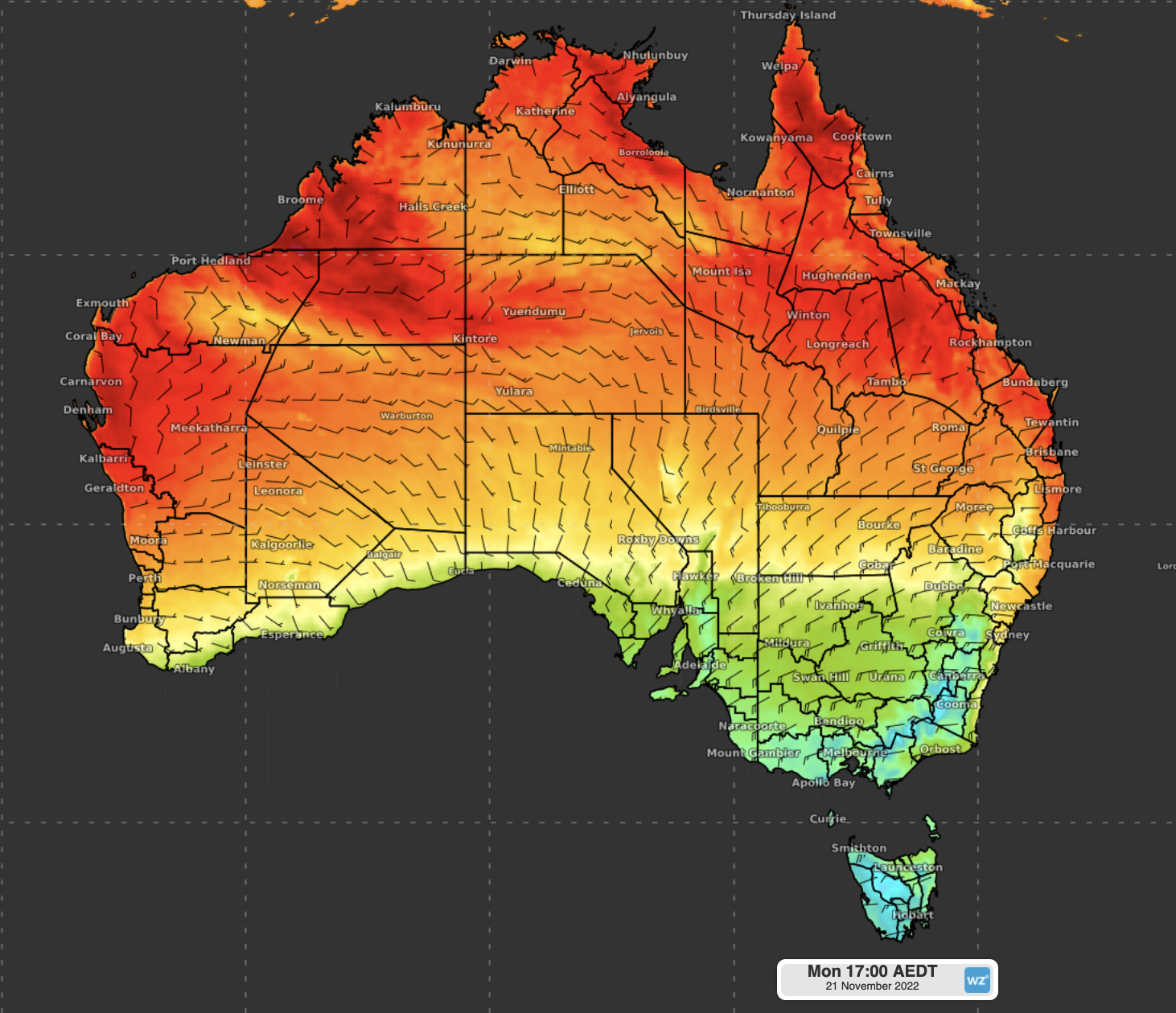
Fig. 2. Maximum temperature and 2m winds, Monday 21st.