Hosing down out the back o' Bourke
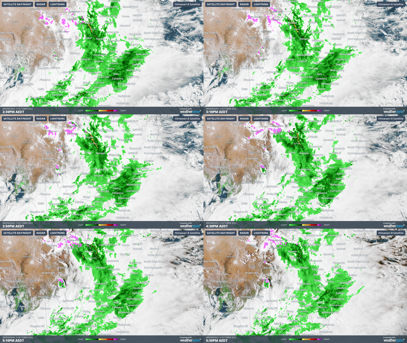
On a very wet day in most of eastern Australia, some of the heaviest rain is falling in areas that are normally the driest, most notably the northwest corner of New South Wales.
Storms passed through the area this morning, and early this afternoon, leaving behind 39.2 mm of rain in Bourke.
- Bourke's average monthly rainfall for October is 26.3 mm, so that went out the window within a few hours. And with more rain on the way today, this looks pretty likely to be Bourke’s wettest October day on record (the old record is 49.8 mm).
- Even further west, the tiny map speck of White Cliffs (population 150) copped a double drenching, with 30.2 mm in late morning storms on the back of 28.6 mm overnight.
The radar in the area is pretty intense as we write this story late on Wednesday afternoon, with thunderstorms generating almost 300,000 lightning strikes within a 400 km radius of White Cliffs between 5am and 5pm today.

According to Weatherzone meteorologist James Rout, this situation is far from over with plenty more rain likely in far-flung parts of the country.
"A number of low pressure troughs are crossing southeast AUS, and the negative IOD and La Niña are providing abundant moisture.
"There's also a large high pressure ridge extending over the Tasman Sea which seems to be slowing down the eastward progress of the systems, allowing more time for rain to fall."
Just after 3 pm on Wednesday, the Bureau of Meteorology issued a Severe Weather Warning for heavy rainfall in for parts of the Central West Slopes and Plains, Lower Western and Upper Western forecast districts. The towns we've just been talking about are in those areas.
Meanwhile the flood warnings continue to be escalated with a major flood warning in effect for the Darling River. We'll no doubt have news and pictures of the serious situation developing in western and central NSW by Thursday morning.
In the meantime, please keep checking our warnings page and never drive over flooded roads.