
Hobart's rare winter 21 degrees as storms brew over Tassie
Tasmania is having a spring-like day, with Hobart hitting 21ºC as thunderstorms start to build over the state.
Northerly winds are carrying warm and relatively humid air over Tasmania today ahead of an approaching cold front.
Amid this pre-frontal northerly flow, Hobart reached 20ºC shortly after 1pm and hit 21ºC just after 2pm. While this isn’t exceptionally warm by spring or summer standards, it is only the 18th time the city has reached 21ºC during winter since records began in 1882. This is around 8ºC above Hobart’s long-term August average maximum temperature of 13.1ºC.
Elsewhere in Tasmania, Strahan registered its warmest August day in records dating back to 1971 after reaching 22.5ºC early on Monday afternoon.
Surprisingly, Hobart’s maximum temperature on Monday was about 3ºC higher than Melbourne’s due to cloud and thunderstorms passing over Victoria.
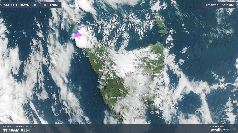
Some of these storms will spread over parts of Tasmania on Monday afternoon and evening, with lightning possible around Hobart. The map below shows the storms beginning to move over northwest Tasmania early on Monday afternoon.
The cold front will pass over Tasmania on Tuesday, reaching Hobart in the afternoon, dropping temperatures by sevaral degrees. Hobart is only forecast to reach about 15ºC on Tuesday and will feel much cooler than this after the front passes over the city.
Cooler conditions will stick around for the rest of the week, with potential for low-level snow as stronger cold fronts sweep over the state between Thursday and Saturday.