
Hobart's coldest day for 7 years, frost to follow
Hobart has just shivered through its coldest day in seven years, with a maximum of just 7.3°C in the city and -3.6°C atop kunanyi/Mt Wellington.
Both readings were the chilliest maximums since August 2015, while numerous other Tasmanian weather stations recorded low maximums that hadn't been seen for even longer – in locations from high mountain summits to sea level.
For example:
- Hobart Airport's max of 7.5°C was the coldest in almost 17 years
- The max at Mount Read, an 1120m peak on Tasmania’s West Coast, reached just -1.9°C. That was also the lowest in almost 17 years.
- Cape Bruny reached just 7.3°C, its coldest max in eight years.
As you can see on the satellite image below with live observations taken around 11 am as we were writing this story, extremely cold temps continue to prevail in Tasmania on Tuesday.
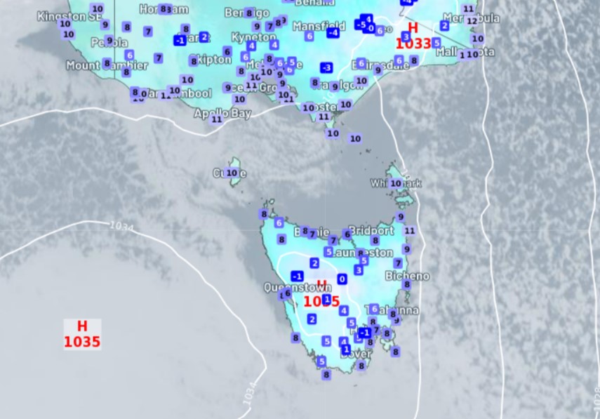
The culprit is a frigid Antarctic airmass, and while snow fell to low levels across the state on Sunday and Monday, the airmass has dried out rapidly as the high pressure system moves in from the west, and the whole of Tasmania looks likely to be free of precipitation of any kind today.
That dry air will ensure some very frosty nights ahead. Indeed, widespread frosts occurred in Tasmania overnight, prompting a Road Weather Alert for icy roads.
Being located at sea level, Hobart doesn't see too many frosts, but the city has historically seen sub-zero nights in each of the five months from May to September, and with minimums of just 1°C predicted for the next two mornings, you can definitely expect white lawns in many suburbs.
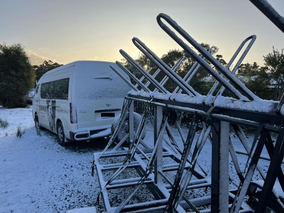
Image: It'll actually be pretty nice mountain biking weather over the next few days if you wear a thick jumper and a beanie. Source: @tasmanian_mtb_adventures
Rug up, Hobartians! And yes, if you learn nothing else today, the technical name for a person from Hobart is a Hobartian, even if the term not used very often.