
High chance of tropical cyclone near Australia next week
A late-season tropical cyclone could form near northern Australia next week, which would make this Australia’s most active cyclone season in six years.
The influence of an equatorial Rossby wave passing to the north of Australia will increase the likelihood of tropical cyclone activity over the coming week.
With cloud already building under the influence of this tropical wave, forecast models are showing clear signs of a potential tropical cyclone, or two, near Australia’s north coast next week.
The main system currently capturing the eyes of meteorologists is a tropical low that’s developing over the Arafura Sea. This low pressure system is expected to move towards the southwest over the next few days, possibly gaining strength as it passes over warm water to the north of WA’s Kimberley region over the weekend and early next week.
According to the Bureau of Meteorology, there is a moderate chance that this low will develop into a tropical cyclone from Friday, increasing to a high chance next week.
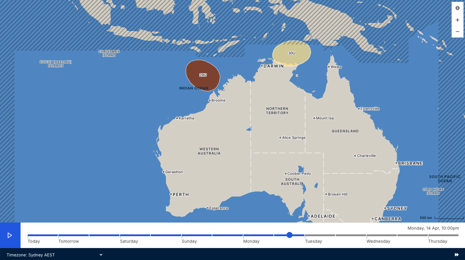
Image: Chance of tropical cyclone activity in the Australian region early next week. Source: Bureau of Meteorology.
At this stage, it’s too hard to predict whether the potential tropical cyclone will stay offshore or approach the north coast of WA next week. More reliable forecast information will become available in the coming days.
Some computer models are also suggesting that another low could form over the eastern Arafura Sea or over the Gulf of Carpentaria next week. This system currently only has a low chance of becoming a tropical cyclone, although it will be one to keep an eye on over the coming week.
Prior to this week, there had been 10 tropical cyclones in the Australian regions so far this season – which runs from the start of November 2024 to the end of April 2025. This has already been Australia’s most active tropical cyclone season in three years and if one more forms, it will be the most active season in six years.
The next tropical cyclone to form in the Australian region will be named Errol.