
Hey, where did Queensland go?
Beautiful one day, not there the next. The great state of Queensland is almost entirely obscured by cloud this Thursday, making the so-called "Sunshine State" not very sunny at all.
Take a look at the image below, which was captured at 10 am Thursday morning. It shows a broad mass of cloud covering the entire state except for small parts of the far southwest and Cape York Peninsula.
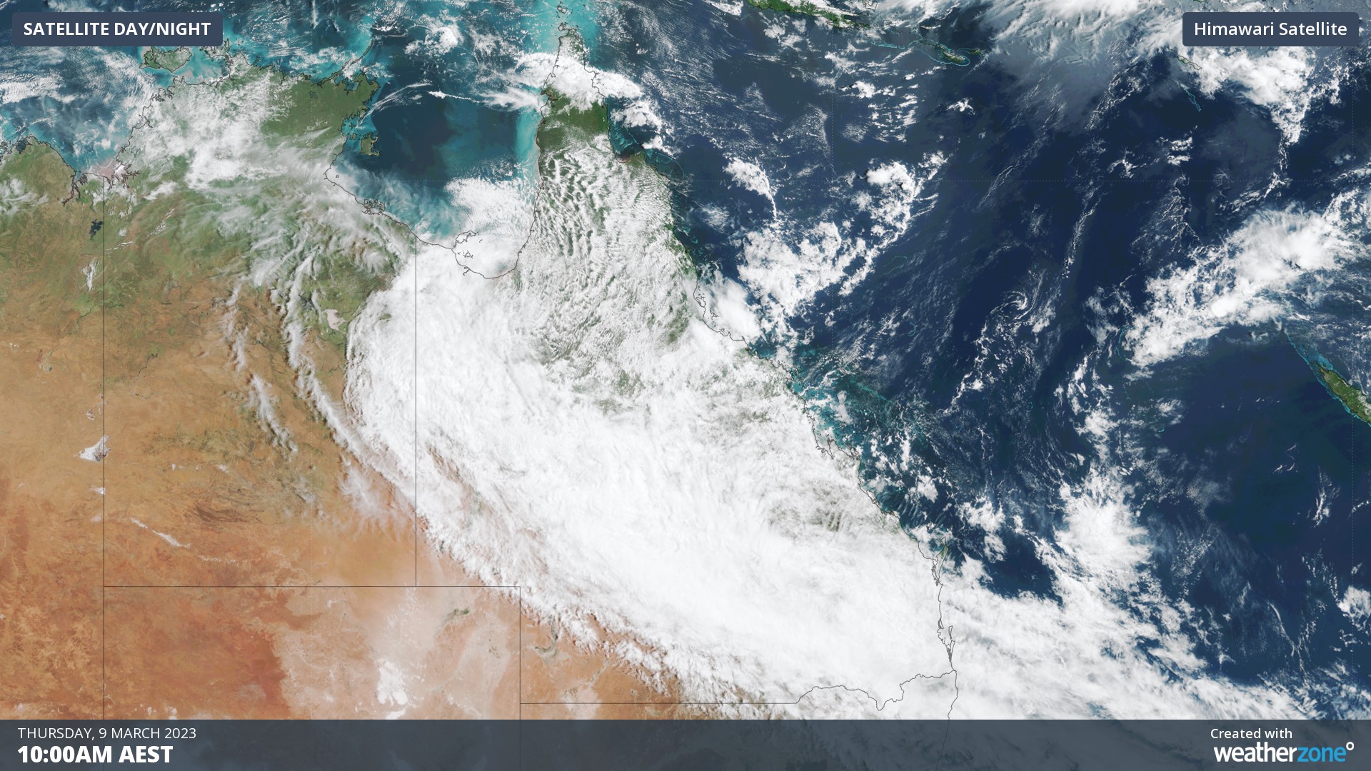
The cloud is being caused by a tropical low and associated trough extending from the Gulf of Carpenteria all the way southeast to the Gold Coast.
A tropical moisture feed is generating heavy rain and storms in the tropics, with lighter showers and the odd storm in the east of the state.
An unusual weather system
- Normally Queensland tends to see its heaviest rainfall in an onshore flow from the east. But Thursday's rain has come in from the northwest.
- When weather comes from that direction in warmer seasons, it often brings the potential for storms, and indeed there's potential for severe storms and heavy rain this weekend across a wide area of Queensland.
Meanwhile, falls of over 200 mm in the state's northwest have already been recorded with system, as well as a spell of unseasonably cool weather due to persistent cloud.
Mt Isa saw 146 mm in 48 hours to 9 am Thursday, the heaviest two-day fall in 19 years. Maximum temps have also stayed below 25°C for three days in Mt Isa, which hasn't happened in March for 55 years.