Heavy rain inbound for central Queensland

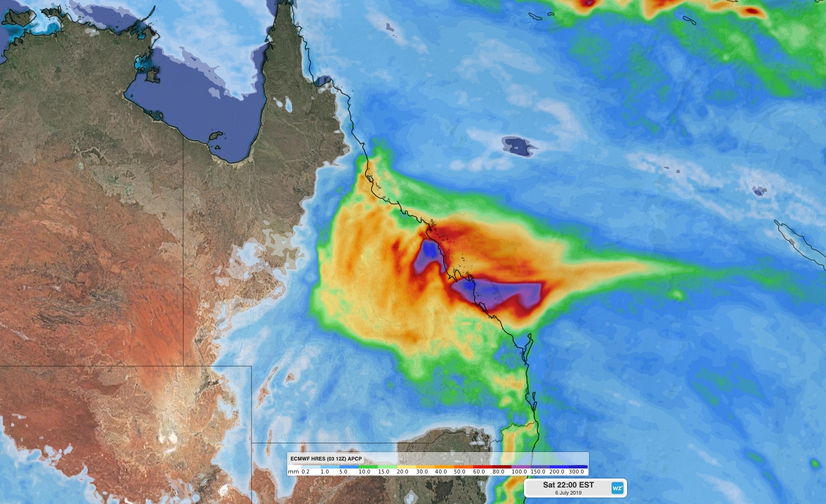
Heavy rain may cause flooding in parts of central eastern Queensland during the next 48 hours, while hazardous surf continues to batter the state's southeast coast.
Moisture-laden onshore winds combining with an upper-level trough will cause rain to increase along the state's central coast and adjacent inland from Thursday afternoon and evening. Fresh to strong onshore winds will cause heavy rain to continue throughout Friday, before easing on Saturday morning as the upper-level trough moves offshore.
A flood watch has been issued for parts of the Central and Capricornia Coasts, where 50-100mm of rain could fall between Thursday night and Saturday morning, with isolated totals of 100-200mm. Mackay usually receives around 40mm of rain during all of July.

Image: Accumulated rain forecast between Thursday and Saturday, according to the ECMWF-HRES model.
The blustery onshore winds will also cause lighter showers and big waves along Queensland's southeast coast during the next few days.
A hazardous surf warning has been issued for the Fraser Island Coast, Sunshine Coast Waters and Gold Coast Waters on Thursday and Friday. This large swell will persist on Saturday before easing on Sunday.
Visit https://www.weatherzone.com.au/warnings.jsp for the latest warnings.