
Heavy rain in Brisbane and Burketown as twin systems soak Qld
A coastal trough in the southeast and a tropical cyclone in the northwest have both delivered torrential rain to parts of Queensland over the last 24 hours, causing flash flooding in some areas.
The satellite image below shows that large areas of Qld were covered by cloud on Friday morning, causing widespread rain and some thunderstorms across the state.
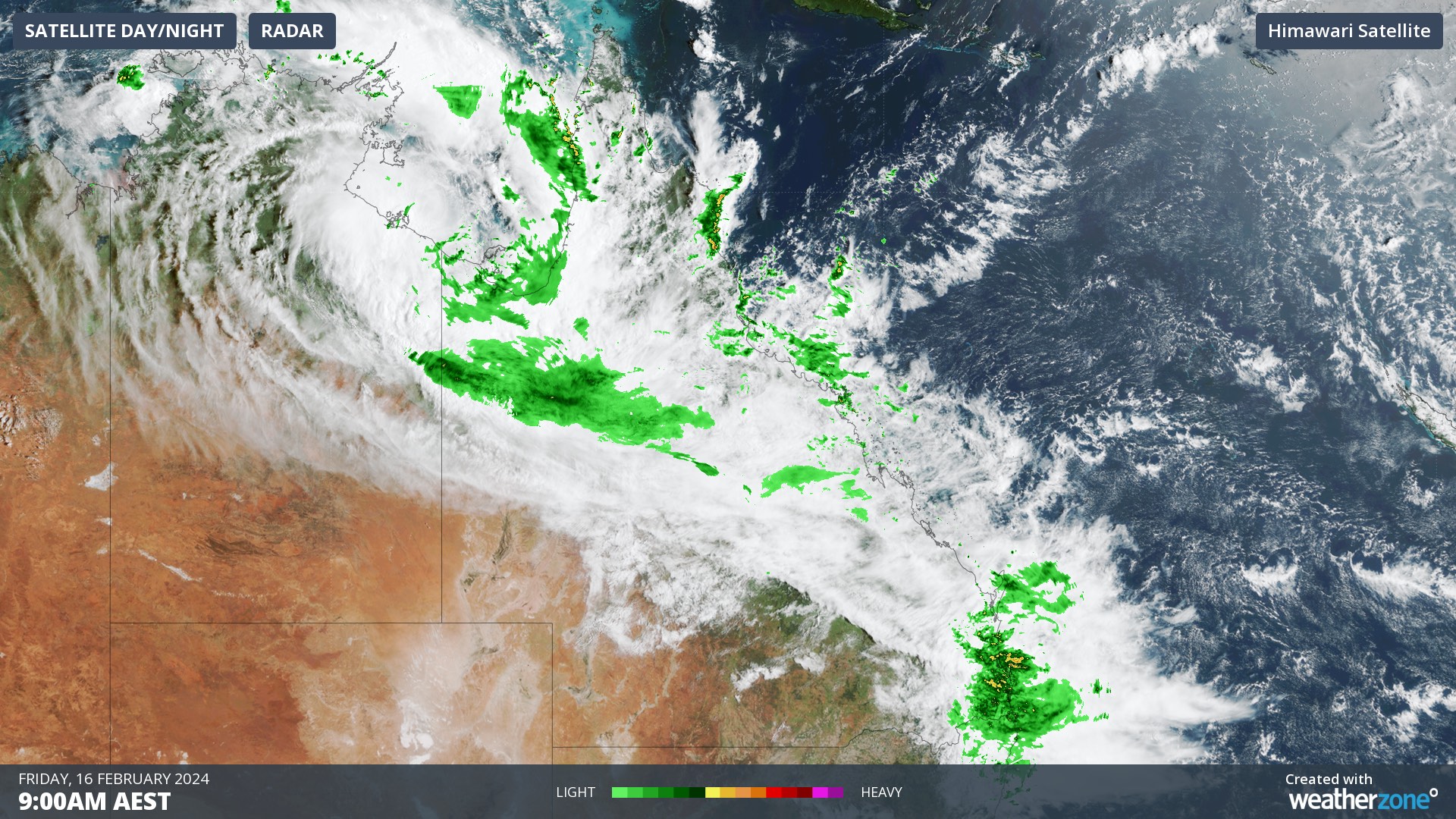
Image: Composite visible true-colour satellite image and radar captured at 10 am AEST on Friday, February 16, 2024.
The widespread cloud was caused by a developing tropical cyclone located over the Gulf of Carpentaria and moisture-laden easterly winds feeding into an upper-level trough further south.
The combined influence of these systems caused rain over a broad area of Qld from Thursday into Friday, with falls exceeding 100 mm in 24 hours over some northern, central, and southeastern parts of the state.
In southeast Qld, a coastal trough delivered heavy rain and on Thursday night into Friday morning, with some areas seeing enough rain to cause flooding.
Brisbane collected 135 mm in the 6 hours ending at 7am AEST on Friday, with 183.6 mm reaching the city’s gauge in the 24 hours ending at 9am Friday. This was Brisbane’s heaviest rain in two years and caused flash flooding in some parts of the city.
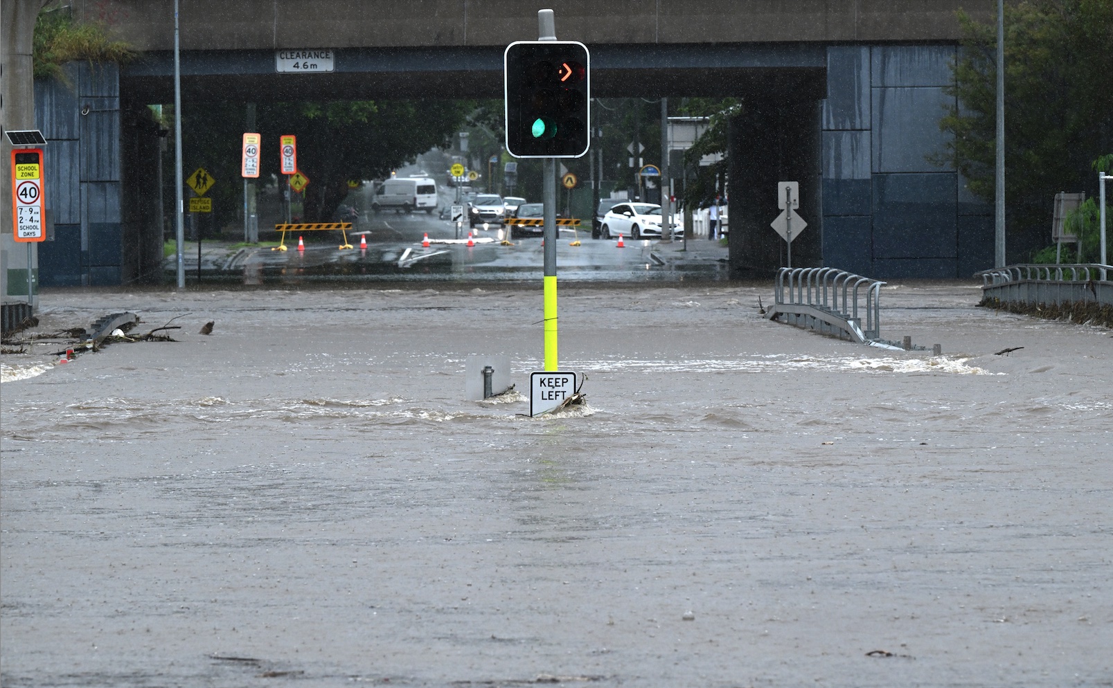
Image: Flooding in the suburb of Toombul in Brisbane on Friday, February 16, 2024. Source: AAP / Darren England
A few other places in southeast Qld collected around 200 mm from this system, including 209 mm at Rosalie and 195 mm at Mount Coot-Tha, also in the 24 hours ending at 9am on Friday. At Rosalie, just over 150mm of this rain fell in 6 hours on Friday morning.
Meanwhile, parts of Qld’s central coast and inland were also soaked with heavy rain over the last couple of days. Mackay’s 73 mm during the 24 hours to 9am on Friday was its highest daily total since January last year. Nearby, a gauge at Bells Creek collected 159 mm in the same period.
Northwest Qld has also received torrential rain over the last couple of days from a developing tropical low centred over the Gulf of Carpentaria, which intensified into a tropical cyclone named Lincoln around midday on Friday.
Bourketown Post Office received 176.4 mm in the 24 hours to 9am on Friday, which was its highest daily total since 2011. This is also close to an entire month’s worth of rain at this time of year, which is an impressive feat for a tropical location during the wet season.
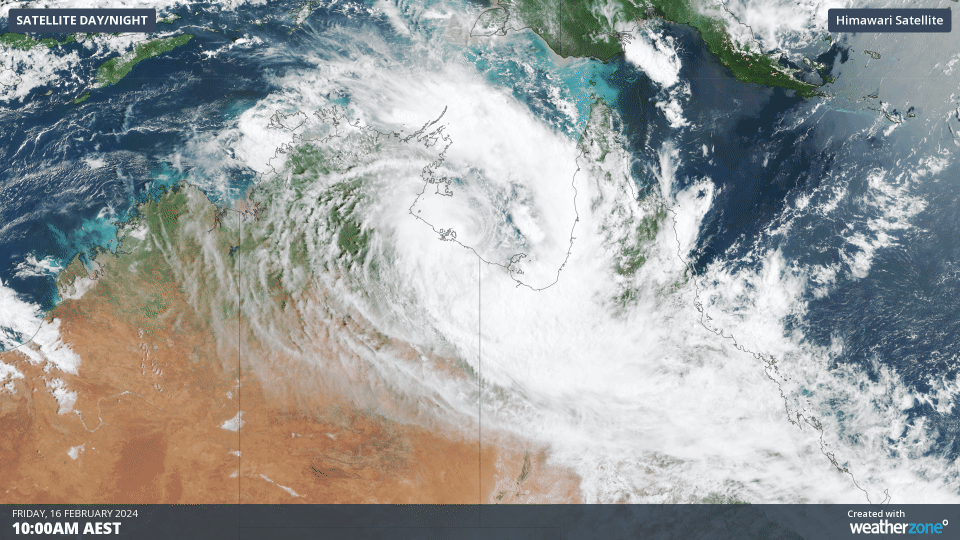
Image: Tropical Cyclone Lincoln spinning over the southern Gulf of Carpentaria on Friday morning.
Tropical Cyclone Lincoln is expected to make landfall somewhere between the NT/Qld border and Port McArthur on Friday afternoon, most likely as a category one system. Lincoln will then weaken back to a tropical low before moving inland across central parts of the NT this weekend and then passing over the north of WA early next week.
Be sure to check the latest weather, flood, and tropical cyclone warnings for the most up-to-date information on these severe weather systems.