Heavy rain heading for Tasmania
A burst of heavy rain will soak Tasmania during the middle of this week, with potential falls in excess of 200 mm expected to cause flooding in the state’s north.
A low pressure trough carrying copious moisture down from the tropics will drive thick clouds and heavy rain over Tasmania between Wednesday and Friday this week.
This surge of wet weather will dampen the entire state, although the heaviest rain is likely to occur in the north, where onshore winds will produce persistent rain between Wednesday afternoon and Friday morning.
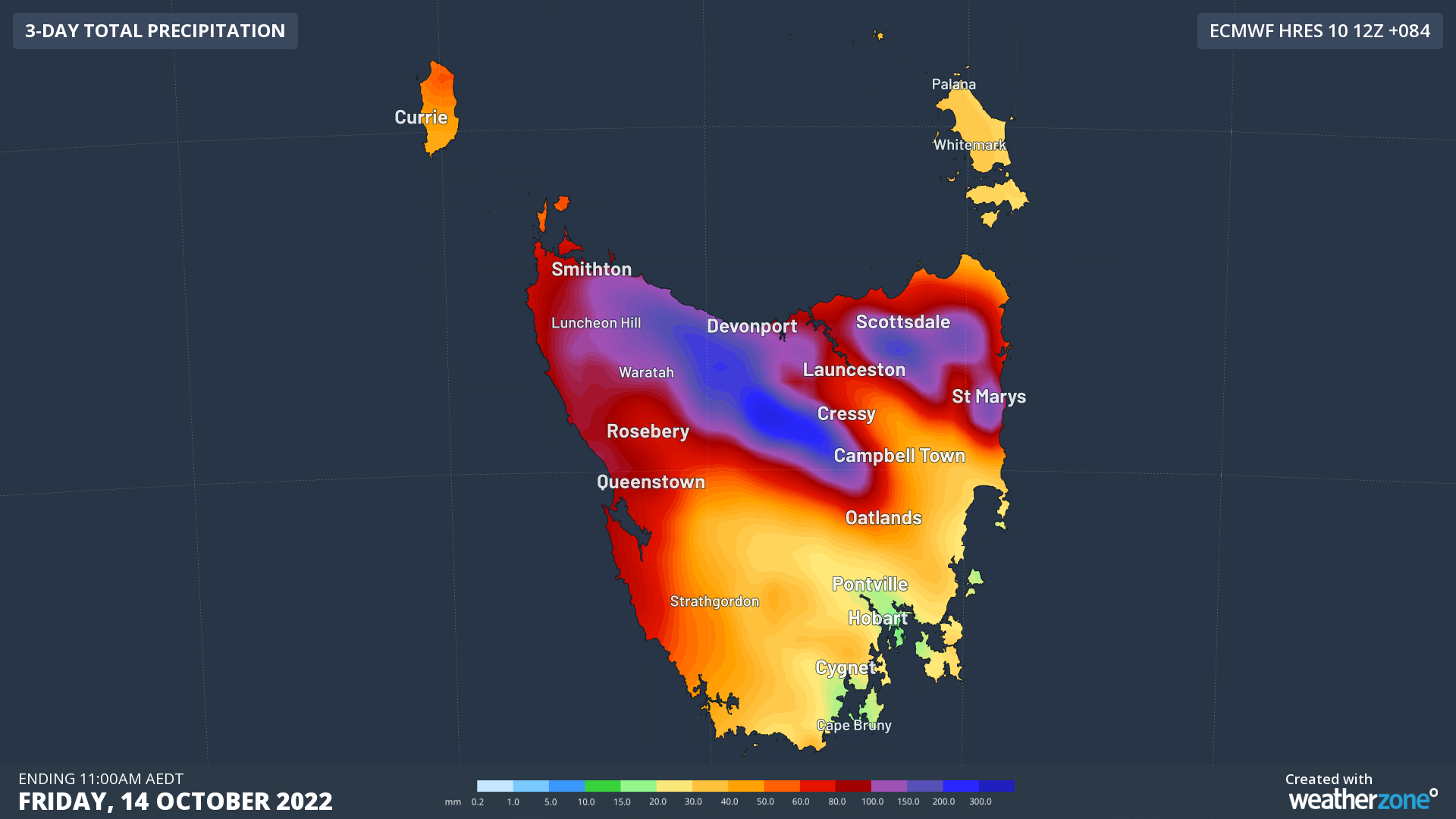
A number of forecast models suggest that accumulated falls of 150 to 250 mm are possible in northern Tasmania between Wednesday and Friday, most of which will hit the ground on Wednesday night and Thursday. This rain is likely to cause flooding.

Image: Forecast accumulated rain during the 84 hours ending at 11pm AEDT on Friday, October 14, according to the ECMWF-HRES model.
Rain will be lighter in southern Tasmania over the next few days, although Hobart could still see around 20 to 40mm between Wednesday and Friday.
Flood watches and warnings and severe weather warnings are likely to be issued in Tasmania over the next few days. Check the latest warnings for the most up-to-date information on this developing system.