Heavy rain, damaging winds heading for Tasmania
A deepening low pressure system will cause wind and rain to increase over Tasmania during the next 48 hours, prompting a flood watch and severe weather warning in some parts of the state.
A low pressure system that caused flooding rain over southeastern NSW on Monday night into Tuesday morning is about to cross Bass Strait and bring a burst of wind and rain to Tasmania.
This dynamic low pressure system will gain strength as it moves south, thanks to an injection of cold air that it will receive from a separate low moving across from Victoria.
As the strengthening low approaches Tasmania later today, wind and rain will increase over the state and persist into Wednesday.
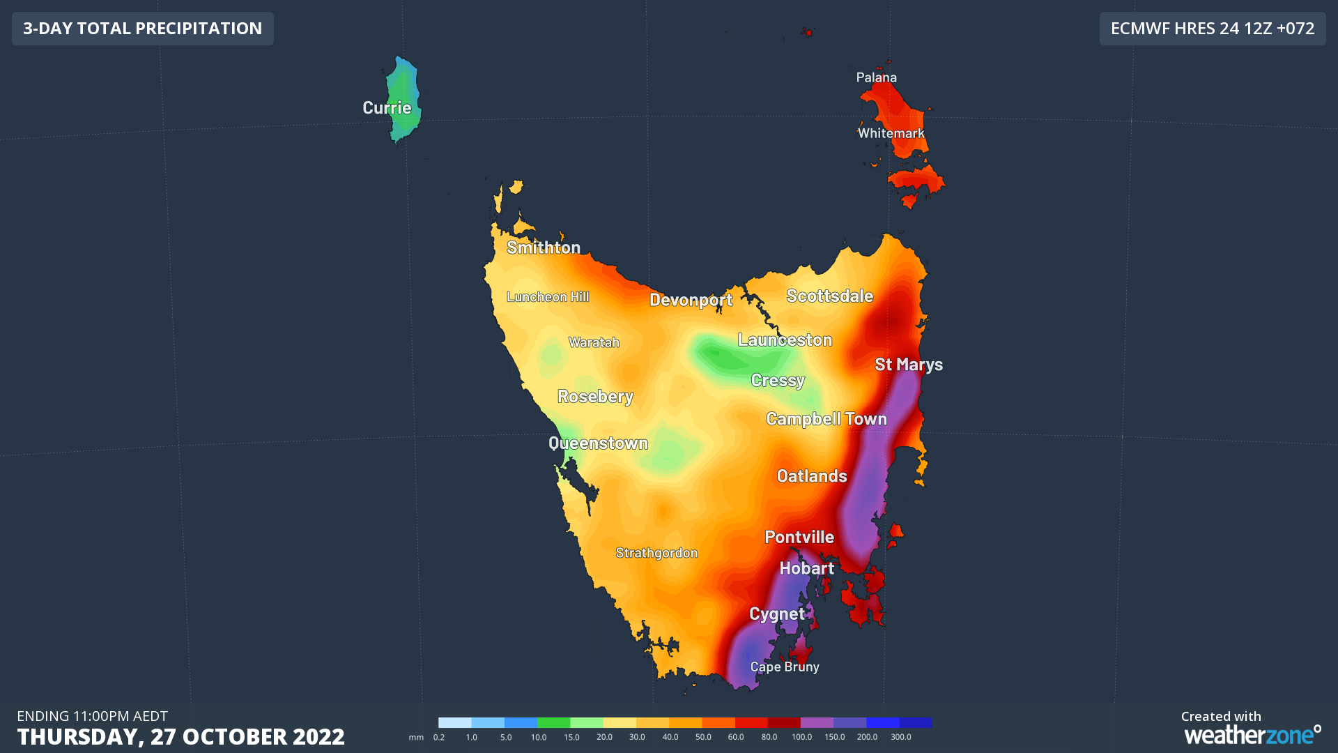
The image below shows how much rain one computer model is predicting over Tasmania between Tuesday and Thursday. Some areas in the state’s east could see 100 to 200 mm of rain during the next 2 to 3 days, with much of this falling between Tuesday night and Wednesday morning.

Image: Forecast accumulated rain during the 72 hours ending at 11pm AEDT on Thursday, October 27.
A severe weather warning has been issued for damaging wind gusts over parts of northern and eastern Tasmania between Tuesday afternoon and Wednesday morning. A flood watch is also in place for the state’s North, North East, Derwent and South East Catchments.
Flood and severe weather warnings will be issued and updated where necessary over the next few days, so be sure to check the latest warnings in your area.