
Heaviest December rain in 75 years soaks parts of SA
A slow-moving rainband has delivered the heaviest December rainfall in decades to parts of South Australia, with strong winds starting to take hold.
It was the wettest December day in 75 years in Cleve, with 55mm falling in the gauge to 9am Sunday. Kimba saw 47mm, its heaviest December rain in 61 years. Several locations set new site December records such as:
- Mount Ive 51.2mm (53-year history)
- Edithburgh 36.8mm (27-year history)
- Noarlunga 40.0mm (23-year history)
- Minlaton 47.8mm (22-year history)
For Wudinna in the state’s west, its 48.6mm set a daily rainfall record for that site which has been in operation since 1999.
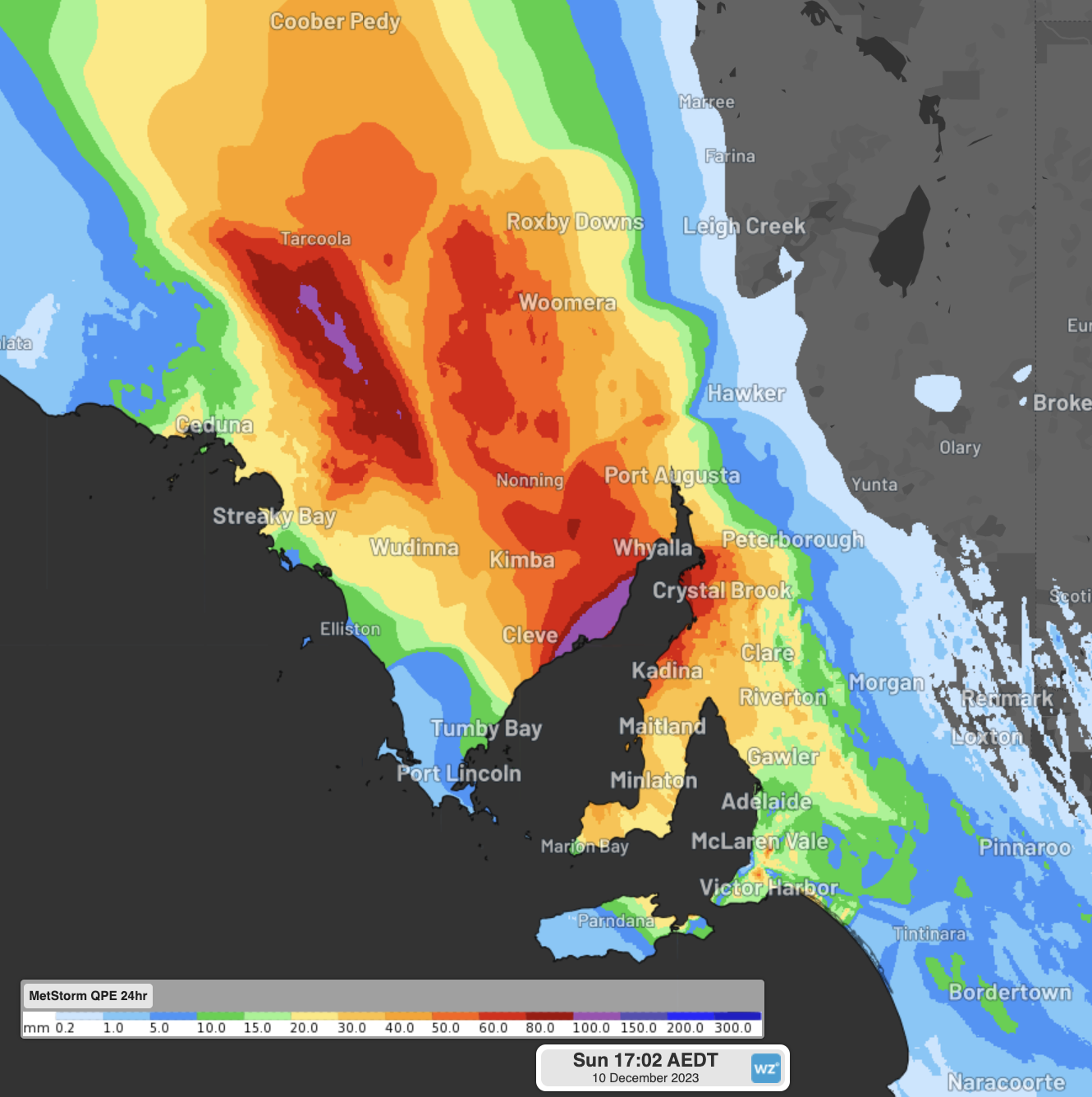
Image: Observed rainfall in the 24hrs to 4:30pm CDT Sunday
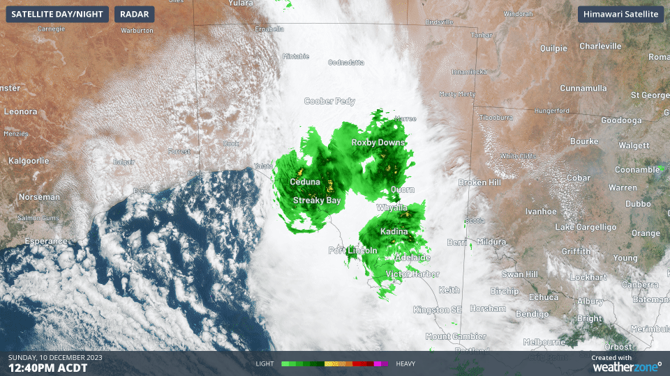
On Sunday, rainfall is continuing over western and central parts of SA, with the edge of the rainband affecting Adelaide.
While the rain might be easing around Adelaide and eastern parts of SA, the southeasterly winds are starting to pick up. Later this evening, southeasterly winds are expected to gust up to 100km/h, with 85km/h already recorded at Selicks Hill at 4pm this afternoon.
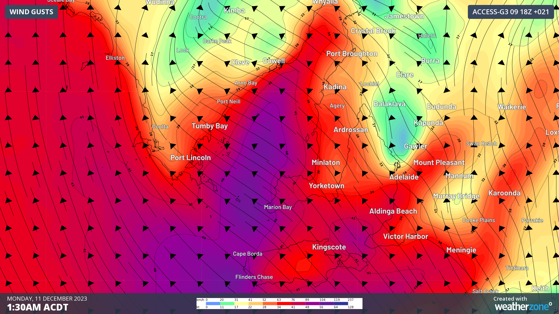
Image: Wind gusts expected in the early hours of Monday morning. Winds in red and purple indicate strong winds that may bring down trees and branches.
Southeasterly winds can be notoriously damaging for parts of the Mount Lofty Ranges and Adelaide Hills due to the local effects of the hills. When a low-level inversion forms (such as during a cold day and night like Sunday), southeasterly winds get squeezed between the ground and the inversion like a wind-tunnel, amplifying the winds over the region. These damaging winds are known as 'gully winds'.
The recent rain further increases the chances of trees and their branches falling overnight, with the softer soils weakening tree roots and making them easier to fall. These trees and limbs can fall on power lines, creating local hazards and large-scale power outages. Please remember to never approach live wires and call the SES on 132 500 to report them.
The rainband and low pressure system responsible will linger around for several days yet, but will return to more ‘normal’ warm with showers and thunderstorms type of weather. Plenty of warnings - including flood watches and severe weather warnings - are current, so please visit Weatherzone for the latest information.