
Heatwave leaving SA, Tasmania and Victoria, travelling to Queensland
A heatwave that has been affecting much of South Australia, Tasmania and Victoria is dissipating and about to leave as southerly winds freshen.
For the past three-to-five days temperatures have been running five-to-10 degrees above average. Some of the more notable temperatures have been in the Adelaide, Hobart and Melbourne areas, particularly on the hills and mountains where it has stayed windier and warmer at night.
It has been running seven-to-eight degrees hotter than average in Adelaide, Mt Lofty, Mt Wellington, Ben Nevis and Mt Dandenong for the past five days and nights, the hottest spell in about two years this early in the season.
During the past three days and nights the most extreme heat in the country has been in the Ben Nevis and Mt Dandenong areas, about nine degrees hotter than average.
On the whole for southeastern Australia, including New South Wales and the ACT, the heatwave has been Low Intensity in most areas, Severe in some.
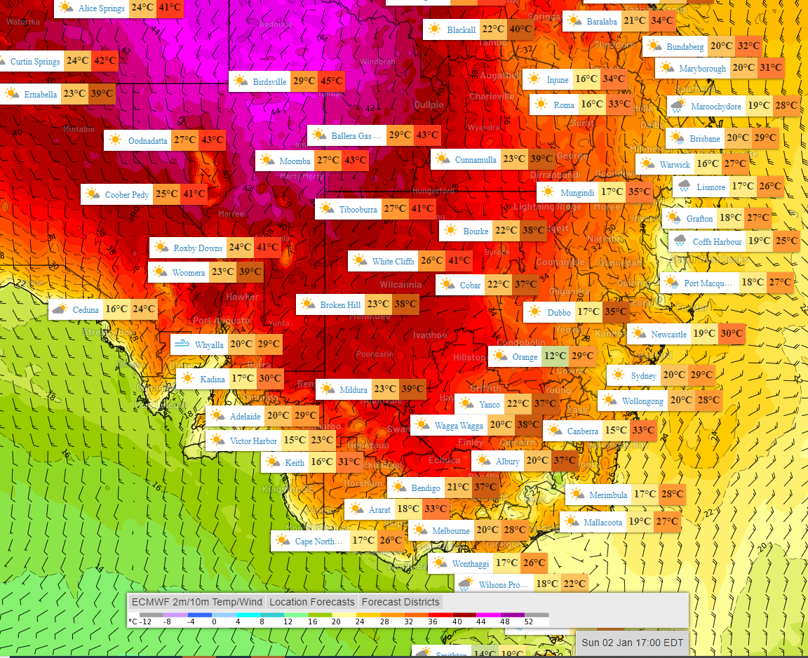
Image: Forecast temperatures and wind at 5pm EDT Sunday 2 Jan
The freshening southerly winds which are gradually cooling the area are forcing the heat further north where it will evolve into a Severe-to-Extreme heatwave in tropical Queensland. Temperatures are likely to exceed 35 degrees for at least four days and peak in the high thirties in the Townsville and Cairns areas during the week.
For parts of the interior, it is expected to reach the low-to-mid forties.
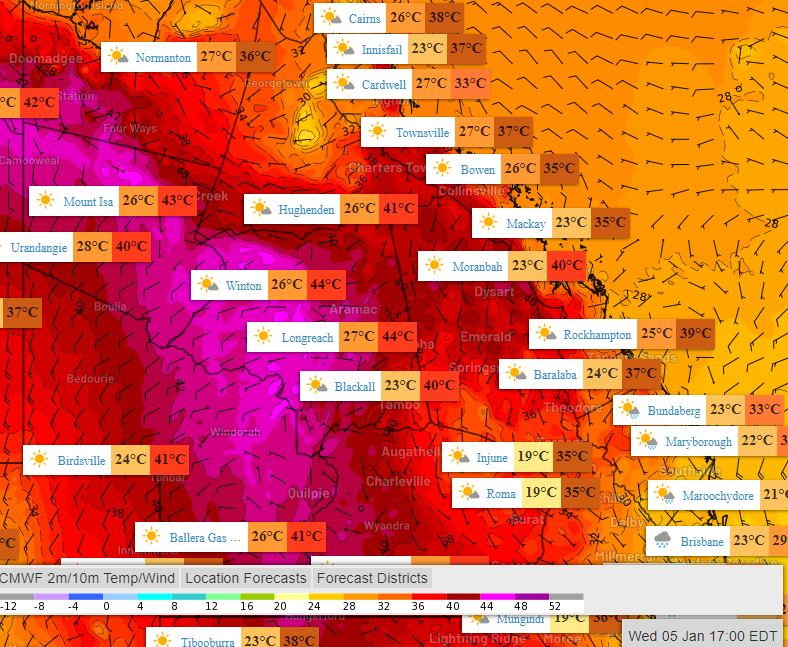
Image: Forecast temperatures and wind at 5pm EDT Wednesday 5 Jan
The heat will bypass the NSW and southern Queensland coasts where humid onshore winds will dominate, fed by a high over the Tasman and Tropical Cyclone Seth in the southern Coral Sea.
For parts of SA, Tasmania and Victoria cooling will take time. Adelaide can expect cooling to continue for five days. Since the city's 39-degree peak on New Years Eve each day to follow is looking a bit cooler than the previous.