
Heat intensifying early in Australia's northwest
Heat has been intensifying early for this time of year in Australia's northwest this past week and is expected to continue doing so, prompting heatwave warnings.
As of Saturday morning, heatwave warnings had been issued for part of the Northern Territory's western Top End, but can be expected to also be issued for larger areas, including across much of Western Australia's Kimberley.
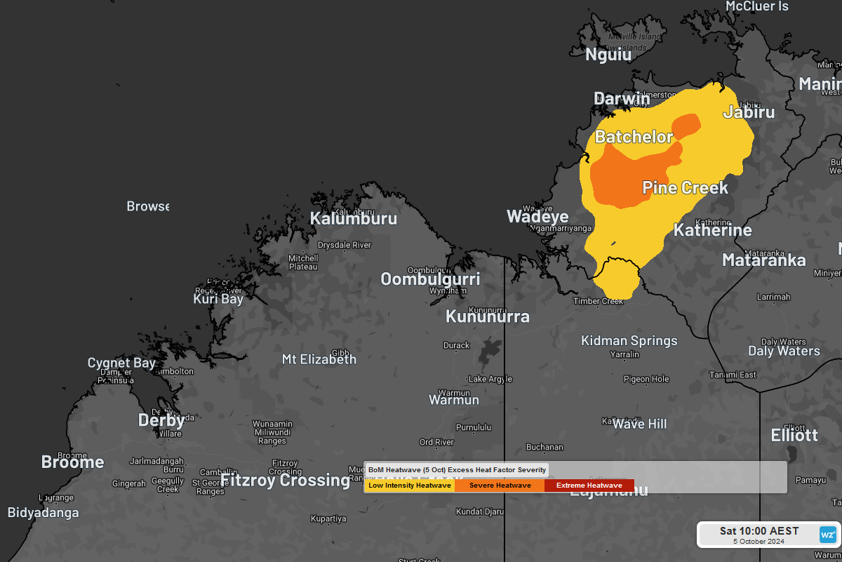
Image: Heatwave forecast for Thursday 3rd October to Saturday 5th October from Bureau of Meteorology, indicating an area of Low intensity heatwave for the NT's western Top End surrounding a smaller area of Severe heatwave.
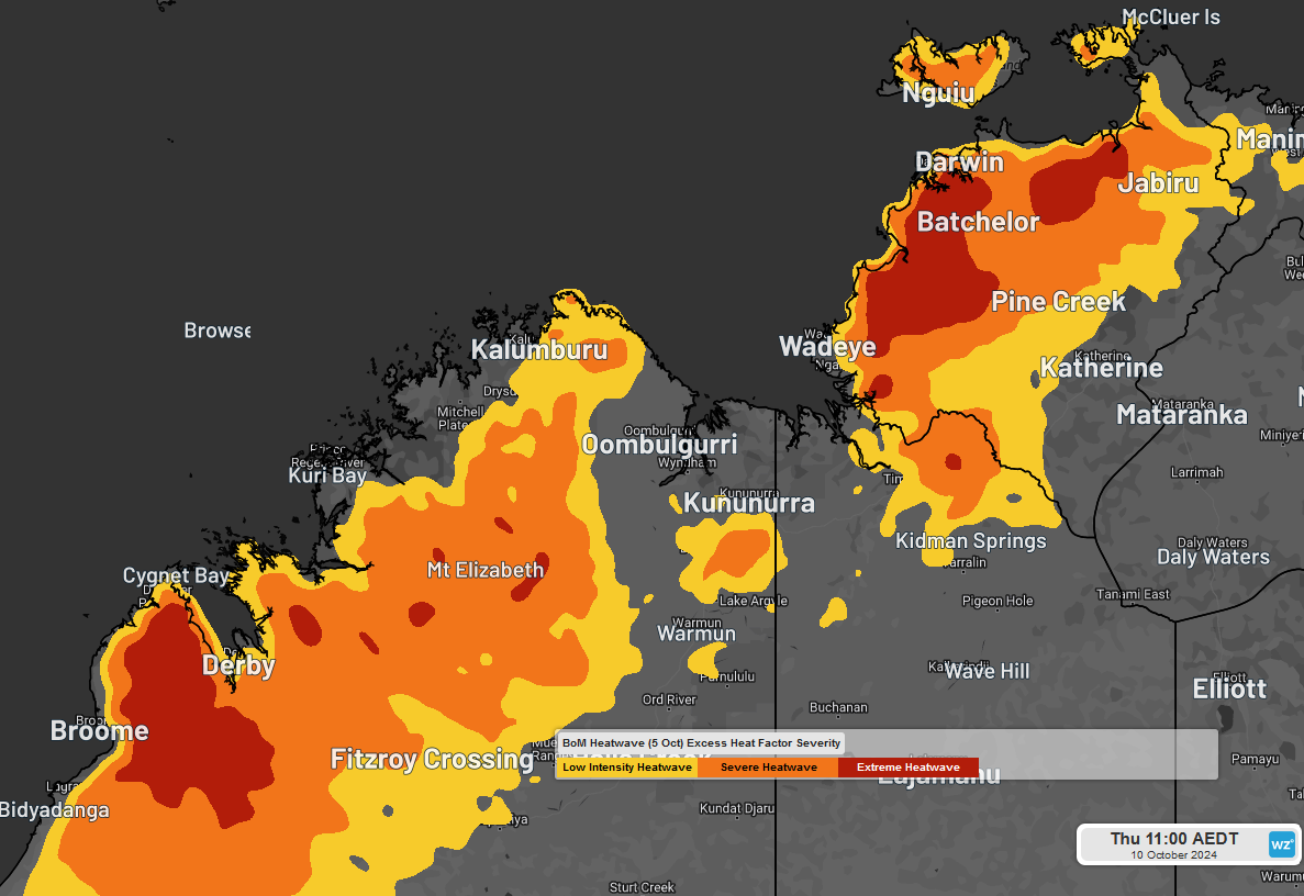
Image: Heatwave forecast for Tuesday 8th October to Thursday 10th October from Bureau of Meteorology, indicating two large heatwave areas of Severe and Extreme.
Last weekend, Oenpelli (Gunbulunya), a good three-hour drive east of Darwin, achieved its first back-to-back 40-degree days in September in more than a decade.
Since then, Derby, in WA's Kimberley has achieved its hottest week this early in the 'build-up' season in 11 years., averaging a maximum of 39.6 degrees. The so-called 'build-up' is the transition time between the dry and wet seasons, when daily sunshine hours reach their peak and heat and humidity increase.
This sort of heat is more typical of mid-to-late October, so has arrived two-to-three weeks earlier than normal. Compared to this time last year, this past week has been the hottest week since early November, reaching the mid-to-high thirties each day.
The heat has largely been due to skies staying mostly clear, allowing sunshine to continually heat the ground each day with help from a warmer-than-normal nearby ocean. The sea surface of the eastern Indian Ocean has been running warmer than normal by one-to-two degrees for this time of year, giving nearby land areas an extra heating boost.
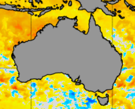
Image: Sea Surface Temperature Anomalies from NOAA, indicating water about two degrees warmer than normal off Australia's northwest.
A clue to the warmer-than-normal eastern Indian Ocean is the 28.3 degrees that Christmas Island warmed to today, its warmest day this early in the season in eight years.
As far as the people on the ground go, most locals would be used to this sort of heat, particularly in short spells but may find the longer version challenging by later next week. For tourists, most are likely to find it tiresome so should keep out of the sun and avoid exercise in the heat of the day. Tours around Litchfield Park will become increasingly energy sapping with each day.
Darwin itself will remain on the fringes of the heatwave, mostly in the area of Low Intensity, a relative oasis.