
Hail and snow in parts of VIC, NSW, as wintry weather returns with a vengeance
Victoria and southern NSW are copping a mid-spring wintry blast which looks set to ease off later today before flaring up again briefly midweek.
Many of you would have seen images of the heavy hail showers that coated Melbourne in a layer of snow-like white on Sunday afternoon. This was "small hail" of the type you typically see with cold fronts down south – as opposed to the larger hailstones that often fall in thunderstorms associated with tropical airmasses.
What's next?! A spontaneous hail storm has blanketed parts of Melbourne, leaving some suburbs looking like winter wonderlands. â„ï¸
— 9News Melbourne (@9NewsMelb) October 4, 2021
Did you get any hail at your place?
See all the vision, 6pm on #9News pic.twitter.com/CZ4Fs742kV
On Sunday evening through to Monday morning, the cold front trekked north, delivering around 10 to 15 cm of snow to the mountains. This was the scene just before 9 am at Perisher in NSW (which closed last week).
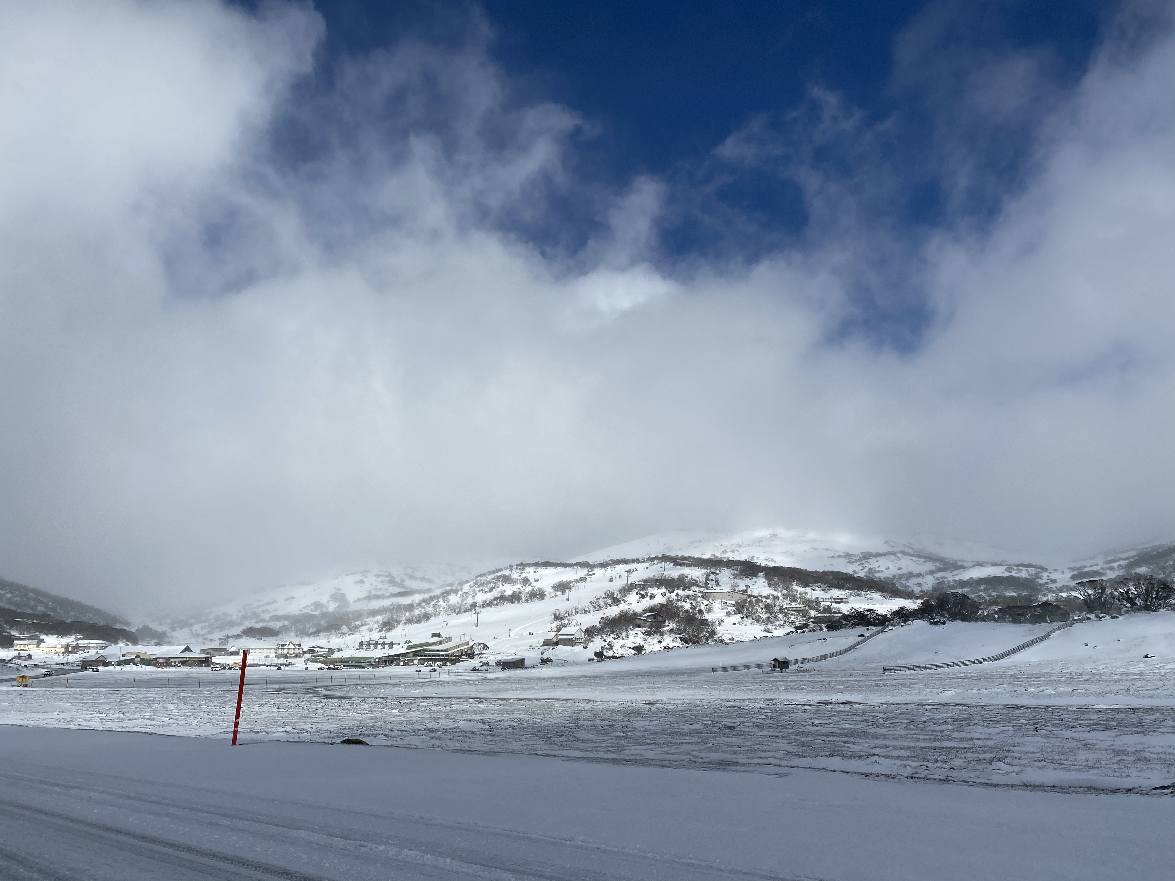
Image: Open the lifts again! Source: @SMS Skier via ski.com.au.
Snow has been falling to about 1400 metres in the last 18 hours or so, and could fall to similar or slightly higher levels around 1400 or 1500 metres on Thursday.
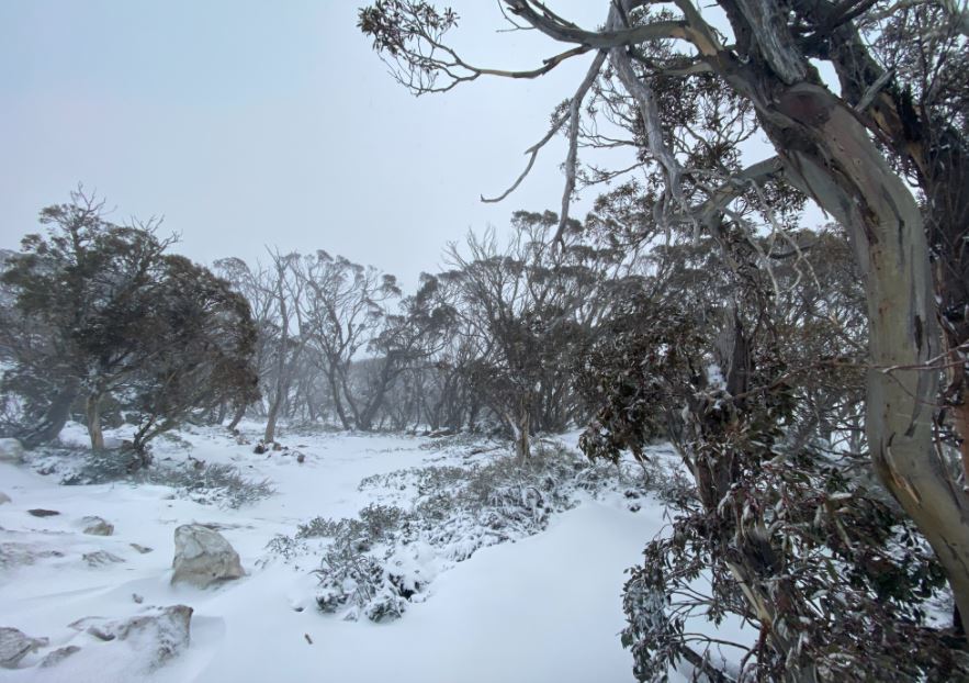
Image: A bleak day, but fortunately there was a little shelter among the snowgums. Source: @SMS Skier via ski.com.au.
As you'd expect, the southernmost capitals like Melbourne, Adelaide, Canberra and Hobart are all expecting tops in the teens today, while Sydney is experiencing strong westerly winds but not much in the way of cool air, with the mercury already having topped 20°C before midday on the way to an expected high of 23°C.
Southeastern Australia is in for an interesting week of see-sawing temperatures, with variations in maximums of as much as six or seven degrees from day to day in the southern capitals, as warm northwesterlies and cooler southwesterlies compete to exert their influence.
For example, Melbourne should reach 22°C tomorrow before dipping to 15°C on Thursday, then bouncing straight back up to 19°C on Friday and 21°C on Saturday before again dropping to 16°C on Sunday.
We like to think of spring as a season with neither the bite of winter nor the heat of summer, but in reality, it's pretty common for temps to bounce around like this, giving us a taste of both seasons, rather than remaining at one constant in-between sort of temperature.