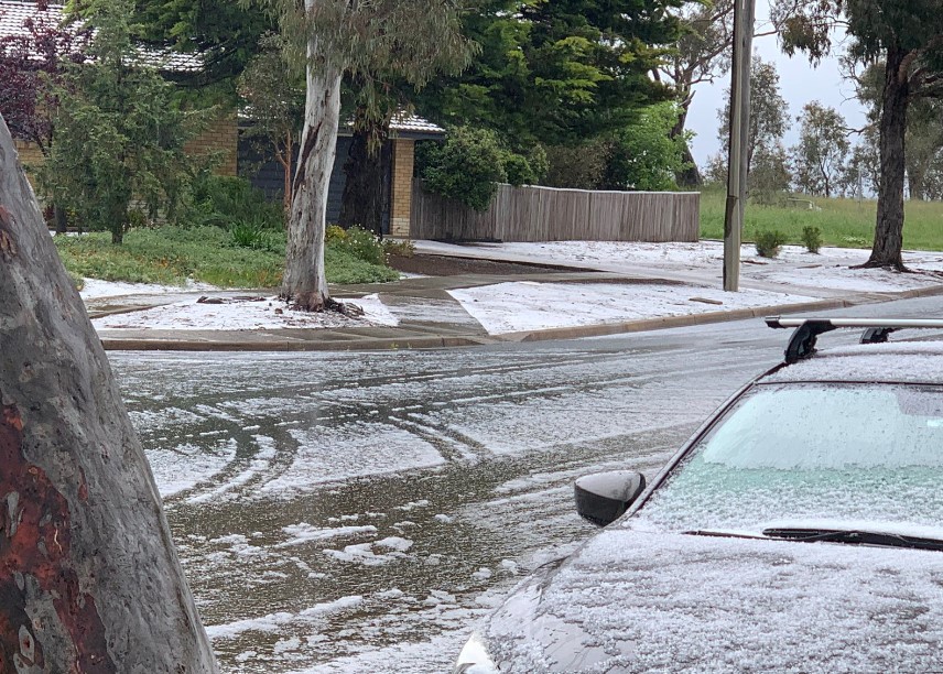
Graupel (not snow) falling in Canberra
It's showery and bitterly cold in Canberra this Wednesday by November standards, and some locals are convinced that sleety snow or even snow was falling this morning. But was it?
The short answer is no, but graupel – a very close cousin of snow – coated the ground in many suburbs.
So what is graupel?
Graupel is a type of hail which falls as tiny pellets. It's caused by supercooled water droplets in the atmosphere which freeze onto snow crystals suspended in the air.
So we know that it's snowing higher up in the atmosphere, and indeed there is proof from this morning's snow cams in the Snowy Mountains, two hours southwest of Canberra, and also via this image at Nimmitabel, a small village an hour or two south of Canberra, which sits an elevation of 1075 metres above sea level.
Did you have to reach for the extra blanket last night?
— Tim the Yowie Man (@TimYowie) November 15, 2022
Here’s why…widespread November snow including a dusting at Nimmitabel.
Pic via the good folk at Royal Arms Guesthouse Nimmitabel pic.twitter.com/Hl6I1lPjDk
Most of Canberra's suburbs sit between about 550 m and 650 metres, and while that's extremely chilly for this time of year, it's not quite cold enough for snow – even though Canberra's official temperature was just 6.6°C at 11 am when some of the heavy heaviest graupel showers were falling.
Graupel is a relatively soft form of hail, and that’s reflected in the videos in the tweets below where it can be seen striking the ground without bouncing around as much as firmer type of hail stones.
Spring in #canberra pic.twitter.com/y6yFyp2wiC
— Fran Marshall (@thefoodmarshall) November 15, 2022
Welcome to November in the Southern Tablelands. Thanks to @antsharwood I learnt a new word: graupel. pic.twitter.com/4RYq6gw3zt
— Tête de la Course (@imaginatude) November 16, 2022
Because it's so soft, graupel is often mistaken for snow, especially by people who haven't seen snowflakes falling before. But graupel is graupel and snow is snow. They're not the same.
- As for the Canberra weather, a very modest maximum of 15°C is expected today, which is a fair way below the average November max of 22.7°C.
- But if it's any consolation to rugged-up locals, a top of 15°C would be considerably warmer than the coldest November day on record, which was November 11, 1965, which saw a top of just 9.1°C.

Image: Snowlike, and undoubtedly treacherous on the roads, but not quite snow. Source: Patrick Tobin.
Things look to warm up in the next few days with tops in the low twenties on Friday and Saturday, although another very wintry burst is due next Monday, and our early prediction is for a max of just 13°C.
Check out our detailed Canberra forecast here.