Giant hail and intense rain lash Qld, NSW
Severe thunderstorms have formed over parts of Qld and NSW this afternoon, with reports of hail around 7cm in diameter, intense rainfall and flooding and damaging winds.
The combination of a surface and upper-level trough and moisture-laden easterly winds are triggering severe thunderstorms across southeastern Qld and northeastern NSW.
The images below show the severe thunderstorms across the region on Wednesday afternoon.
Image: Himawari-9 satellite image at 2pm AEST on Wednesday, October 9.
This comes after severe thunderstorms lashed southeast Qld on Tuesday afternoon, bringing heavy rainfall to parts of Brisbane and the Sunshine Coast.
On Wednesday afternoon severe thunderstorms developed across parts of NSW and Qld, with reports of giant hail and heavy rainfall:
- 7cm hailstones were observed north of Injune, Qld at around 1:20PM AEST.
- 35.6mm was recorded at Inverell in 30 minutes to 2:46pm.
- Intense rainfall and flooding in Southport, Qld has been reported
Widespread falls of 50 to 70mm have been observed across southeast Qld and Northeast NSW in the past seven hours since 9am.
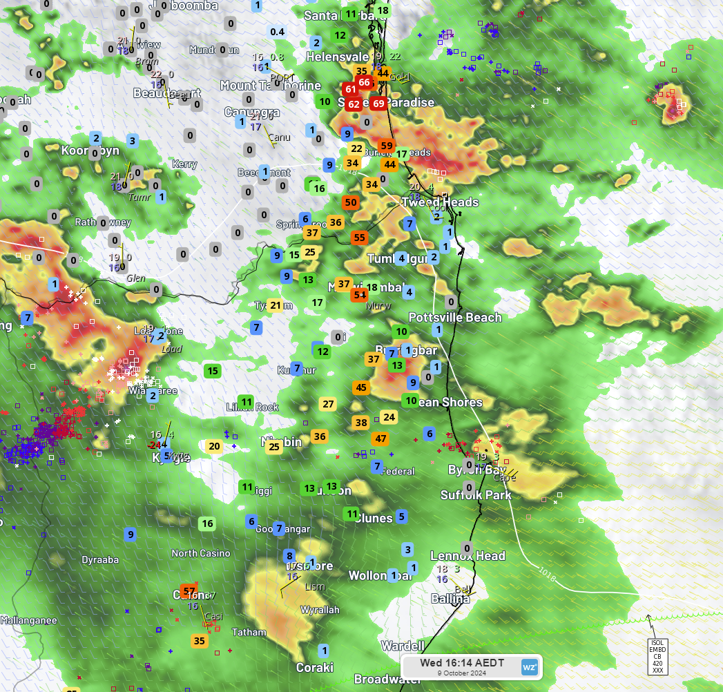
Image: Rainfall observations for seven hours since 9am, Wednesday, October 9.
As of 3:30pm, a severe thunderstorm warning is current for very dangerous storms which are likely to produce large, possibly giant hailstones and damaging winds across southern and central Qld. Over the border in NSW, a thunderstorm warning has been issued for heavy rainfall, large hailstones and damaging winds about the Northern Tablelands and North West Slopes.
These thunderstorms have the potential to continue into Wednesday evening, before the risk eases in some areas on Thursday. While storms should clear NSW on Thursday, Qld could see severe thunderstorms develop in central and northeastern Qld on Thursday, with the potential for damaging wind gusts.
Please keep an eye out for the latest warnings and forecasts as this activity unfolds.