Furious Friday in TAS, VIC
Tasmania and parts of Victoria are going to cop a blast of damaging winds today, with showers, thunderstorms and low-level snow all on the cards.
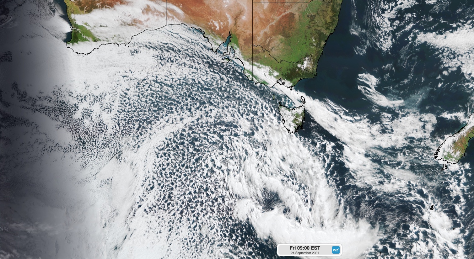
The satellite image below shows two cold fronts near southeastern Australia on Friday morning.

Image: Visible true-colour satellite image captured by the Himawari-8 satellite at 9am AEST on Friday.
The first front, located to the northeast to Tasmania in the image above, caused wind gusts up to 172 km/h as it passed over Tasmania yesterday.
The second front, which is sitting near state's southwest coast in the image, will cross Tasmania and southern Victoria today. The two most significant features of this system will be the wind and snow.

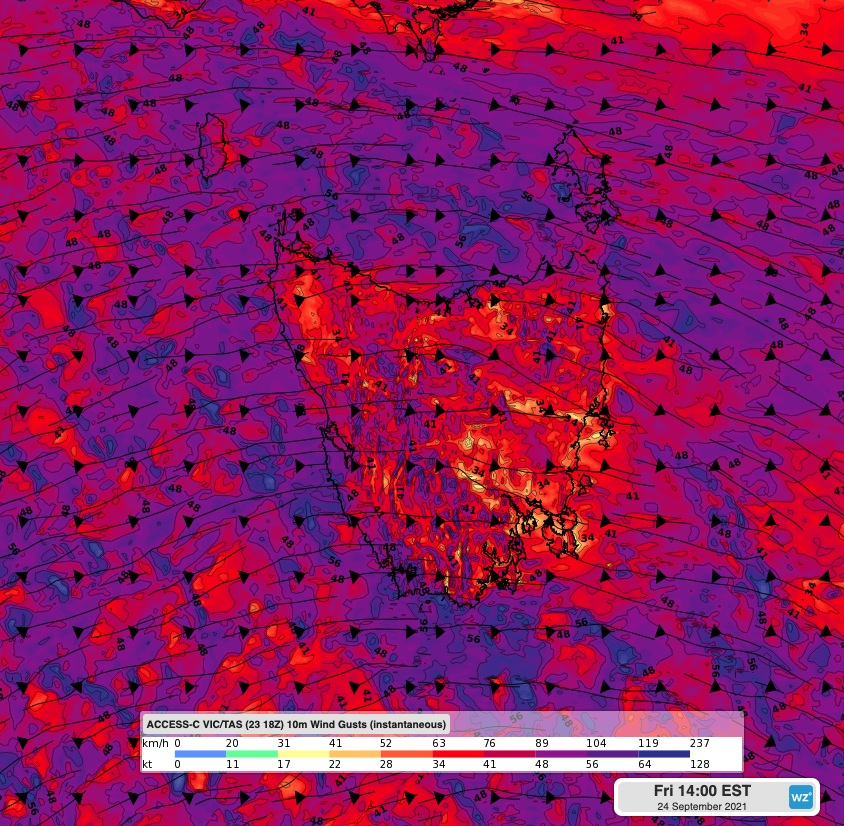
Image: Forecast wind gust speed and direction over Tasmania at 2pm AEST on Friday, according to the ACCESS-C model.
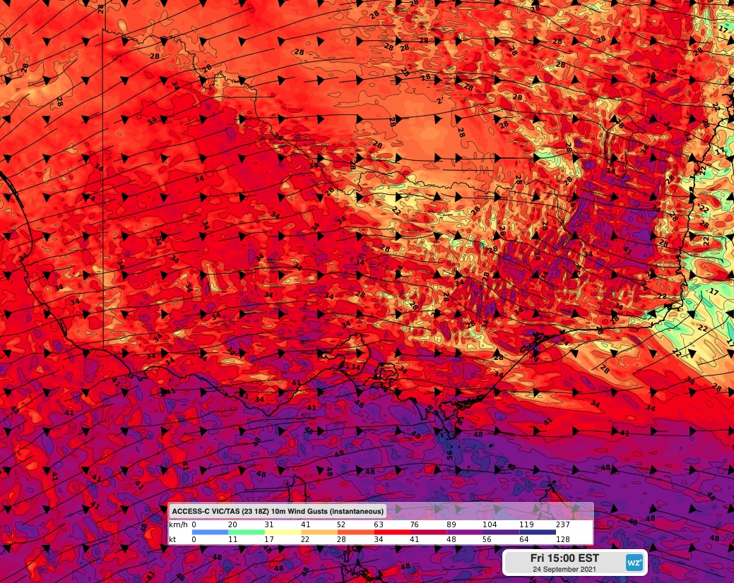
As of 10am AEST on Friday, a severe weather warning was in place for damaging winds in every district of Tasmania. In Victoria, the warning covered the coasts and ranges in the state's far south and the ranges in the northeast.

Image: Forecast wind gust speed and direction over Victoria at 3pm AEST on Friday, according to the ACCESS-C model.
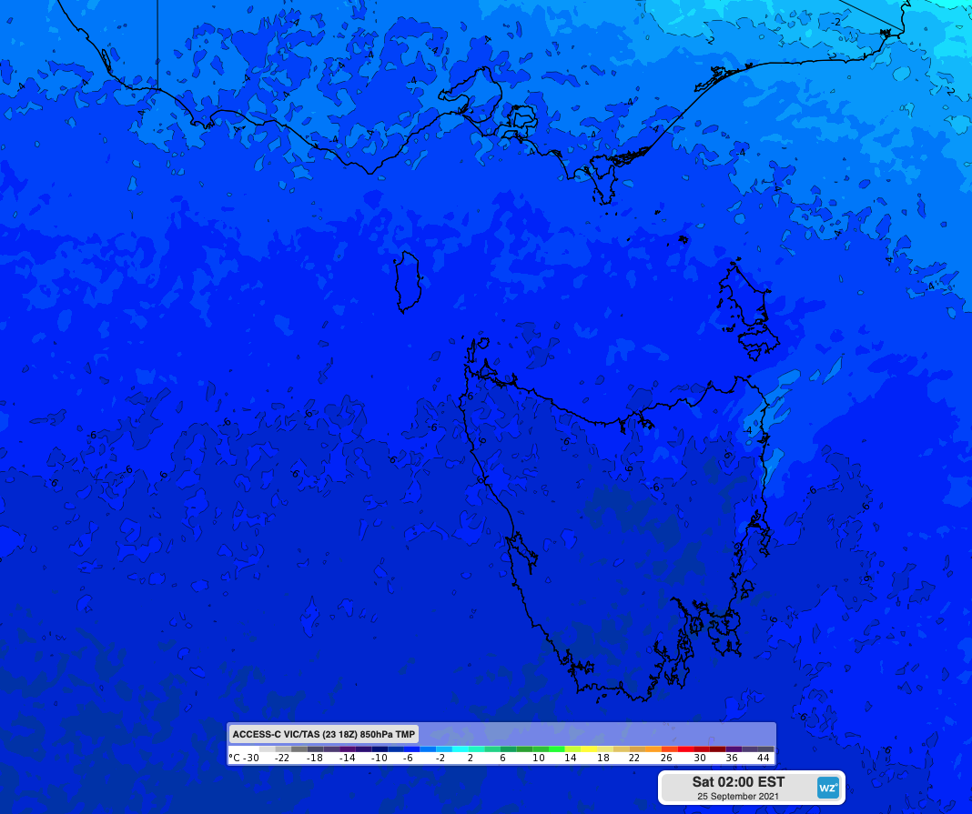
Exceptionally cold air behind the front will also cause temperatures to plummet in Tasmania today. This will cause widespread and low-level snow across the state, potentially as low as sea-level in some areas. The heaviest snow will fall over the central highlands and in the state's west, although some snow could reach higher terrain around Hobart by Friday night.

Image: Forecast 850 hPa air temperature at 2am AEST on Saturday, showing a very cold air mass above Tasmania.
The impending cold weather has prompted a Sheep Grazier's Warning for most of Tasmania and some central and eastern districts of Victoria today, while a Road Weather Alert and Bush Walker's Weather Alert are also current in parts of Tasmania.
Winds will gradually ease in Tasmania and Victoria on the weekend as the two cold fronts move out into the Tasman Sea.