
Frost on coldest Perth morning in seven years
It was a very wintry night in the west, with temps falling below zero across a wide area, including in numerous Perth suburbs.
- Perth's official weather station near the CBD dropped to 0.7ºC overnight just after 7 am, which was the coldest morning in any month since July 2016 and the coldest June morning since 2010
- Jandakot in the city's south recorded a low -0.9ºC, which was also the coldest morning since July 2016 and again, the coldest June morning since 2010
- For the record, Perth's lowest temp on record was -0.7ºC on June 17, 2006
While Perth locals enjoyed the relatively rare sight of frosty lawns, not every local was convinced they were a good thing. This black labrador looked a little uncertain about its morning walk across a frosty Perth playing field, as temps remained below zero after sunrise.
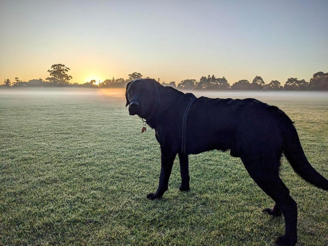
Image: Why are my feet so cold? Source: @mondo.adventures.theblacklab via Instagram.
And the overnight cold wasn't confined to Western Australia's southern regions.
- Shark Bay Airport in the Gascoyne Region, just 300 km south of the iconic Ningaloo Reef, fell to 3.7ºC, its coldest morning since July 2010, and the lowest June temp in records dating back to 2001.
Nor were chilly temps restricted to the dark hours of night. For example:
- Geraldton, four-and-a-half hours north of Perth, had a top of just 13.8ºC on Monday. That made it the coldest day since 2008 and the coldest June day since 1946 (NOTE: I am monitoring temps until 9 am AWST to make sure this doesn’t change before publication)
- The average June max temp in Geraldton is 20.9ºC
Why so cold?
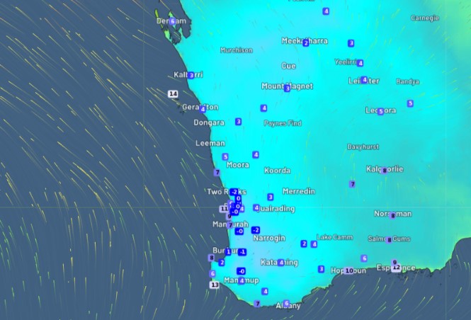
Take a look at the image below which shows live temps at 7 am Tuesday.
If you look closely you can see the subzero temps in and around Perth. But the other feature is the tiny arrows, which are called wind streamlines. They show the deep southerly flow as air circulates around a high pressure system centred in the Indian Ocean southwest of Perth.
The cold and mostly dry airflow will continue for several days, meaning a string of cold nights ahead for the southern half of WA, albeit perhaps not quite as cold as Monday night/Tuesday morning.
The good news is that days should stay mostly dry in southern WA, with only a light shower or two along the southern coast. People, it might be a good idea to walk your labradors in the afternoon instead of the morning this week!